Abbey Road DLR station
| Abbey Road | |
|---|---|
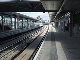 Abbey Road platforms | |
 Abbey Road Location of Abbey Road in Greater London | |
| Location | West Ham |
| Local authority | London Borough of Newham |
| Managed by | Docklands Light Railway |
| Number of platforms | 2 |
| Accessible | Yes |
| Fare zone | 2 and 3 |
| DLR annual boardings and alightings | |
| 2012 | 1.115 million[1] |
| 2013 | |
| 2014 | |
| 2015 | |
| 2016 | |
| Railway companies | |
| Original company | Transport for London |
| Key dates | |
| 31 August 2011 | Opened[4] |
| Other information | |
| WGS84 | 51°31′55″N 0°00′14″E / 51.532°N 0.004°ECoordinates: 51°31′55″N 0°00′14″E / 51.532°N 0.004°E |

Abbey Road DLR station is a Docklands Light Railway station in West Ham in the London Borough of Newham, in east London, England. It is located on the Stratford International extension of the Docklands Light Railway.[5]
History[]
The station is built on the original route of the Eastern Counties and Thames Junction Railway which opened between Stratford and Canning Town stations in 1846. The line became part of what is now known as the North London Line in 1979. The Eastern Counties and Thames Junction Railway had four tracks over this section of route. The western pair were redeveloped as part of an extension to the London Underground's Jubilee line in 1999 and the eastern pair, which carried the North London Line service, were cut back at Stratford in 2006. The tracks were converted for use as part of the Docklands Light Railway and the station was constructed with two platforms. It opened on 31 August 2011, over a year late, providing the community new links to the rest of London.[6]
Design[]

Abbey Road station utilises a simple platform setup with two tracks.[7] At the southern section of each platform are lifts and stairs for access to a skybridge to connect the two platforms. The eastern end of this bridge has a concourse that runs to the northern side of Abbey Road, where passengers can exit the station.[7] The Jubilee line passes through this station but does not have platforms here.
Along with Stratford High Street, Stratford and Star Lane - the station has artwork Places of Exchange by Scottish artist Toby Paterson[8] - tessellated patterns inspired by the local area, etched into the glass panels of the station.[9]
Location[]

The area between Canning Town and Stratford has been identified for major regeneration and new development as part of the Lower Lea Valley. The street that it serves is named after the nearby Stratford Langthorne Abbey.
The station is nowhere near the other, better-known Abbey Road of Beatles fame, which is located in Westminster, with the celebrated zebra crossing near St. John's Wood tube station. Signs directing travellers to the right station are posted, complete with references to The Beatles' hits.[10]
The station is on Abbey Road in West Ham, which is a busy road linking the A118, A11 and A12 at Bow and the A1011 and A112 at West Ham, avoiding Stratford town centre.
Services[]
Off-peak, trains run every ten minutes North to Stratford International and South to Woolwich Arsenal. In the peak hours trains run every eight minutes.[11]
See also[]
- Abbey Road, London, a road in North London best known for the Beatles album, Abbey Road, and the Abbey Road Studios
References[]
| Wikimedia Commons has media related to Abbey Road DLR station. |
- ^ Transport for London (12 February 2013). "Freedom of Information DLR usage 1213". Transport for London. Retrieved 10 November 2013.
- ^ a b c "Up-to-date DLR entry/exit statistics for each station" (XLSX). What Do They Know. Transport for London. 18 March 2016. Retrieved 2 April 2016.
- ^ "Passenger Numbers - Docklands Light Railway Limited" (XLSX (after downloading zip)). What Do They Know. Transport for London. 8 June 2017. Retrieved 11 September 2017.
- ^ "Docklands Light Railway extension marks one year to go to the London 2012 Paralympic Games". Retrieved 31 August 2011.[dead link]
- ^ Docklands Light Railway - Stratford International Extension Archived 22 February 2010 at the Wayback Machine
- ^ "New £211m DLR Olympic route opens". BBC News. 31 August 2011. Retrieved 24 June 2020.
- ^ a b Abbey Road station map Archived 4 October 2007 at the Wayback Machine DLR Developments Retrieved 2010-04-04
- ^ "Toby Paterson". www.nationalgalleries.org. Retrieved 24 June 2020.
- ^ "DLR Stratford International Extension - Modus Operandi Art Consultants". Modus Operandi Art Consultants. Retrieved 24 June 2020.
- ^ Pic at Time Out London's Facebook page, February 1, 2013.
- ^ "DLR frequencies". Transport for London. Retrieved 7 February 2012.
| Stations |
| ||||||||||||
|---|---|---|---|---|---|---|---|---|---|---|---|---|---|
| Future |
| ||||||||||||
| Rolling stock |
| ||||||||||||
| |||||||||||||
- Rail transport stations in London fare zone 2
- Rail transport stations in London fare zone 3
- Docklands Light Railway stations in the London Borough of Newham
- West Ham
- Mill Meads
- Railway stations in Great Britain opened in 2011