Aberporth Airport
This article needs additional citations for verification. (February 2013) |
West Wales Airport West Wales/Aberporth Airport | |||||||||||
|---|---|---|---|---|---|---|---|---|---|---|---|
| Summary | |||||||||||
| Airport type | Public | ||||||||||
| Operator | West Wales Airport Ltd. | ||||||||||
| Serves | Cardigan | ||||||||||
| Location | Aberporth | ||||||||||
| Elevation AMSL | 428 ft / 130 m | ||||||||||
| Coordinates | 52°06′53″N 004°33′34″W / 52.11472°N 4.55944°WCoordinates: 52°06′53″N 004°33′34″W / 52.11472°N 4.55944°W | ||||||||||
| Map | |||||||||||
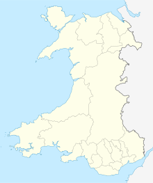
 EGFA Location in Wales | |||||||||||
| Runways | |||||||||||
| |||||||||||
Aberporth Airport (ICAO: EGFA) is situated southwest of Aberporth, Ceredigion, Wales. The airport is being developed as West Wales Airport for domestic flights.[2] It is also developing as a centre for the deployment of civil and military unmanned aerial vehicles (UAVs), known as 'drones'. The airport underwent major improvements in 2008 which extended the length of the runway from 945 to 1,257 m (3,100 to 4,124 ft).
History[]
The following military units were posted here at some point:[3]
- ‘B’ Flight of No. 1 Anti-Aircraft Co-operation Unit RAF (1 AACU)
- ‘L’ Flight of 1 AACU
- ‘O’ Flight of 1 AACU
- ‘Q’ Flight of 1 AACU
- ‘X’ Flight of 1 AACU
- No. 6 Anti-Aircraft Co-operation Unit RAF
- No. 7 Anti-Aircraft Co-operation Unit RAF
- No. 7 Maintenance Unit RAF
- No. 595 Squadron RAF
- No. 636 Volunteer Gliding Squadron RAF
- No. 1608 (Anti-Aircraft Co-operation) Flight RAF
- No. 1609 (Anti-Aircraft Co-operation) Flight RAF
- No. 2758 Squadron RAF Regiment
- Combined Services Projectile Development Establishment
- University of Wales Air Squadron
Current use[]
The nearby range, MoD Aberporth, is used for testing rockets by the British military, as well as for launching civilian rockets for atmospheric research. The site is currently managed by QinetiQ.
Aberporth Aerodrome has a CAA Ordinary Licence (Number P859) that allows flights for the public transport of passengers or for flying instruction as authorised by the licensee. The aerodrome is not licensed for night use.[4]
The airfield is being used as a base for Thales Watchkeeper WK450 military unmanned aerial vehicle (UAV) trials over Cardigan Bay. On 13 June 2018 a Watchkeeper crashed into a lane near the airfield; there were no injuries.[5][6]
References[]
- ^ West Wales/Aberporth - EGFA
- ^ West Wales Airport
- ^ "Aberporth (Blaenannerch) (West Wales)". Airfields of Britain Conservation Trust. Retrieved 16 December 2014.
- ^ Civil Aviation Authority Aerodrome Ordinary Licences Archived 28 June 2007 at the Wayback Machine
- ^ Lewis, Mike (14 June 2018). "Fire crews called after drone crash near West Wales Airport". Cambrian News. Retrieved 18 April 2019.
- ^ Adam Lusher; Helen Hoddinott (21 June 2018). "A £1m military drone flew over a packed primary school sports day - then there was a crash". The Independent. Retrieved 18 April 2019.
External links[]
- Transport in Ceredigion
- Airports in Wales
- Buildings and structures in Ceredigion
