Admington
| Admington | |
|---|---|
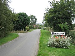 The main street of Admington | |
 Admington Location within Warwickshire | |
| Area | 1.56 sq mi (4.0 km2) |
| Population | 100 (2001 census) |
| • Density | 64/sq mi (25/km2) |
| OS grid reference | SP200460 |
| Civil parish |
|
| District |
|
| Shire county | |
| Region | |
| Country | England |
| Sovereign state | United Kingdom |
| Post town | SHIPSTON-ON-STOUR |
| Postcode district | CV36 |
| Police | Warwickshire |
| Fire | Warwickshire |
| Ambulance | West Midlands |

Admington is a village and civil parish in the Stratford-on-Avon district of the English county of Warwickshire. The name Admington means "estate associated with a man called Æthelhelm" [1] and the village is referred to in the Domesday Book as Edelmintone.[2] Until 31 March 1931 the parish was a part of Gloucestershire. The village lies 1+3⁄4 miles (2.8 km) north-west of Ilmington and 5+1⁄2 miles (8.9 km) north-east of Chipping Campden.[3] The parish has an area of 997 acres (403 ha).[4]
Admington shares a village hall with the neighbouring village of Quinton which is situated in Quinton. In the 2001 census the parish had a population of 100. The 2011 Census gives population details combined with those of Quinton.
Admington is the location of Admington Hall, an early 17th-century country house with an 18th-century façade.[5]
References[]
- ^ Dictionary Definition - Admington
- ^ Admington in the Domesday Book
- ^ Google. "Admington" (Map). Google Maps. Google.
- ^ J. H. F. Brabner (1997). The Comprehensive Gazetteer of England and Wales, 1894-5. Routledge. Admington. ISBN 978-0-415-16095-7.
- ^ Our Warwickshire
External links[]
| Wikimedia Commons has media related to Admington. |
- About Britain - Admington
- Admington UK
- Windows on Warwickshire - Admington Hall
- Wikimapia - Admington
- Quinton & Admington Village Hall
This Warwickshire location article is a stub. You can help Wikipedia by . |
- Villages in Warwickshire
- Civil parishes in Warwickshire
- Warwickshire geography stubs