Aerodrom, Kragujevac
Aerodrom
Аеродром | |
|---|---|
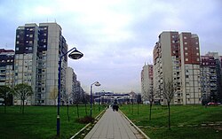 Residential neighborhoods of Aerodrom | |
 Location of the municipality of Aerodrom within Serbia | |
| Coordinates: 44°01′57″N 20°54′18″E / 44.03250°N 20.90500°ECoordinates: 44°01′57″N 20°54′18″E / 44.03250°N 20.90500°E | |
| Country | Serbia |
| Region | Šumadija and Western Serbia |
| District | Šumadija |
| Municipality | Kragujevac |
| Founded | 31 May 2002 |
| Dissolved | 4 March 2008 |
| Settlements | 17 |
| Area | |
| • Municipality | 232 km2 (90 sq mi) |
| Population (2002 census)[citation needed] | |
| • Urban | 23,249 |
| • Municipality | 36,217 |
| Time zone | UTC+1 (CET) |
| • Summer (DST) | UTC+2 (CEST) |
| Postal code | 34000 |
| Area code | +381(0)34 |
| Car plates | KG |

Aerodrom (Serbian Cyrillic: Аеродром; meaning Airport) was one of five city municipalities which constituted the City of Kragujevac. According to the 2002 census results, the municipality had a population of 36,217 inhabitants. The municipality was formed in May 2002, only to be dissolved in March 2008.
Municipality[]


The Municipality of Aerodrom covered the area of about 232 square kilometres, and comprised a part of urban Kragujevac and 17 villages:
- Aerodrom
- Vinogradi
- Šumarice
- Jovanovac
- Cvetojevac
- Resnik
- Novi Milanovac
- Opornica
- Desimirovac
- Cerovac
- Lužnice
- Gornje Jarušice
- Čumić
- Mali Šenj
- Pajazitovo
- Mironić
- Gornje Grbice
- Šljivovac
- Poskurice
Gallery[]

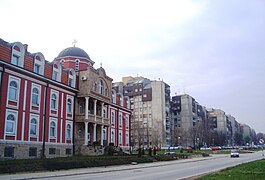
The Cathedral of Saint Sava, Aerodrom, Kragujevac

School Seminary of Saint Jovan Zlatousti, Aerodrom, Kragujevac.
School Seminary of Saint Jovan Zlatousti, Aerodrom, Kragujevac.

Description City Market, Aerodrom, City of Kragujevac.

Lake of Šumarice


References[]
- ^ "Municipalities of Serbia, 2006". Statistical Office of Serbia. Retrieved 2010-11-28.
External links[]
| Wikimedia Commons has media related to Aerodrom, Kragujevac. |
This Šumadija District, Serbia location article is a stub. You can help Wikipedia by . |
- Šumadija
- Defunct urban municipalities of Kragujevac
- Šumadija District
- Šumadija District geography stubs