Agios Pavlos, Thessaloniki
Agios Pavlos
Άγιος Παύλος | |
|---|---|
 | |
 Agios Pavlos Location within the regional unit 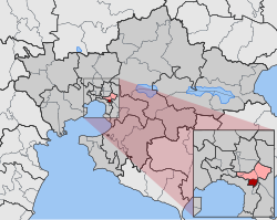 | |
| Coordinates: 40°38.6′N 22°57.7′E / 40.6433°N 22.9617°ECoordinates: 40°38.6′N 22°57.7′E / 40.6433°N 22.9617°E | |
| Country | Greece |
| Administrative region | Central Macedonia |
| Regional unit | Thessaloniki |
| Municipality | Neapoli-Sykies |
| • Municipal unit | 1.953 km2 (0.754 sq mi) |
| Elevation | 140 m (460 ft) |
| Population (2011)[1] | |
| • Municipal unit | 6,852 |
| • Municipal unit density | 3,500/km2 (9,100/sq mi) |
| Time zone | UTC+2 (EET) |
| • Summer (DST) | UTC+3 (EEST) |
| Postal code | 554 38 |
| Area code(s) | +30-231x-xxx-xxx |
| Vehicle registration | NAx-xxxx to NXx-xxxx |

Agios Pavlos (Greek: Άγιος Παύλος), Saint Paul, is a suburb of the Thessaloniki Urban Area and a former municipality.[2] Since the 2011 local government reform it is part of the municipality of Neapoli-Sykies, of which it is a municipal unit.[2] The 2011 census recorded 6,852 people in Agios Pavlos.[1] The municipal unit of Agios Pavlos covers an area of 1.953 km2.[3]
People[]
- Giorgos Koudas, football player
See also[]
References[]
- ^ a b c "Απογραφή Πληθυσμού - Κατοικιών 2011. ΜΟΝΙΜΟΣ Πληθυσμός" (in Greek). Hellenic Statistical Authority.
- ^ a b "ΦΕΚ B 1292/2010, Kallikratis reform municipalities" (in Greek). Government Gazette.
- ^ "Population & housing census 2001 (incl. area and average elevation)" (PDF) (in Greek). National Statistical Service of Greece. Archived from the original (PDF) on 2015-09-21.
This Central Macedonia location article is a stub. You can help Wikipedia by . |
Categories:
- Populated places in Thessaloniki (regional unit)
- Paul the Apostle
- Central Macedonia geography stubs