Agly
| Agly | |
|---|---|
 | |
| Location | |
| Country | France |
| Physical characteristics | |
| Source | |
| • location | Corbières Massif |
| Mouth | |
• location | Mediterranean Sea |
• coordinates | 42°46′44″N 3°2′20″E / 42.77889°N 3.03889°ECoordinates: 42°46′44″N 3°2′20″E / 42.77889°N 3.03889°E |
| Length | 80 km (50 mi) |
| Basin size | 903 km2 (349 sq mi) |
| Discharge | |
| • average | 6.31 m3/s (223 cu ft/s) |

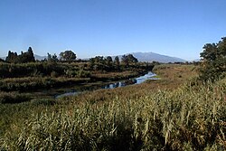
The Agly (Catalan: Aglí, Occitan: Aglin) is a river in southern France. It is 79.9 km (49.6 mi) long.[1] Its source is in the hills of the Corbières Massif, near Camps-sur-l'Agly. It flows through Saint-Paul-de-Fenouillet, Estagel, Rivesaltes and Saint-Laurent-de-la-Salanque before it flows into the Mediterranean Sea near Le Barcarès.
Tributaries[]
- Boulzane
- Désix
References[]
External links[]
| hide Authority control | |
|---|---|
| General |
|
| National libraries | |
This Occitanie geographical article is a stub. You can help Wikipedia by . |
Categories:
- Rivers of France
- Rivers of Aude
- Rivers of Pyrénées-Orientales
- Rivers of Occitanie
- Coastal basins of the Mediterranean Sea in France
- Occitanie geography stubs
- France river stubs