Ailey, Georgia
Ailey, Georgia | |
|---|---|
 Ailey City Hall | |
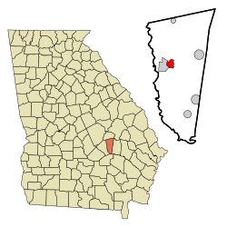 Location in Montgomery County and the state of Georgia | |
| Coordinates: 32°11′14″N 82°34′8″W / 32.18722°N 82.56889°WCoordinates: 32°11′14″N 82°34′8″W / 32.18722°N 82.56889°W | |
| Country | United States |
| State | Georgia |
| County | Montgomery |
| Area | |
| • Total | 2.18 sq mi (5.64 km2) |
| • Land | 2.16 sq mi (5.59 km2) |
| • Water | 0.02 sq mi (0.05 km2) |
| Elevation | 249 ft (76 m) |
| Population (2010) | |
| • Total | 432 |
| • Estimate (2019)[4] | 536 |
| • Density | 248.26/sq mi (95.86/km2) |
| Time zone | UTC-5 (Eastern (EST)) |
| • Summer (DST) | UTC-4 (EDT) |
| ZIP code | 30410 |
| Area code(s) | 912 |
| FIPS code | 13-00828[2] |
| GNIS feature ID | 0310413[3] |

Ailey is a city in Montgomery County, Georgia, United States. As of the 2010 census, the city had a population of 432.[5] It is part of the Vidalia Micropolitan Statistical Area.
History[]
A post office called Ailey was established in 1891.[6] The town incorporated in 1893.[7]
Geography[]
Ailey is located at 32°11′14″N 82°34′8″W / 32.18722°N 82.56889°W (32.187181, -82.568932).[8]
According to the United States Census Bureau, the city has a total area of 2.0 square miles (5.2 km2), all land.
Climate[]
| hideClimate data for Ailey, Georgia | |||||||||||||
|---|---|---|---|---|---|---|---|---|---|---|---|---|---|
| Month | Jan | Feb | Mar | Apr | May | Jun | Jul | Aug | Sep | Oct | Nov | Dec | Year |
| Average high °F (°C) | 60.4 (15.8) |
64.3 (17.9) |
70.7 (21.5) |
78.6 (25.9) |
85.6 (29.8) |
90.7 (32.6) |
92.7 (33.7) |
91.6 (33.1) |
87.0 (30.6) |
79.5 (26.4) |
70.3 (21.3) |
62.9 (17.2) |
77.9 (25.5) |
| Average low °F (°C) | 37.1 (2.8) |
38.9 (3.8) |
44.3 (6.8) |
52.4 (11.3) |
60.3 (15.7) |
66.5 (19.2) |
69.8 (21.0) |
69.3 (20.7) |
64.5 (18.1) |
54.2 (12.3) |
44.4 (6.9) |
38.6 (3.7) |
53.4 (11.9) |
| Average precipitation inches (mm) | 4.4 (110) |
4.2 (110) |
4.7 (120) |
3.2 (81) |
3.8 (97) |
4.2 (110) |
4.8 (120) |
5.4 (140) |
3.6 (91) |
2.4 (61) |
2.5 (64) |
3.5 (89) |
46.5 (1,180) |
| Source: Weatherbase [9] | |||||||||||||
Demographics[]
| Historical population | |||
|---|---|---|---|
| Census | Pop. | %± | |
| 1900 | 271 | — | |
| 1910 | 306 | 12.9% | |
| 1920 | 385 | 25.8% | |
| 1930 | 428 | 11.2% | |
| 1940 | 506 | 18.2% | |
| 1950 | 508 | 0.4% | |
| 1960 | 469 | −7.7% | |
| 1970 | 487 | 3.8% | |
| 1980 | 579 | 18.9% | |
| 1990 | 579 | 0.0% | |
| 2000 | 394 | −32.0% | |
| 2010 | 432 | 9.6% | |
| 2019 (est.) | 536 | [4] | 24.1% |
| U.S. Decennial Census[10] | |||
As of the census[2] of 2000, there were 394 people, 165 households, and 111 families residing in the city. The population density was 194.1 people per square mile (74.9/km2). There were 182 housing units at an average density of 89.7 per square mile (34.6/km2). The racial makeup of the city was 60.66% White, 36.29% African American, 0.51% Asian, 0.25% Pacific Islander, 1.78% from other races, and 0.51% from two or more races. Hispanic or Latino of any race were 1.78% of the population.
There were 165 households, out of which 25.5% had children under the age of 18 living with them, 41.8% were married couples living together, 20.0% had a female householder with no husband present, and 32.7% were non-families. 27.9% of all households were made up of individuals, and 14.5% had someone living alone who was 65 years of age or older. The average household size was 2.39 and the average family size was 2.90.
In the city, the population was spread out, with 25.6% under the age of 18, 7.6% from 18 to 24, 22.6% from 25 to 44, 26.9% from 45 to 64, and 17.3% who were 65 years of age or older. The median age was 40 years. For every 100 females, there were 72.1 males. For every 100 females age 18 and over, there were 74.4 males.
The median income for a household in the city was $36,125, and the median income for a family was $39,000. Males had a median income of $30,694 versus $30,000 for females. The per capita income for the city was $21,926. About 19.8% of families and 22.1% of the population were below the poverty line, including 43.8% of those under age 18 and 20.0% of those age 65 or over.
Notable people[]
- Hugh Peterson, lawyer
- Sugar Ray Robinson, boxer
References[]
- ^ "2019 U.S. Gazetteer Files". United States Census Bureau. Retrieved July 9, 2020.
- ^ Jump up to: a b "U.S. Census website". United States Census Bureau. Retrieved 2008-01-31.
- ^ "US Board on Geographic Names". United States Geological Survey. 2007-10-25. Retrieved 2008-01-31.
- ^ Jump up to: a b "Population and Housing Unit Estimates". United States Census Bureau. May 24, 2020. Retrieved May 27, 2020.
- ^ United States Census
- ^ "County". Jim Forte Postal History. Retrieved 6 September 2017.
- ^ Candler, Allen Daniel; Evans, Clement Anselm (1906). Georgia: Comprising Sketches of Counties, Towns, Events, Institutions, and Persons. State historical association. p. 32.
- ^ "US Gazetteer files: 2010, 2000, and 1990". United States Census Bureau. 2011-02-12. Retrieved 2011-04-23.
- ^ "Weatherbase: Historical Weather for Ailey, Georgia". Weatherbase. 2011. Retrieved on November 24, 2011.
- ^ "Census of Population and Housing". Census.gov. Retrieved June 4, 2015.
| show Municipalities and communities of Montgomery County, Georgia, United States |
|---|

| show Authority control |
|---|
- Cities in Georgia (U.S. state)
- Cities in Montgomery County, Georgia
- Vidalia, Georgia, micropolitan area