Ainley Top
| Ainley Top | |
|---|---|
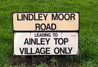 Village sign | |
 Ainley Top | |
| Population | 649 (inc. Blackley) [1] |
| OS grid reference | SE115195 |
| Metropolitan borough | |
| Metropolitan county | |
| Region | |
| Country | England |
| Sovereign state | United Kingdom |
| Post town | HUDDERSFIELD |
| Postcode district | HD2 |
| Postcode district | HD3 |
| Dialling code | 01422 |
| Police | West Yorkshire |
| Fire | West Yorkshire |
| Ambulance | Yorkshire |
| UK Parliament | |


Ainley Top is a village in Calderdale, West Yorkshire in England. It is situated approximately 3 miles (4.8 km) north west of Huddersfield on the A629 to Elland and Halifax. It is situated on a hill (the Ainleys) with the M62 motorway to the north, and junction 24 of the motorway adjacent to the village. It is in the Elland ward of Calderdale Metropolitan Borough Council with 419 registered electors in 248 properties in 2013.[2]

Nag's Head Inn

Hill Top Avenue

Cedar Court Hotel, Lindley Moor Road

Ainley Top Roundabout


Ainley Top is also the name of the roundabout just south of the village. This is the junction of the A643 and the A629 and also gives access to junction 24 of the M62 motorway.
References[]
- ^ Calderdale 2004 Ward Digest Archived 28 October 2008 at the Wayback Machine Retrieved 16 October 2009
- ^ Calderdale Council (2013) Elland Ward. Retrieved 13 October 2016
This West Yorkshire location article is a stub. You can help Wikipedia by . |
- Geography of Calderdale
- Geography of Huddersfield
- West Yorkshire geography stubs