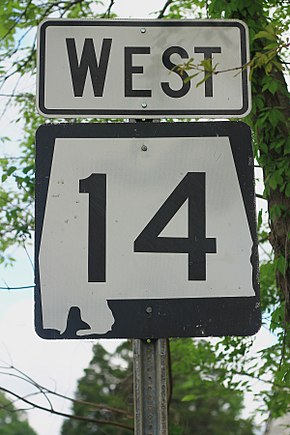
Alabama State Route 14
This article needs additional citations for verification. (June 2015) |
 | ||||
|---|---|---|---|---|
 SR 14 highlighted in red | ||||
| Route information | ||||
| Maintained by ALDOT | ||||
| Length | 218.289 mi[1] (351.302 km) | |||
| Major junctions | ||||
| West end | ||||
| East end | ||||
| Location | ||||
| Counties | Pickens, Greene, Hale, Perry, Hale, Dallas, Autauga, Elmore, Tallapoosa, Macon, Lee | |||
| Highway system | ||||
| ||||
State Route 14 (SR 14) is a major east-to-west state highway in the U.S. state of Alabama. Spanning 218.289 miles (351.302 km), the highway begins at the Mississippi state line at the terminus of Mississippi Highway 69 (MS 69) and connects the cities of Selma and Prattville before ending at SR 147 on the western side of Auburn.
History[]
This section does not cite any sources. (December 2007) |
SR 14 was one of the original routes in the Alabama's first statewide highway system in the 1920s. The original routing followed much of the same path as today, but was significantly shorter. The highway as built then started in Selma and traveled east along its current route to Auburn. As was standard for highways of the era, SR 14 was unpaved for its full length. The first paved section was constructed in 1932 between Elmore and Wetumpka. Paving continued sporadically for the next 15 years, with the last gravel section on the route being paved in 1947.
In 1956–57, the state renumbered many highways, and as a result other state highways to the northwest of Selma were renumbered as SR 14, extending the highway to the Mississippi state line along its modern course. In the 1960s, when the first segment of Interstate 85 (I-85) was constructed, bypassing Auburn and Opelika, SR 14 was extended from its eastern end at US 29 in Auburn along US 29 through Opelika to the northern end of that first Interstate Highway segment, at the current exit 64. When US 280 was re-routed to meet I-85 between Auburn and Opelika in 1998, SR-14 was truncated to a new eastern endpoint at US 280 in Opelika. In 2009, it was further truncated to its present terminus at the junction with SR 147.
Local routings[]

- SR 14 is routed along Broad Street in Pickensville.
- SR 14 is routed along Columbus Road NW, 2nd Street NW, 1st Avenue, 3rd Street SE, and Dr. Martin Luther King Memorial Highway in Aliceville.
- SR 14 is routed along Mesopotamia Street, Eutaw Avenue, Main Street, Morrow Avenue, Boligee Street, and Greensboro Street in Eutaw.
- SR 14 is routed along Hobson Street and State Street in Greensboro.
- SR 14 is routed along West Greene Street, Washington Street, and Martin Luther King Parkway in Marion.
- SR 14 shares a route with SR 183 for 5 miles (8.0 km) between Marion and Sprott in Perry County.
- SR 14 shares a route with SR 219 for 4 miles (6.4 km) north of US 80 in Selma, Alabama.
- SR 14 shares a route with US 80 for 4 miles (6.4 km) through Selma.
- SR 14 is routed along Highland Avenue in Selma.
- SR 14 shares a route with US 82 for roughly five miles in Prattville.
- SR 14 is routed along I-65 in Prattville between Exits 179 and 181
- SR 14 is routed along Elmore Road, Coosa River Parkway, and Tallassee Highway in Wetumpka.
- SR 14 shares a route with SR 111 in Wetumpka.
- SR 14 is routed along Gilmer Avenue, Barnette Boulevard, Central Boulevard, Main Street, and Notasulga Road in Tallassee.
- SR 14 is routed along Tallapoosa Street and Auburn Road in Notasulga.

Major intersections[]
| County | Location | mi[1] | km | Destinations | Notes |
|---|---|---|---|---|---|
| Pickens | | 0.00 | 0.00 | Mississippi state line; Western terminus | |
| Pickensville | 9.41 | 15.14 | |||
| Aliceville | 19.26 | 31.00 | Western end of SR 17 concurrency | ||
| 19.55 | 31.46 | Eastern end of SR 17 concurrency | |||
| Greene | Clinton | 38.27 | 61.59 | ||
| Eutaw | 43.43 | 69.89 | I-20/I-59 exit 40 | ||
| 46.41 | 74.69 | West end of US 11 south / SR 7 south concurrency (westbound only) | |||
| 46.44 | 74.74 | east end of US 11 south / SR 7 south concurrency (westbound only); west end of US 11 north / SR 7 north concurrency (eastbound only); west end of US 43 / SR 13 concurrency | |||
| 46.46 | 74.77 | East end of US 11 north / SR 7 north concurrency (eastbound only) | |||
| 46.99 | 75.62 | Eastern end of US 43 / SR 13 concurrency | |||
| Hale | Wedgeworth | 54.21 | 87.24 | ||
| Greensboro | 67.65 | 108.87 | Western end of SR 25/SR 69 concurrency | ||
| 68.00 | 109.44 | Eastern end of SR 25/SR 69 concurrency | |||
| 68.88 | 110.85 | ||||
| Perry | Marion | 86.96 | 139.95 | ||
| 88.55 | 142.51 | ||||
| | 89.36 | 143.81 | Western end of SR 183 concurrency | ||
| | 91.55 | 147.34 | |||
| Sprott | 93.79 | 150.94 | Eastern end of SR 183 concurrency | ||
| Dallas | | 111.35 | 179.20 | Western end of SR 219 concurrency | |
| Valley Grande | 112.13 | 180.46 | Eastern end of SR 219 concurrency | ||
| Selma | 114.20 | 183.79 | Western end of US 80/SR 8/SR 22 Truck concurrency | ||
| 116.28 | 187.13 | Eastern end of SR 22 Truck concurrency (it ends at this intersection); Eastern end of SR 8 concurrency (SR 8 follows Business US 80 through Selma.) | |||
| 117.16 | 188.55 | Eastern end of US 80 concurrency | |||
| Burnsville | 126.34 | 203.32 | |||
| Autauga | Prattville | 151.04 | 243.08 | Western end of US 82/SR 6 concurrency | |
| 153.86 | 247.61 | Eastern end of US 82/SR 6 concurrency; western end of US 31/SR 3 concurrency | |||
| 154.28 | 248.29 | Eastern end of US 31/SR 3 concurrency | |||
| Elmore | | 157.44 | 253.38 | I-65 exit 181 | |
| Millbrook | 160.25 | 257.90 | Western end of SR 143 concurrency | ||
| Elmore | 164.49 | 264.72 | Eastern end of SR 143 concurrency | ||
| Wetumpka | 170.08 | 273.72 | |||
| 171.34 | 275.75 | Western end of SR 111 Truck concurrency (it ends at this intersection) | |||
| 172.87 | 278.21 | Eastern end of SR 111 Truck concurrency | |||
| 173.69 | 279.53 | ||||
| 180.48 | 290.45 | ||||
| Tallassee | 188.45 | 303.28 | Western end of SR 229 concurrency | ||
| 192.04 | 309.06 | Eastern end of SR 229 concurrency | |||
| Tallapoosa | | 197.83 | 318.38 | ||
| Macon | | 200.56 | 322.77 | ||
| Macon–Tallapoosa county line | 202.19 | 325.39 | |||
| Macon | Notasulga | 207.36 | 333.71 | ||
| Lee | Auburn | 218.29 | 351.30 | Eastern terminus | |
1.000 mi = 1.609 km; 1.000 km = 0.621 mi
| |||||
See also[]
 U.S. roads portal
 United States portal
References[]
- ^ a b "Mileposts/General Highway Maps". Alabama Department of Transportation. Archived from the original on July 27, 2011. Retrieved August 25, 2011.
Route map:

| ( • help)
|
- State highways in Alabama
- Bypasses in Alabama
- Transportation in Pickens County, Alabama
- Transportation in Greene County, Alabama
- Transportation in Hale County, Alabama
- Transportation in Perry County, Alabama
- Transportation in Dallas County, Alabama
- Transportation in Autauga County, Alabama
- Transportation in Elmore County, Alabama
- Transportation in Tallapoosa County, Alabama
- Transportation in Macon County, Alabama
- Transportation in Lee County, Alabama
- Buildings and structures in Selma, Alabama
- Buildings and structures in Auburn, Alabama