Alexandrov Gay
Alexandrov Gay
Александров Гай | |
|---|---|
Selo | |
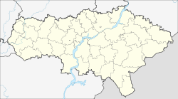
show Location of Alexandrov Gay | |
 Alexandrov Gay Location of Alexandrov Gay | |
| Coordinates: 50°08′N 48°33′E / 50.133°N 48.550°ECoordinates: 50°08′N 48°33′E / 50.133°N 48.550°E | |
| Country | Russia |
| Federal subject | Saratov Oblast |
| Administrative district | Alexandrovo-Gaysky District |
| Founded | 1762 |
| Elevation | 21 m (69 ft) |
| Population | |
| • Total | 9,728 |
Administrative status | |
| • Capital of | Alexandrovo-Gaysky District |
| Time zone | UTC+4 (MSK+1 |
| Postal code(s)[3] | 413370—413372 |
| OKTMO ID | 63602401101 |


Alexandrov Gay (Russian: Алекса́ндров Гай; Kazakh: Алғай, Alǵaı) is a rural locality (a selo) and the administrative center of Alexandrovo-Gaysky District of Saratov Oblast, Russia, located near the Russo-Kazakh border. Population: 9,728 (2010 Census);[1] 9,993 (2002 Census);[4] 9,611 (1989 Census).[5]
History[]
It was founded in 1762.[citation needed]
Economy[]
It is an entry point to Russia for natural gas trunklines from Central Asia (Central Asia-Center gas pipeline system) as also for the Russian natural gas export lines Soyuz and Orenburg–Novopskov.
Climate[]
| hideClimate data for Alexandrov Gay | |||||||||||||
|---|---|---|---|---|---|---|---|---|---|---|---|---|---|
| Month | Jan | Feb | Mar | Apr | May | Jun | Jul | Aug | Sep | Oct | Nov | Dec | Year |
| Record high °C (°F) | 9.1 (48.4) |
11.2 (52.2) |
21.7 (71.1) |
32.8 (91.0) |
38.4 (101.1) |
43.7 (110.7) |
43.4 (110.1) |
43.8 (110.8) |
38.4 (101.1) |
31.3 (88.3) |
20.1 (68.2) |
10.0 (50.0) |
43.8 (110.8) |
| Average high °C (°F) | −5.2 (22.6) |
−4.8 (23.4) |
2.2 (36.0) |
15.2 (59.4) |
23.3 (73.9) |
29.1 (84.4) |
31.1 (88.0) |
29.4 (84.9) |
22.7 (72.9) |
13.0 (55.4) |
2.6 (36.7) |
−3.4 (25.9) |
12.9 (55.2) |
| Daily mean °C (°F) | −8.7 (16.3) |
−8.9 (16.0) |
−2.3 (27.9) |
9.0 (48.2) |
16.4 (61.5) |
22.1 (71.8) |
24.2 (75.6) |
22.2 (72.0) |
15.4 (59.7) |
7.3 (45.1) |
−1.0 (30.2) |
−6.8 (19.8) |
7.4 (45.3) |
| Average low °C (°F) | −12.1 (10.2) |
−12.5 (9.5) |
−6.1 (21.0) |
3.5 (38.3) |
9.9 (49.8) |
15.3 (59.5) |
17.6 (63.7) |
15.4 (59.7) |
9.0 (48.2) |
2.7 (36.9) |
−4 (25) |
−10 (14) |
2.4 (36.3) |
| Record low °C (°F) | −39.9 (−39.8) |
−39.4 (−38.9) |
−33.5 (−28.3) |
−17.6 (0.3) |
−4.4 (24.1) |
−0.9 (30.4) |
5.3 (41.5) |
3.6 (38.5) |
−5.2 (22.6) |
−15.2 (4.6) |
−32.4 (−26.3) |
−33.1 (−27.6) |
−39.9 (−39.8) |
| Average precipitation mm (inches) | 33 (1.3) |
23 (0.9) |
22 (0.9) |
26 (1.0) |
28 (1.1) |
32 (1.3) |
26 (1.0) |
27 (1.1) |
25 (1.0) |
32 (1.3) |
27 (1.1) |
29 (1.1) |
329 (13.0) |
| Average snowfall cm (inches) | 8 (3.1) |
12 (4.7) |
8 (3.1) |
1 (0.4) |
0 (0) |
0 (0) |
0 (0) |
0 (0) |
0 (0) |
0.1 (0.0) |
1 (0.4) |
4 (1.6) |
34.1 (13.3) |
| Average rainy days | 4 | 3 | 5 | 9 | 9 | 9 | 7 | 7 | 8 | 9 | 8 | 5 | 84 |
| Average snowy days | 15 | 11 | 8 | 2 | 0 | 0 | 0 | 0 | 0 | 0 | 8 | 13 | 59 |
| Average relative humidity (%) | 86 | 84 | 83 | 66 | 56 | 52 | 52 | 52 | 59 | 73 | 86 | 87 | 70 |
| Mean monthly sunshine hours | 58 | 99 | 128 | 187 | 242 | 255 | 265 | 217 | 167 | 114 | 63 | 50 | 1,845 |
| Source 1: Pogoda.ru.net[6] | |||||||||||||
| Source 2: NOAA (sun, 1961–1990)[7] | |||||||||||||
References[]
- ^ Jump up to: a b Russian Federal State Statistics Service (2011). Всероссийская перепись населения 2010 года. Том 1 [2010 All-Russian Population Census, vol. 1]. Всероссийская перепись населения 2010 года [2010 All-Russia Population Census] (in Russian). Federal State Statistics Service.
- ^ "Об исчислении времени". Официальный интернет-портал правовой информации (in Russian). June 3, 2011. Retrieved January 19, 2019.
- ^ Почта России. Информационно-вычислительный центр ОАСУ РПО. (Russian Post). Поиск объектов почтовой связи (Postal Objects Search) (in Russian)
- ^ Russian Federal State Statistics Service (May 21, 2004). Численность населения России, субъектов Российской Федерации в составе федеральных округов, районов, городских поселений, сельских населённых пунктов – районных центров и сельских населённых пунктов с населением 3 тысячи и более человек [Population of Russia, Its Federal Districts, Federal Subjects, Districts, Urban Localities, Rural Localities—Administrative Centers, and Rural Localities with Population of Over 3,000] (XLS). Всероссийская перепись населения 2002 года [All-Russia Population Census of 2002] (in Russian).
- ^ Всесоюзная перепись населения 1989 г. Численность наличного населения союзных и автономных республик, автономных областей и округов, краёв, областей, районов, городских поселений и сёл-райцентров [All Union Population Census of 1989: Present Population of Union and Autonomous Republics, Autonomous Oblasts and Okrugs, Krais, Oblasts, Districts, Urban Settlements, and Villages Serving as District Administrative Centers]. Всесоюзная перепись населения 1989 года [All-Union Population Census of 1989] (in Russian). Институт демографии Национального исследовательского университета: Высшая школа экономики [Institute of Demography at the National Research University: Higher School of Economics]. 1989 – via Demoscope Weekly.
- ^ "Weather and Climate- The Climate of Alexandrov Gay" (in Russian). Weather and Climate (Погода и климат). Retrieved April 25, 2020.
- ^ "Aleksandrov–Gaj (Alexandrov Gay) Climate Normals 1961–1990". National Oceanic and Atmospheric Administration. Retrieved May 13, 2015.
| Authority control |
|
|---|
Categories:
- Rural localities in Saratov Oblast
- Populated places established in 1762
- Samara Governorate