Allmersbach
Allmersbach im Tal | |
|---|---|
 Allmersbach town hall | |
 Coat of arms | |
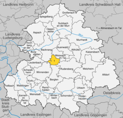
show Location of Allmersbach im Tal within Rems-Murr-Kreis district | |
 Allmersbach im Tal | |
| Coordinates: 48°54′23″N 09°28′08″E / 48.90639°N 9.46889°ECoordinates: 48°54′23″N 09°28′08″E / 48.90639°N 9.46889°E | |
| Country | Germany |
| State | Baden-Württemberg |
| Admin. region | Stuttgart |
| District | Rems-Murr-Kreis |
| Area | |
| • Total | 7.95 km2 (3.07 sq mi) |
| Elevation | 286 m (938 ft) |
| Population (2020-12-31)[1] | |
| • Total | 4,994 |
| • Density | 630/km2 (1,600/sq mi) |
| Time zone | UTC+01:00 (CET) |
| • Summer (DST) | UTC+02:00 (CEST) |
| Postal codes | 71573 |
| Dialling codes | 07191 |
| Vehicle registration | WN, BK |
| Website | www |


Allmersbach im Tal is a municipality in the Rems-Murr district of Baden-Württemberg, Germany.
History[]
The municipality of Allmersbach im Tal was formed on 1 January 1972, as part of the , by the merging of the towns of Allmersbach and Heutensbach.[2]
Geography[]
The municipality (Gemeinde) of Allmersbach lies at the center of the Rems-Murr district of Baden-Württemberg, one of the 16 States of the Federal Republic of Germany. Allmersbach is physically located in the and the southwest edge of the . The municipal area also includes portions of the Schurwald and Welzheim Forest. Elevation above sea level in the municipal area ranges from a high of 462 meters (1,516 ft) Normalnull (NN) to a low of 414 meters (1,358 ft) NN.[2]
The Federally-protected Sommerrain nature reserve is located in Allmersbach's municipal area.[2]
Politics[]
Allmersbach is in a municipal association (Verwaltungsgemeinschaft) with the city of Backnang and the municipalities of Althütte, Aspach, Auenwald, Burgstetten, Kirchberg an der Murr, Oppenweiler, and Weissach im Tal.[2]
Coat of arms[]
Allmersbach's coat of arms displays a crossbow, in red and with its trigger guard facing right, upon a field of silver. The crossbow is a motif that has been associated with Allmersbach since 1686, though it is not known why, and the tincture is taken from the arms of the , which had property in the town. The coat of arms was approved for official use and a corresponding municipal flag issued by the Federal Ministry of the Interior on 16 September 1965.[2]
Transportation[]
Allermsbach is connected to German's network of roadways by its local Landesstraßen and Kreisstraßen. Local public transportation is provided by the Verkehrs- und Tarifverbund Stuttgart.[2]
References[]
- ^ "Bevölkerung nach Nationalität und Geschlecht am 31. Dezember 2020". Statistisches Landesamt Baden-Württemberg (in German). June 2021.
- ^ Jump up to: a b c d e f "Allmersbach im Tal". LEO-BW (in German). Baden-Württemberg. Retrieved 24 July 2020.
External links[]
- Official website
 (in German)
| show Towns and municipalities in Rems-Murr (district) |
|---|
| Authority control |
|---|
- Municipalities in Baden-Württemberg
- Rems-Murr-Kreis
- Württemberg