Alviso, San Jose
Alviso | |
|---|---|
Neighborhood of San Jose | |
    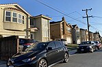 Clockwise: Aerial view of New Years Eve celebrations in Alviso; new townhomes in El Dorado; homes in Alviso; San Francisco Bay; townhomes on North First. | |
 Alviso Location within San Jose | |
| Coordinates: 37°25′30″N 121°58′0″W / 37.42500°N 121.96667°WCoordinates: 37°25′30″N 121°58′0″W / 37.42500°N 121.96667°W | |
| Country | United States |
| State | California |
| Region | San Francisco Bay Area |
| County | Santa Clara County |
| Incorporated (City of Alviso) | March 4, 1852 |
| Consolidated with San Jose | March 12, 1968 |
| Population (2000) | |
| • Total | 2,128 |
| Demonym(s) | Alvisans |
| Time zone | UTC-8 (Pacific) |
| • Summer (DST) | UTC-7 (PDT) |
| ZIP code | 95002 |
| Area codes | 408/669 |
| GNIS feature ID | 233410 |
Alviso Historic District | |
| Coordinates | 37°25′30″N 121°58′0″W / 37.42500°N 121.96667°W |
| Area | 9 acres (3.6 ha) |
| Built | 1851 |
| NRHP reference No. | 73000449[1] |
| Added to NRHP | October 9, 1973 |

Alviso is a district of San Jose, California, located in North San Jose on the southern shores of San Francisco Bay. Originally an independent town, founded in 1852, today Alviso is San Jose's only waterfront district, primarily residential in nature, with several Silicon Valley tech companies and recreation-oriented businesses. Alviso is named after 19th-century Californio ranchero Ignacio Alviso, who owned the area as part of his Rancho Rincón de Los Esteros.
The Guadalupe River separates Alviso from Santa Clara and Sunnyvale to the west, while Coyote Creek separates Alviso from Milpitas to the east. Alviso is the lowest point in the San Francisco Bay Area at 13 feet (4.0 m) below sea level.[2]
History[]

Alviso was first settled in the 18th century. The community was named for Ignacio Alviso, the son of Corporal Domingo Alviso, one of the original members of the de Anza expedition. Corporal Alviso lived but a short time after reaching San Francisco and was buried March 11, 1777.[3] Alviso's descendants were granted the Rancho Rincón de los Esteros holding. In 1840, Ignacio Alviso, moved from Mission Santa Clara de Asís to this 3,653 acres (14.78 km2) ranchero. From this port, beaver pelts, cattle hides and tallow went to San Francisco.[4]
The city of Alviso was incorporated on March 4, 1852, as the boating and shipping port of San José and the transportation hub for the Santa Clara Valley to the San Francisco Bay. Steamboats traveled regularly between San Francisco and Alviso. That usage declined with the growth in railroad transportation between San Francisco and San José. In 1864 Alviso was bypassed by the San Francisco and San Jose Railroad, (later part of the Southern Pacific Railroad). However, in the 1880s Alviso was a stop on the Newark line of Southern Pacific Railroad between San José and Oakland.
Alviso was the home to a series of several successful business ventures. Alviso Mills, founded in 1853, at its peak produced up to 300 barrels of flour a day. As wheat production in the San Joaquín Valley grew, production in the Santa Clara Valley waned and the Alviso Mills closed in 1885. In 1906, Sai Yin Chew opened the Bayside Canning Company there, and at its peak was the 3rd largest cannery in the United States. During The Depression Alviso was known for its dance halls and gambling establishments. In the 1960s and 1970s a small independent boat building community developed there.[5]

The city ceased to exist when it was consolidated with the City of San Jose on March 12, 1968, following a 189 to 180 vote in favor of consolidation. The city's final census was in 1960 when it recorded a population of 1,174.[6] The United States Postal Service still recognizes "Alviso" as a place name. Mail is not delivered in Alviso, but must be picked up at the post office.

After the 1970s, Alviso was treated like a socioeconomic backwater of the prospering Silicon Valley business community and struggled to restore its former vitality. On October 9, 1973, 9 acres (3.6 ha) were added to the National Register of Historic Places listings in Santa Clara County, California as site 73000449 under the name Alviso Historic District. The listing cited 11 historic structures and alternative name Embarcadero de Santa Clara, although exact boundaries were not disclosed.[1] The floods of the early 1980s were devastating to Alviso, especially because Alviso is below sea level and is on marshland. Water was as much as 10 feet (3 m) deep in some locations. A number of homes and businesses were destroyed. Some of the picturesque character of the town was lost.
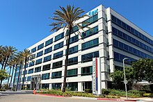
Shipping and industry have left Alviso, leaving it mostly as a small residential neighborhood. Digital video recorder company TiVo and Polycom have their corporate headquarters in Alviso. Many salt evaporation ponds formerly owned by Cargill in the neighborhood are being converted to wetlands as part of the Don Edwards San Francisco Bay National Wildlife Refuge.

Throughout the 20th Century, Alviso has been victim to severe flooding, most recently in 1983 and 1995.[7]
As of 2021, Amtrak trains and the Altamont Commuter Express still cross through Alviso on the Coast Line (Union Pacific Railroad).
Demographics[]


The Bureau of the Census provides demographic information for the 95002 Zip Code Tabulation Area, which includes the former City of Alviso. (See map of the 95002 Zip Code Tabulation Area.)[8] As of the census[9] of 2000, there were 2,128 people, 506 households, and 400 families residing in the CDP. There were 514 housing units.
The racial makeup of the CDP was 40.8% White, 0.6% African American, 1.1% Native American, 2.7% Asian, 50.5% from other races, and 4.3% from two or more races. Hispanic or Latino of any race were 75.4% of the population.
The median income for a household in the CDP was $87,679, and the median income for a family was $105,827. Males had a median income of $58,750 versus $56,875 for females. The per capita income for the CDP was $62,452. About 3.8% of families and 5.1% of the population were below the poverty line, including 11.8% of those under the age of eighteen and 10.4% of those sixty five or over.
Attractions[]
Alviso Marina County Park[]

This 18.9 acres (76,000 m2) bayside park, though small in size, offers a great deal of activities within its boundaries and on into the Wildlife Refuge. The first phase of improvements, which included construction of a boardwalk, trails, observation deck, signage, picnic areas, and improvements to the parking lot, was completed in 2005. A second phase, completed in 2010, added new boat launch ramps, a parking lot for boat trailers, and wetland mitigation areas.[10] Both the pathways and boardwalks of the County Park and trails around the ponds in the adjacent Wildlife Refuge offer fantastic views of the mountains surrounding the bay, and of the wildlife that call these ponds home.

Dogs are allowed in the County Park's pathways and picnic areas, but are not allowed on the trails, levees and boardwalks. Bicycles are allowed on all pathways and trails in the park, but should be walked when on the boardwalks. The launch ramp provides one of the few clear routes in the San Jose area through the salt marshes out to the open waters of the San Francisco Bay.[11]
- Day on the Bay
Every year on a Sunday in October Alviso celebrates Day on the Bay, a multicultural event, free for all, sponsored by Santa Clara County. Day on the Bay attracts families with music, food, booths for community organizations, Halloween pumpkins, kayak rides, and other activities.
Day on the Bay began on October 16, 2010 to celebrate the opening of the newly renovated Marina Park. About 5,000 people were in attendance from all around the county. The event was created to celebrate the new city attraction but also to attract a diverse crowd to the outdoor recreational setting.[12]
Don Edwards San Francisco Bay National Wildlife Refuge[]

Don Edwards San Francisco Bay National Wildlife Refuge, the first urban National Wildlife Refuge established in the United States, is dedicated to preserving and enhancing wildlife habitat, protecting migratory birds, protecting threatened and endangered species, and providing opportunities for wildlife-oriented recreation and nature study for the surrounding communities.
As of 2004, the Refuge spans 30,000 acres (120 km2) of open bay, salt pond, salt marsh, mudflat, upland and vernal pool habitats located throughout south San Francisco Bay. Located along the Pacific Flyway, the Refuge hosts over 280 species of birds each year. Millions of shorebirds and waterfowl stop to refuel at the Refuge during the spring and fall migration. In addition to its seasonal visitors, the Refuge provides critical habitat to resident species like the endangered Ridgway's rail and salt marsh harvest mouse.
The Don Edwards San Francisco Bay National Wildlife Refuge is part of a complex made up of six other wildlife refuges in the San Francisco Bay Area. Founded in 1974 and administered by the U.S. Fish and Wildlife Service, It was renamed Don Edwards San Francisco Bay National Wildlife Refuge in 1995 in recognition of Congressman Don Edwards' efforts to protect sensitive wetlands in south San Francisco Bay.[13]
Landmarks[]
Bayside Cannery[]

The Bayside Cannery is a historic Mission Revival style building in Alviso, built in 1906. Originally founded as the Precita Canning Co. in San Francisco, the cannery moved to Alviso following the 1906 San Francisco earthquake. Bayside Cannery grew to be the third largest canning company in the world, after Del Monte and Libby Cannery.[14] It was closed in 1936 and the property is currently used by the .[15]
Laine Store[]

The Laine Store at 996 Elizabeth Street, was run by the Tilden family from 1865 to 1912. In the 1920s it became a Chinese gambling hall.[16] After the 1983 flood, the store was abandoned and fell into disrepair. In 2017 it collapsed and the debris was removed.
Tilden–Laine House[]
An Italianate–Victorian home built in 1887 by Susan Tilden, and located on Elizabeth Street.[17] The home is still occupied by the Laine family; Thomas Laine and Beverly Laine.
Wade Warehouse[]
The H. G. Wade Warehouse was built in 1860 and used for storage of grain and hay prior to shipment to San Francisco, and also for Wells Fargo horse-drawn carriages. It was a City of San Jose historic landmark.[18] It was destroyed by fire in June 2021.[19]
References[]
- ^ a b "National Register Information System". National Register of Historic Places. National Park Service. March 13, 2009.
- ^ Kurhi, Eric (2014-12-11). "San Jose: Overwhelmed pumps led to Alviso flooding; residents say it's a 'wake-up call'". newspaper. Retrieved 2015-02-13.
- ^ Filion, Ron. "Members of the Anza Expedition: Individual Profiles". SFGenealogy.com. Retrieved 2013-06-26.
- ^ Caroline Mehaffy & Bob Mehaffy (1999). Revised and Expanded Cruising Guide to San Francisco Bay. Arcata, California: Paradise Cay Publications. p. 155. ISBN 978-0-939837-31-1.
- ^ "History of Alviso". HistorySanJose.org. Archived from the original on 2014-06-23. Retrieved 2013-06-26.
- ^ "Historical US Census Populations of Places, Towns, and Cities in California". California Department of Finance. Archived from the original on 2012-04-28. Retrieved 2013-06-26.
- ^ "Flood Control". Guadalupe River Park Conservancy. Retrieved 2015-02-13.
- ^ "American FactFinder Fact Sheet for 05002 ZCTA". Bureau of the Census. Archived from the original on 2020-02-10. Retrieved 2013-06-26.
- ^ "U.S. Census website". United States Census Bureau. Retrieved 2008-01-31.
- ^ "Site Description for Alviso Marina County Park", Coastal Conservancy
- ^ "Ideas Wanted! Help create a brand new place to play at Vasona Lake County Park! - Parks and Recreation - County of Santa Clara". ParkHere.org. Retrieved 2013-06-26.
- ^ "'Day on the Bay' launches in Alviso and draws big, multicultural crowd". San Jose Mercury News. Retrieved 2013-06-26.
- ^ "Don Edwards San Francisco Bay". National Wildlife Refuges. U.S. Fish & Wildlife Service. Retrieved 2013-06-26.
- ^ "Five Views: An Ethnic Historic Site Survey for California (Chinese Americans)". www.nps.gov. Retrieved 2017-08-27.
- ^ Visit San Jose - Bayside Cannery
- ^ "Alviso, CA". Ghosttown.info. Retrieved 2013-06-26.
- ^ Gustaitis, Rasa (2012). San Francisco Bay Shoreline Guide: A State Coastal Conservancy Book: Access Maps to the Entire San Francisco Bay Trail. Univ of California Press. ISBN 978-0520274365.
- ^ "Alviso, California Community Assessment & Urban Design Analysis" (PDF). San Jose State University Urban & Regional Planning Department. September 2009. pp. 42, 190.
- ^ Graff, Amy (June 25, 2021). "Historic building that stored stagecoaches destroyed in Bay Area fire Friday morning". SFGate (San Francisco Chronicle).
Further reading[]
- "The Community of Alviso's Timeline". cachis.com. Archived from the original on 2005-05-07. Retrieved 2008-10-17.
Information posted here is gathered from old newspaper clippings, books, and reference materials found at the Alviso Branch of the San Jose Library.
- Boncher, Clarence R. (January 3, 1996). "South Bay Yacht Club". cachis.com. Archived from the original on 2005-02-05. Retrieved 2008-10-17.
The SBYC club house itself stands as a prominent landmark in Alviso with her tall flag staff and yard arm proudly displaying the South Bay Burgee.
- Douglas, Jack. "Historical Footnotes of the Santa Clara Valley". cachis.com. Archived from the original on 2005-06-12. Retrieved 2008-10-17.
Settled at the south end of San Francisco Bay in the 1700s, this little town was the junction for the transportation of goods and people going north and south.
External links[]
| Wikimedia Commons has media related to |
- City of San José, Council District 4
- Alviso branch of San José Public Library system
- History of Alviso and Alviso Schools
- History of the Alviso Neighborhood

- Neighborhoods in San Jose, California
- 1852 establishments in California
- 1968 disestablishments in California
- Former municipalities in California
- Historic districts on the National Register of Historic Places in California
- History of Santa Clara County, California
- National Register of Historic Places in Santa Clara County, California
- Populated coastal places in California
- Populated places on the National Register of Historic Places in California