Amapá (municipality)
Amapá | |
|---|---|
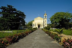 Church of Amapá | |
 Seal | |
 Location of Amapá in Amapá State | |
| Coordinates: 02°03′10″N 50°47′34″W / 2.05278°N 50.79278°WCoordinates: 02°03′10″N 50°47′34″W / 2.05278°N 50.79278°W | |
| Country | |
| Region | North |
| State | Amapá |
| Government | |
| • Mayor | Carlos Sampaio (PMN) |
| Area | |
| • Total | 9,169 km2 (3,540 sq mi) |
| Elevation | 8 m (26 ft) |
| Population (2020)[1] | |
| • Total | 9,187 |
| • Density | 0.808/km2 (2.09/sq mi) |
| Time zone | UTC−3 (BRT) |
| HDI (2000) | 0.72 – medium[2] |

Amapá ([ɐmɐˈpa] (![]() listen)) is a municipality located in the easternmost portion of the homonymous state of Amapá in Brazil. Its population is 9,187 and its area is 9,169 square kilometres (3,540 sq mi).
listen)) is a municipality located in the easternmost portion of the homonymous state of Amapá in Brazil. Its population is 9,187 and its area is 9,169 square kilometres (3,540 sq mi).
History[]
The borders between French Guiana and Brazil were not clear. Attempts at negotiations failed, and in 1862 it was decided that the area between the Amazon and the Oyapock was a neutral territory.[3] In 1894 gold was discovered in the Calçoene River, which resulted in a declaration of an autonomous state under Brazilian protection by general Francisco Cabral.[3] In May 1895, Camille Charvein, the Governor of French Guiana, sent troops to Mapá (nowadays: Amapá). During the battle, six French, and 30 Brazilian soldiers and civilians were killed .[4] In 1897, France and Brazil asked Switzerland to settle the dispute, and most of the territory was given to Brazil in what is nowadays the state of Amapá.[3]
The municipality was founded in 1911 as Montenegro. In 1930, the name was changed to Amapá after the Amapá tree. The municipality contains two districts: the town of Amapá and Sucuriju.[5] The municipality is home to a World War II airbase built by the Americans which has been turned into a museum.[6]
Nature[]

The municipality is home to part of the Lago Piratuba Biological Reserve.[7] It also contains the Maracá-Jipioca Ecological Station, which covers two very low-lying islands just off the coast with rich biodiversity.[8] It contains 6.32% of the 2,369,400 hectares (5,855,000 acres) Amapá State Forest, a sustainable use conservation unit established in 2006.[9] It contains 3.08% of the 460,353 hectares (1,137,560 acres) Amapá National Forest, a sustainable use conservation unit created in 1989.[10]
From Amapá you can access Cachoeira Grande, a series of waterfalls in the Amapá Grande River. The site is technically located in the Calçoene municipality.[6] Near the falls, is a sandbank and a holiday resort with restaurants.[11]
See also[]
- Sucuriju, fishing village and district of Amapá
References[]
- ^ IBGE 2020
- ^ "Archived copy". Archived from the original on 2009-10-03. Retrieved 2009-12-17.CS1 maint: archived copy as title (link) UNDP
- ^ Jump up to: a b c Denis Lamaison. "The Republic of Counani: The man who would be king". Guianas Geographic. Retrieved 5 August 2020.
- ^ Stéphane Granger (2011). "Le Contesté franco-brésilien : enjeux et conséquences d'un conflit oublié entre la France et le Brésil". Outre-Mers. Revue d'histoire (in French): 162–163.
- ^ "História". IBGE (in Portuguese). Retrieved 31 March 2021.
- ^ Jump up to: a b "Amapá". Municipality of Amapá (in Portuguese). Retrieved 31 March 2021.
- ^ Unidade de Conservação: Reserva Biológica do Lago Piratuba, MMA: Ministério do Meio Ambiente, retrieved 2016-04-27
- ^ Unidade de Conservação: Estação ecológica de Maracá-Jipioca (in Portuguese), MMA: Ministério do Meio Ambiente, retrieved 2016-04-16
- ^ FES do Amapá (in Portuguese), ISA: Instituto Socioambiental, retrieved 2016-07-06
- ^ FLONA do Amapá (in Portuguese), ISA: Instituto Socioambiental, retrieved 2016-07-06
- ^ "CACHOEIRA GRANDE EM AMAPÁ – AP". Viaja Brasil (in Portuguese). Retrieved 1 April 2021.
External links[]
- Official site (in Portuguese)
| Wikimedia Commons has media related to Amapá (municipality). |

| show Authority control |
|---|
- Populated places in Amapá
- Municipalities in Amapá