Amonate, Virginia
Amonate, Virginia | |
|---|---|
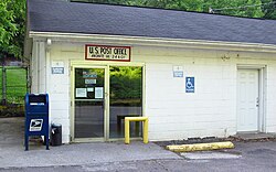 Post Office in Amonate | |
 Amonate, Virginia | |
| Coordinates: 37°11′27″N 81°38′19″W / 37.19083°N 81.63861°WCoordinates: 37°11′27″N 81°38′19″W / 37.19083°N 81.63861°W | |
| Country | United States |
| State | Virginia |
| County | Tazewell |
| Elevation | 1,736 ft (529 m) |
| Time zone | UTC-5 (Eastern (EST)) |
| • Summer (DST) | UTC-4 (EDT) |
| Area code(s) | 276 |
| GNIS feature ID | 1492468[1] |


Amonate is an unincorporated community in Tazewell County, Virginia, United States. Amonate is 8.5 miles (13.7 km) northwest of Tazewell. Its zip code is 24601.
The community was established in the early 1920s by Faraday Coal & Coke, but became a company town of Pocahontas Fuel in 1923. Its name comes from a nickname for Pocahontas.[2]
References[]
- ^ U.S. Geological Survey Geographic Names Information System: Amonate, Virginia
- ^ "Amonate, VA". Coal Camp USA. Retrieved March 27, 2018.
Municipalities and communities of Tazewell County, Virginia, United States | ||
|---|---|---|
| Towns |  | |
| CDPs | ||
| Other communities | ||
| Footnotes | ‡This populated place also has portions in an adjacent county or counties | |
| ||
This Tazewell County, Virginia state location article is a stub. You can help Wikipedia by . |
Categories:
- Unincorporated communities in Tazewell County, Virginia
- Unincorporated communities in Virginia
- Coal towns in Virginia
- Heart of Appalachia, Virginia geography stubs