Amrapur, Jamnagar district
- See Amrapur for namesakes
Village | |
| Coordinates: 22°22′17″N 70°23′11″E / 22.371262°N 70.38633°ECoordinates: 22°22′17″N 70°23′11″E / 22.371262°N 70.38633°E | |
| Country | |
| State | Gujarat |
| District | Jamnagar |
| Population (2001) | |
| • Total | 250 |
| Languages | |
| • Official | Gujarati, Hindi |
| Time zone | UTC+5:30 (IST) |
| Postal Index Number | 361130 |
| Vehicle registration | GJ |
| Website | gujaratindia |
![Amrapur[1][2] is located in Gujarat](http://upload.wikimedia.org/wikipedia/commons/thumb/a/a9/India_Gujarat_location_map.svg/250px-India_Gujarat_location_map.svg.png)
![Amrapur[1][2] is located in India](http://upload.wikimedia.org/wikipedia/commons/thumb/d/dc/India_location_map.svg/250px-India_location_map.svg.png)

Amrapur is a town and former petty princely state in Jamnagar, in Kathiawar, Gujarat state, western India.
Village[]
Most inhabitants are farmers. Some of them are connected with animal husbandry. Mr Vijaybhai Borsadiya is currently sarpanch of the village.
Location[]
Amrapur is surrounded on three sides by a dam. Amrapur is located at 22°22′17″N 70°23′11″E / 22.371262°N 70.38633°E On Globe.[3] The road to it is from Kalavad to Ranuja, Dhutarpur, Sumary,[clarification needed] Kharavedha, Amrapur.
Statistics[]
- Population (approx): 250
- Buildings (approx): 25
- Temples: 3
- Shops: 2
- Primary School:1
History[]
| Princely state |
|---|
|
| Individual residencies |
|
| Agencies |
|
| Lists |
|
Amrapur was the seat of an eponymous non-salute princely state in Halar prant, comprising it and another village on Saurashtra peninsula in present Gujarat, western India. It was ruled by Muslim Chieftains of a Shaikh family.
It had a population of 1210 in 1901, yielding a state revenue of 8,000 Rupees (all from land, 1903-4) and paying 511 Rupees to the British.
Photo gallery[]
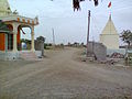
main entrance of Amrapur village
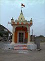
Hanuman temple Amrapur
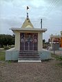
Shiva temple Amrapur

a view of village Amrapur

a view of village Amrapur

Primary school Amrapur

Gam no choro Amrapur

Bapa sitaram oto Amrapur

Borsadiya family's makan in Amrapur
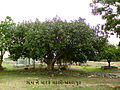
a banyan tree in village.


| Wikimedia Commons has media related to Amrapur, Jamnagar, Gujarat. |
External links and Sources[]
References[]
- Villages in Jamnagar district