Anaheim, California
Anaheim, California | |
|---|---|
City | |
| City of Anaheim | |
 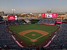   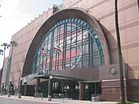 Clockwise from top: Sleeping Beauty Castle at Disneyland Park, Anaheim Regional Transportation Intermodal Center, Honda Center, Anaheim Convention Center, Angel Stadium of Anaheim | |
 Flag  Seal | |
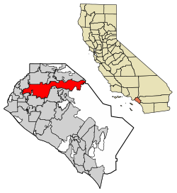 Location within Orange County | |
 Anaheim Location within the Los Angeles Metropolitan Area | |
| Coordinates: 33°50′10″N 117°53′23″W / 33.83611°N 117.88972°WCoordinates: 33°50′10″N 117°53′23″W / 33.83611°N 117.88972°W | |
| Country | United States |
| State | California |
| County | Orange |
| Founded | 1857 |
| Incorporated | March 18, 1876[12] |
| Named for | "Ana", after the Santa Ana River, and "Heim", the German word for "home". |
| Government | |
| • Mayor | Harry Sidhu[1] (R) |
| • United States representatives[2] | Young Kim (R),[3] Katie Porter (D),[4] and Lou Correa (D)[5] |
| • State senators[10] | Josh Newman (D), Tom Umberg (D), and Dave Min (D) |
| • Assemblymembers[11] | Sharon Quirk-Silva (D), Steven Choi (R), and Tom Daly (D) |
| Area | |
| • Total | 50.88 sq mi (131.77 km2) |
| • Land | 50.27 sq mi (130.20 km2) |
| • Water | 0.60 sq mi (1.57 km2) 1.92% |
| Elevation | 157 ft (48 m) |
| Population | |
| • Total | 346,824 |
| • Rank | 1st in Orange County 10th in California 56th in the United States |
| • Density | 6,899.22/sq mi (2,663.77/km2) |
| Time zone | UTC−8 (Pacific) |
| • Summer (DST) | UTC−7 (PDT) |
| ZIP codes[9] | 92801–92809, 92812, 92814–92817, 92825, 92850, 92899 |
| Area codes | 657/714 |
| FIPS code | 06-02000 |
| GNIS feature IDs | 1652663, 2409704 |
| Website | www |


Anaheim (/ˈænəhaɪm/) is a city in Orange County, California, part of the Los Angeles metropolitan area. As of the 2020 United States Census, the city had a population of 346,824, making it the most populous city in Orange County, the 10th-most populous city in California, and the 56th-most populous city in the United States.[8] Anaheim is the second-largest city in Orange County in terms of land area, and is known for being the home of the Disneyland Resort, the Anaheim Convention Center, and two major sports teams: the Anaheim Ducks ice hockey club and the Los Angeles Angels baseball team.
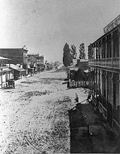
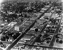
Anaheim was founded by fifty German families in 1857 and incorporated as the second city in Los Angeles County on March 18, 1876;[12] Orange County was split off from Los Angeles County in 1889. Anaheim remained largely an agricultural community until Disneyland opened in 1955. This led to the construction of several hotels and motels around the area, and residential districts in Anaheim soon followed. The city also developed into an industrial center, producing electronics, aircraft parts and canned fruit. Anaheim is a charter city.[13]
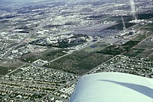
Anaheim's city limits extend almost the full width of Orange County, from Cypress in the west, twenty miles east to the Riverside County line in the east, encompassing a diverse range of neighborhoods. In the west, mid-20th-century tract houses predominate. Downtown Anaheim has three mixed-use historic districts, the largest of which is the Anaheim Colony. South of downtown, a center of commercial activity of regional importance begins, the Anaheim–Santa Ana edge city, which stretches east and south into the cities of Orange, Santa Ana and Garden Grove. This edge city includes the Disneyland Resort, with two theme parks, multiple hotels, and its retail district; Disney is part of the larger Anaheim Resort district with numerous other hotels and retail complexes. The Platinum Triangle, a neo-urban redevelopment district surrounding Angel Stadium, which is planned to be populated with mixed-use streets and high-rises. Further east, Anaheim Canyon is an industrial district north of the Riverside Freeway and east of the Orange Freeway. The city's eastern third consists of Anaheim Hills, a community built to a master plan, and open land east of the Route 241 tollway.
History[]

Spanish and Mexican era[]
The area that makes up modern-day Anaheim, along with Placentia and Fullerton, were part of the Rancho San Juan Cajón de Santa Ana, a Mexican-era rancho grant, given to Juan Pacífico Ontiveros in 1837 by Juan Bautista Alvarado, then Governor of Alta California. Following the American Conquest of California, the rancho was patented to Ontiveros by Public Land Commission. In 1857, Ontiveros sold 1,160 acres (out of his more than 35,000 acre estate) to 50 German-American families for the founding of Anaheim.
Founding[]
Anaheim's name is a blend of Ana, after the nearby Santa Ana River, and German -heim meaning "home", which is also a common Germanic place name compound (compare Trondheim in Norway and many place names in Germany).[14]
The city of Anaheim was founded in 1857 by 50 German-Americans who were residents of San Francisco[15] and whose families had originated in Rothenburg ob der Tauber, Franconia in Bavaria.[16][17] After traveling through the state looking for a suitable area to grow grapes, the group decided to purchase a 1,165 acres (4.71 km2) parcel from Juan Pacifico Ontiveros' large Rancho San Juan Cajon de Santa Ana in present-day Orange County for $2 per acre.[15]
For $750 a share, the group formed the Anaheim Vineyard Company headed by George Hansen.[15] Their new community was named Annaheim, meaning "home by the Santa Anna River" in German.[15] The name later was altered to Anaheim. To the Spanish-speaking neighbors, the settlement was known as Campo Alemán (English: German Field).

Although grape and wine-making was their primary objective, the majority of the 50 settlers were mechanics, carpenters and craftsmen with no experience in wine-making.[15] The community set aside 40 acres (16 ha) for a town center and a school was the first building erected there.[15] The first home was built in 1857, the Anaheim Gazette newspaper was established in 1870 and a hotel in 1871. The census of 1870 reported a population of 565 for the Anaheim district.[18] For 25 years, the area was the largest wine producer in California.[15] However, in 1884, a disease infected the grape vines and by the following year the entire industry was destroyed. Other crops – walnuts, lemons and oranges – soon filled the void. Fruits and vegetables had become viable cash crops when the Los Angeles – Orange County region was connected to the continental railroad network in 1887.[19]
Helena Modjeska[]
Polish actress Helena Modjeska settled in Anaheim with her husband and various friends, among them Henryk Sienkiewicz, Julian Sypniewski and Łucjan Paprocki. While living in Anaheim, Helena Modjeska became good friends with Clementine Langenberger, the second wife of August Langenberger.[20] Helena Street[21] and Clementine Street[21] are named after these two ladies, and the streets are located adjacent to each other as a symbol of the strong friendship which Helena Modjeska and Clementine Lagenberger shared. Modjeska Park[22] in West Anaheim, is also named after Helena Modjeska.
Early 20th century[]

During the first half of the 20th century, Anaheim was a massive rural community dominated by orange groves and the landowners who farmed them. One of the landowners was Bennett Payne Baxter, who owned much land in northeast Anaheim that today is the location of Angel Stadium.[23] He came up with many new ideas for irrigating orange groves and shared his ideas with other landowners. He was not only successful, he helped other landowners and businesspeople succeed as well. Ben Baxter and other landowners helped to make Anaheim a thriving rural community before the opening of Disneyland transformed the city. A street along Edison Park[23] is named Baxter Street. Also during this time, Rudolph Boysen served as Anaheim's first Park Superintendent from 1921 to 1950. Boysen created a hybrid berry which Walter Knott later named the boysenberry, after Rudy Boysen. Boysen Park[24] in East Anaheim was also named after him.
In 1924, Ku Klux Klan members were elected to the Anaheim City Council on a platform of political reform. Up until that point, the city had been controlled by a long-standing business and civic elite that was mostly German American. Given their tradition of moderate social drinking, the German Americans did not strongly support prohibition laws of the day. The mayor himself was a former saloon keeper. Led by the minister of the First Christian Church, the Klan represented a rising group of politically oriented non-ethnic Germans who denounced the elite as corrupt, undemocratic, and self-serving. The Klansmen aimed to create what they saw as a model, orderly community, one in which prohibition against alcohol would be strictly enforced. At the time, the KKK had about 1200 members in Orange County. The economic and occupational profile of the pro and anti-Klan groups shows the two were similar and about equally prosperous. Klan members were Protestants, as were the majority of their opponents; however, the opposition to the Klan also included many Catholic Germans. Individuals who joined the Klan had earlier demonstrated a much higher rate of voting and civic activism than did their opponents, and many of the individuals in Orange County who joined the Klan did so out of a sense of civic activism. Upon easily winning the local Anaheim election in April 1924, the Klan representatives promptly fired city employees who were known to be Catholic and replaced them with Klan appointees. The new city council tried to enforce prohibition. After its victory, the Klan chapter held large rallies and initiation ceremonies over the summer.[25]
The opposition to the KKK's hold on Anaheim politics organized, bribed a Klansman for their secret membership list, and exposed the Klansmen running in the state primaries, defeating most of the candidates. Klan opponents in 1925 took back local government, and succeeded in a special election in recalling the Klansmen who had been elected in April 1924. The Klan in Anaheim quickly collapsed; its newspaper closed after losing a libel suit, and the minister who led the local Klavern moved to Kansas.[25]
Disneyland and the late 20th century[]
Construction of the Disneyland theme park began on July 16, 1954, and it opened to the public on July 17, 1955. It has become one of the world's most visited tourist attractions, with over 650 million visitors since its opening. The location was formerly 160 acres (0.65 km2) of orange and walnut trees. Hotels and motels began to spread and residential districts soon followed. By the mid-1960s, the city's explosive growth would attract a Major League Baseball team, with the California Angels relocating from Los Angeles to Anaheim in 1966, where they have remained since. In 1980, the National Football League's Los Angeles Rams relocated from the Los Angeles Memorial Coliseum to the Angels' home field, Anaheim Stadium, playing there until their relocation to St. Louis in 1995. In 1993, Anaheim gained its own National Hockey League team when The Walt Disney Company founded the Mighty Ducks of Anaheim.
In 1970, the Census Bureau reported Anaheim's population as 9.3% Hispanic and 89.2% non-Hispanic white.[26] In the late 20th century, Anaheim grew rapidly in population. Today, Anaheim has a diverse ethnic and racial composition.[26]
During the large expansion of the Disneyland Resort in the late 1990s and early 2000s, the city of Anaheim recognized the surrounding Anaheim Resort area as a tourist destination. It includes the Disneyland Resort, the Anaheim Convention Center, the Honda Center, and Angel Stadium.
21st century[]
In 2001, Disney's California Adventure (renamed Disney California Adventure Park in 2010), the most expansive project in Disneyland's history, opened to the public.[27] In 2007, Anaheim celebrated its sesquicentennial.[28]
In July 2012, political protests by Hispanic residents occurred following the fatal shooting of two men, the first of whom was unarmed. Protesting occurred in the area between State College and East Street, and was motivated by concerns over police brutality, gang activity, domination of the city by commercial interests, and a perceived lack of political representation of Hispanic residents in the city government.[29][30][31] The protests were accompanied by looting of businesses and homes.[32][33]
Geography[]
Anaheim is located at 33°50′10″N 117°53′23″W / 33.836165°N 117.889769°W[34] and is approximately 25 miles (40 km) southeast of downtown Los Angeles. The city roughly follows the east-to-west route of the 91 Freeway from the Orange-Riverside county border to Buena Park. To the north, Anaheim is bounded by Yorba Linda, Placentia, Fullerton, and Buena Park (from east to west). The city shares its western border with Buena Park and Cypress. Anaheim is bordered on the south by Stanton, Garden Grove, and Orange (from west to east). Various unincorporated areas of Orange County also abut the city, including Anaheim Island.[35] According to the United States Census Bureau, the city has a total area of 50.8 square miles (132 km2), 49.8 square miles (129 km2) of which is land and 1.0 square mile (2.6 km2) of which (1.92%) is water.
Cityscape[]
The city recognizes several districts, including the Anaheim Resort (the area surrounding Disneyland), Anaheim Canyon (an industrial area north of California State Route 91 and east of California State Route 57), and the Platinum Triangle (the area surrounding Angel Stadium). Anaheim Hills also maintains a distinct identity. The contiguous commercial development from the Disney Resort through into the cities of Orange, Garden Grove and Santa Ana has collectively been termed the Anaheim–Santa Ana edge city.

Communities and neighborhoods[]
This section contains content that is written like an advertisement. (September 2016) |

Downtown Anaheim is located in the heart of the Colony Historic District. Downtown is the administrative heart of the city where City Hall, Anaheim West Tower, Anaheim Police Headquarters, the Anaheim Chamber of Commerce and the Main Library are located. Anaheim Ice (formerly Disney Ice), the Downtown Anaheim Farmer's Market, a food hall in a historic 1919 Sunkist packing house, and the Center Street Promenade are also located in Downtown Anaheim. In late 2007, The Muzeo,[36] the newest major museum in Orange County, opened its doors for the first time and is located next to Anaheim West Tower. Pearson Park[37] is also located in Downtown Anaheim, and is named after Charles Pearson,[21] who was Mayor of Anaheim during the time Walt Disney opened Disneyland in Anaheim. One of the major attractions located in Pearson Park is the Pearson Park Amphitheater.[38] In the Colony Historic District just west of Downtown Anaheim is the Mother Colony House,[39] which was built by George Hanson and was the first house built in Anaheim,[40] the founder of Anaheim. Today, it is Anaheim's and Orange County's oldest extant museum. The Woelke-Stoeffel House[41] is a Victorian mansion located next door to the Mother Colony House. Originally the Victorian Home was occupied by the Stoeffel family,[42] early pioneer residents of Anaheim. The home served as headquarters for the local Red Cross until the early 1990s. In 2010–2011, the Woelke-Stoeffel house became refurnished and is now part of the Founder's Park complex. Founder's Park includes the Mother Colony house and a carriage house, which serves as a museum of Anaheim's agricultural history.
Climate[]
| Anaheim, California | ||||||||||||||||||||||||||||||||||||||||||||||||
|---|---|---|---|---|---|---|---|---|---|---|---|---|---|---|---|---|---|---|---|---|---|---|---|---|---|---|---|---|---|---|---|---|---|---|---|---|---|---|---|---|---|---|---|---|---|---|---|---|
| Climate chart (explanation) | ||||||||||||||||||||||||||||||||||||||||||||||||
| ||||||||||||||||||||||||||||||||||||||||||||||||
| ||||||||||||||||||||||||||||||||||||||||||||||||
Like many other South Coast cities, Anaheim maintains a borderline hot semi-arid climate (Köppen BSh), a little short of a Mediterranean climate (Köppen Csa) characterized by warm winters with erratic heavy rainfalls, and hot, essentially rainless summers.[43] The record high temperature in Anaheim is 115 °F (46 °C) on July 6, 2018[44][45] and the record low temperature is 30 °F (–1 °C) on February 15, 1990, and January 30, 2002.[46]
| hideClimate data for Anaheim, California (1991–2020 normals) | |||||||||||||
|---|---|---|---|---|---|---|---|---|---|---|---|---|---|
| Month | Jan | Feb | Mar | Apr | May | Jun | Jul | Aug | Sep | Oct | Nov | Dec | Year |
| Record high °F (°C) | 95 (35) |
97 (36) |
98 (37) |
106 (41) |
106 (41) |
112 (44) |
115 (46) |
107 (42) |
110 (43) |
107 (42) |
102 (39) |
91 (33) |
115 (46) |
| Average high °F (°C) | 71.0 (21.7) |
71.0 (21.7) |
73.7 (23.2) |
76.6 (24.8) |
78.0 (25.6) |
81.7 (27.6) |
86.8 (30.4) |
88.8 (31.6) |
87.8 (31.0) |
83.4 (28.6) |
76.8 (24.9) |
70.6 (21.4) |
78.8 (26.0) |
| Average low °F (°C) | 48.9 (9.4) |
49.3 (9.6) |
51.4 (10.8) |
52.8 (11.6) |
58.2 (14.6) |
61.7 (16.5) |
65.6 (18.7) |
66.0 (18.9) |
64.1 (17.8) |
59.3 (15.2) |
53.0 (11.7) |
48.2 (9.0) |
56.5 (13.7) |
| Record low °F (°C) | 30 (−1) |
30 (−1) |
37 (3) |
38 (3) |
45 (7) |
50 (10) |
54 (12) |
52 (11) |
51 (11) |
44 (7) |
33 (1) |
32 (0) |
30 (−1) |
| Average rainfall inches (mm) | 3.34 (85) |
3.47 (88) |
1.86 (47) |
0.83 (21) |
0.53 (13) |
0.15 (3.8) |
0.07 (1.8) |
0.01 (0.25) |
0.10 (2.5) |
0.72 (18) |
0.99 (25) |
2.02 (51) |
14.09 (356.35) |
| Source 1: [47] | |||||||||||||
| Source 2: [46][48] | |||||||||||||
Demographics[]
| Historical population | |||
|---|---|---|---|
| Census | Pop. | %± | |
| 1870 | 881 | — | |
| 1880 | 833 | −5.4% | |
| 1890 | 1,273 | 52.8% | |
| 1900 | 1,456 | 14.4% | |
| 1910 | 2,628 | 80.5% | |
| 1920 | 5,526 | 110.3% | |
| 1930 | 10,995 | 99.0% | |
| 1940 | 11,031 | 0.3% | |
| 1950 | 14,556 | 32.0% | |
| 1960 | 104,184 | 615.7% | |
| 1970 | 166,408 | 59.7% | |
| 1980 | 219,494 | 31.9% | |
| 1990 | 266,406 | 21.4% | |
| 2000 | 328,014 | 23.1% | |
| 2010 | 336,265 | 2.5% | |
| 2020 | 346,824 | 3.1% | |
2010[]
The 2010 United States Census[50] reported that Anaheim had a population of 336,265. The population density was 6,618.0 people per square mile (2,555.2/km2). The racial makeup of Anaheim was:
- 177,237 (52.7%) White (27.5% non-Hispanic White alone),
- 80,705 (24.0%) from other races
- 49,857 (14.8%) Asian (4.4% Vietnamese, 3.6% Filipino, 2.0% Korean, 1.4% Chinese, 1.3% Indian), 1,607 (0.5%) Pacific Islander
- 14,864 (4.4%) from two or more races (multiracial/mestizo)
- 9,347 (2.8%) African American
- 2,648 (0.8%) Native American
Hispanic or Latino of any race were 177,467 persons (52.8%); 46.0% of Anaheim's population was of Mexican descent, 1.2% Salvadoran, and 1.0% Guatemalan; the remainder of the Hispanic population came from smaller ancestral groups.[51]
The census reported that 332,708 people (98.9% of the population) lived in households, 2,020 (0.6%) lived in non-institutionalized group quarters, and 1,537 (0.5%) were institutionalized.
There were 98,294 households, out of which 44,045 (44.8%) had children under the age of 18 living in them, 52,518 (53.4%) were opposite-sex married couples living together, 14,553 (14.8%) had a female householder with no husband present, 7,223 (7.3%) had a male householder with no wife present. There were 6,173 (6.3%) unmarried opposite-sex partnerships, and 733 (0.7%) same-sex married couples or partnerships. 17,448 households (17.8%) were made up of individuals, and 6,396 (6.5%) had someone living alone who was 65 years of age or older. The average household size was 3.38. There were 74,294 families (75.6% of all households); the average family size was 3.79.
The age distribution of the population was as follows: 91,917 people (27.3%) under the age of 18, 36,506 people (10.9%) aged 18 to 24, 101,110 people (30.1%) aged 25 to 44, 75,510 people (22.5%) aged 45 to 64, and 31,222 people (9.3%) who were 65 years of age or older. The median age was 32.4 years. For every 100 females, there were 99.0 males. For every 100 females age 18 and over, there were 97.1 males.
There were 104,237 housing units at an average density of 2,051.5 per square mile (792.1/km2), of which 47,677 (48.5%) were owner-occupied, and 50,617 (51.5%) were occupied by renters. The homeowner vacancy rate was 1.7%; the rental vacancy rate was 7.2%. 160,843 people (47.8% of the population) lived in owner-occupied housing units and 171,865 people (51.1%) lived in rental housing units.
According to the 2010 United States Census, Anaheim had a median household income of $59,627, with 15.6% of the population living below the federal poverty line.[52]
2000[]
As of the census[53] of 2000, there were 328,014 people, 96,969 households, and 73,502 families residing in the city. The population density was 6,842.7 inhabitants per square mile (2,587.8/km2). There were 99,719 housing units at an average density of 2,037.5 per square mile (786.7/km2). The racial makeup of the city was 55% White, 3% Black or African American, 0.9% Native American, 12% Asian, 0.4% Pacific Islander, 24% from other races, and 5% from two or more races. 46% of the population were Hispanic or Latino.
Of Anaheim's 96,969 households, 43.0% had children under the age of 18 living with them, 56.3% were married couples living together, 13.1% had a female householder with no husband present, and 24.2% were non-families. 18.1% of all households were made up of individuals, and 6.1% had someone living alone who was 65 years of age or older. The average household size was 3.34 and the average family size was 3.75.
In the city, the population was spread out, with 30.2% under the age of 18, 10.5% from 18 to 24, 33.5% from 25 to 44, 17.7% from 45 to 64, and 8.2% who were 65 years of age or older. The median age was 30 years. For every 100 females, there were 100.1 males. For every 100 females age 18 and over, there were 98.1 males.
The median income household income was $47,122, and the median family income was $49,969. Males had a median income of $33,870 versus $28,837 for females. The per capita income for the city was $18,266. About 10.4% of families and 14.1% of the population were below the poverty line, including 18.9% of those under age 18 and 7.5% of those age 65 or over.
Economy[]

Anaheim's income is based on a tourism economy. In addition to The Walt Disney Company being the city's largest employer, the Disneyland Resort itself contributes about $4.7 billion annually to Southern California's economy. It also produces $255 million in taxes every year.[54] Another source of tourism is the Anaheim Convention Center, which is home to many important national conferences. Many hotels, especially in the city's Resort district, serve theme park tourists and conventiongoers. Continuous development of commercial, entertainment, and cultural facilities stretches from the Disney area east to the Santa Ana River, south into the cities of Garden Grove, Orange and Santa Ana – collectively, this area has been labeled the Anaheim–Santa Ana edge city and is one of the three largest such clusters in Orange County, together with the South Coast Plaza–John Wayne Airport edge city and Irvine Spectrum.
The Anaheim Canyon business park makes up 63% of Anaheim's industrial space and is the largest industrial district in Orange County. Anaheim Canyon is also home to the second-largest business park in Orange County.[55][56] Anaheim Canyon houses 2,600 businesses, which employ over 55,000 workers.[citation needed]
Several notable companies have corporate offices and/or headquarters within Anaheim.
- Anaheim Memorial Medical Center
- AT&T
- Banco Popular, a bank based in Puerto Rico, has its mainland American headquarters in Anaheim
- CKE Restaurants, the parent company of the Carl's Jr., Hardee's, Green Burrito, and Red Burrito restaurant chains
- Disneyland Resort, part of Walt Disney Parks, Experiences and Consumer Products, a subsidiary of the Walt Disney Company
- Extron Electronics, designs, manufactures, and services A/V electronics worldwide
- Fisker Automotive[57]
- Fujitsu, computer
- General Dynamics
- Hewlett Packard[58]
- Isuzu[59] North American headquarters
- Kaiser Foundation
- L-3 Communications
- Living Stream Ministry
- Pacific Sunwear
- Panasonic[60]
- Pendarvis Manufacturing[61]
- Raytheon
- Sunny Delight[62]
- Targus, a computer peripheral manufacturer
- Tenet Healthcare
- Toyota Financial Services
- YKK,[63] world's largest zipper manufacturing firm
- Yogurtland
- Zyxel, maker of routers, switches and other networking products
Top employers[]
According to the city's 2017 Comprehensive Annual Financial Report,[64] the top employers in the city are:
| # | Employer | # of Employees |
|---|---|---|
| 1 | Disneyland Resort | 31,000 |
| 2 | Kaiser Foundation Hospital | 6,000 |
| 3 | Northgate González Markets | 2,000 |
| 4 | Hilton Anaheim | 1,575 |
| 5 | Angels Baseball | 1,484 |
| 6 | Anaheim Regional Medical Center | 1,262 |
| 7 | Anaheim Marriott | 1,030 |
| 8 | L-3 Communications | 1,000 |
| 9 | St. Joseph Heritage Healthcare | 900 |
| 10 | Time Warner Cable | 900 |
Retail[]
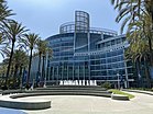
Larger retail centers include the Downtown Disney shopping area at the Disneyland Resort, the power centers Anaheim Plaza in western Anaheim (347,000 ft²),[65] and Anaheim Town Square in East Anaheim (374,000 ft²),[66] as well as the Anaheim GardenWalk lifestyle center (440,000 ft² of retail, dining and entertainment located in the Anaheim Resort).
Attractions[]
This section is in list format, but may read better as prose. (September 2016) |
- American Sports Centers, home of the U.S. men's national volleyball team and U.S. women's national volleyball team[67]
- Anaheim Convention Center
- Anaheim GardenWalk
- Anaheim Hills Golf Course
- Anaheim Founders' Park
- Anaheim Ice
- Anaheim/OC Walk of Stars[68]
- Angel Stadium of Anaheim
- Dad Miller Golf Course
- Disneyland Resort
- Disneyland Park
- Disney California Adventure Park
- Downtown Disney
- Flightdeck Flight Simulation Center
- The Grove of Anaheim, formerly the Sun Theater, formerly Tinseltown Studios
- Honda Center, formerly the Arrowhead Pond of Anaheim
- La Palma Park[69]
- MUZEO, Art Museum located in Downtown Anaheim
- Oak Canyon Nature Center
Sports teams[]
This section is in list format, but may read better as prose. (September 2016) |
Current teams[]
- NHL team: Anaheim Ducks – 2007 Stanley Cup Champions
- MLB team: Los Angeles Angels – 2002 World Series Champions under the name Anaheim Angels
Defunct or relocated teams[]
- NLL team: Anaheim Storm (Folded after 2004–2005 season because of low attendance)
- NFL team: Los Angeles Rams played in Anaheim in Anaheim Stadium from 1980 through 1994 before moving to St. Louis, Missouri.
- NBA team: Los Angeles Clippers played select games in Anaheim at Arrowhead Pond of Anaheim from 1994 through 1999 before moving permanently to Staples Center in Downtown Los Angeles.
- World Football League team: The Southern California Sun played at Anaheim Stadium from 1974 to 1975.
- Arena Football League team: Anaheim Piranhas played at the Arrowhead Pond from 1994 to 1997.
- AFL team: Los Angeles Kiss played at Honda Center from 2014 to 2016.
- Roller Hockey International team: Anaheim Bullfrogs played in the RHI from 1993 to 1997 and 1999, winning the Murphy Cup Championship twice.
- American Basketball Association team: Anaheim Amigos played at the Anaheim Convention Center during the 1967–68 Season, then moved to Los Angeles.
- ABA2000 team: Southern California Surf played at the Anaheim Convention Center from 2001 to 2002.
- NBADL team: Anaheim Arsenal played at the Anaheim Convention Center from 2006 to 2009. The team moved to Springfield, Massachusetts and was renamed for the 2009–2010 season.
- World Team Tennis: The Anaheim Oranges[70] played in 1978.
- Continental Indoor Soccer League Team: The Anaheim Splash, played from 1994 to 1997.
- California Surf of the now defunct North American Soccer League played from 1978 to 1981.
Court battle against the Angels[]

On January 3, 2005, Angels Baseball LP, the ownership group for the Anaheim Angels, announced that it would change the name of the club to the Los Angeles Angels of Anaheim. Team spokesmen pointed out that from its inception, the Angels had been granted territorial rights by Major League Baseball to the counties of Los Angeles, Ventura, Riverside, and San Bernardino in addition to Orange County. The new owner, Arturo Moreno, believed the name would help him market the team to the entire Southern California region rather than just Orange County. The "of Anaheim" was included in the official name to comply with a provision of the team's lease at Angel Stadium which requires that "Anaheim" be included in the team's name.
Mayor Curt Pringle and other city officials countered that the name change violated the spirit of the lease clause, even if it was in technical compliance. They argued that a name change was a major bargaining chip in negotiations between the city and Disney Baseball Enterprises, Inc., then the ownership group for the Angels. They further argued that the city would never have agreed to the new lease without the name change, because the new lease required that the city partially fund the stadium's renovation, but provided very little revenue for the city. Anaheim sued Angels Baseball LP in Orange County Superior Court, and a jury trial was completed in early February 2006, resulting in a victory for the Angels franchise.
Anaheim appealed the court decision with the California Court of Appeal in May 2006. The case was tied up in the Appeals Court for over two years. In December 2008, the Appeals Court upheld the February 2006 Decision and ruled in favor of Angels Baseball. In January 2009, the Anaheim City Council voted not to appeal the court case any further, bringing an end to the four-year legal dispute.
Government and politics[]
Anaheim was, at one point in time, one of the most politically conservative major cities in the United States.[71][72] However, in recent years it has been moving leftward. According to the California Secretary of State, as of October 22, 2018, Anaheim has 141,549 registered voters. Of those, 58,411 (41.27%) are registered Democrats, 39,885 (28.18%) are registered Republicans, and 37,877 (26.76%) have declined to state a political party.[73]
| Year | Democratic | Republican | Third Parties |
|---|---|---|---|
| 2020[74] | 58.65% 77,895 | 39.25% 52,124 | 2.10% 2,794 |
| 2016[75] | 57.93% 59,566 | 35.44% 36,438 | 6.63% 6,812 |
| 2012[76] | 52.73% 47,662 | 44.83% 40,517 | 2.44% 2,206 |
| 2008[77] | 51.34% 47,433 | 46.46% 42,924 | 2.19% 2,025 |
| 2004[78] | 40.95% 34,598 | 57.89% 48,914 | 1.16% 982 |
| 2000[79] | 43.93% 34,787 | 52.28% 41,401 | 3.80% 3,006 |
| 1996[80] | 40.38% 28,924 | 48.86% 34,999 | 10.75% 7,703 |
| 1992[81] | 32.46% 27,211 | 43.39% 36,375 | 24.16% 20,255 |
| 1988[82] | 31.58% 24,881 | 67.21% 52,954 | 1.22% 959 |
| 1984[83] | 24.28% 19,266 | 74.66% 59,238 | 1.05% 836 |
| 1980[84] | 23.34% 17,816 | 68.08% 51,960 | 8.58% 6,546 |
| 1976[85] | 39.67% 26,464 | 58.10% 38,758 | 2.23% 1,484 |
City government[]

Under its city charter, Anaheim operates under a council-manager government. Legislative authority is vested in a city council of seven nonpartisan members, who hire a professional city manager to oversee day-to-day operations. The mayor serves as the presiding officer of the city council in a first among equals role. Under the city's term limits, an individual may serve a maximum of two terms as a city council member and two terms as the mayor.
Up until 2014, all council seats were elected at large. Voters elected the mayor and four other members of the city council to serve four-year staggered terms. Elections for two council seats were held in years divisible by four while elections for the mayor and the two other council seats were elected during the intervening even-numbered years.
In response to protests and a California Voting Rights Act lawsuit by the American Civil Liberties Union and several residents, the city placed two measures on the November 2014 ballot. Measure L proposed that council members be elected by district instead of at large. Measure M proposed to increase the number of council seats from five to seven. Both measures passed.[86]
The current city council consists of:[87]
- Mayor Harry Sidhu (since 2018)
- Denise Barnes, District 1 (since 2016)
- Jordan Brandman, District 2 (since 2018)
- Jose F. Moreno, District 3 (since 2016)
- Lucille Kring, District 4 (since 2012)
- Stephen Faessel, District 5 (since 2016)
- Trevor O'Neil, District 6 (since 2018)
Federal, state and county representation[]
In the United States House of Representatives, Anaheim is split among three Congressional districts:[2]
- California's 39th congressional district, represented by Republican Young Kim,[3]
- California's 45th congressional district, represented by Democrat Katie Porter,[4] and
- California's 46th congressional district, represented by Democrat Lou Correa.[5]
In the California State Senate, Anaheim is split among three districts:[10]
- the 29th Senate District, represented by Democrat Josh Newman,
- the 34th Senate District, represented by Democrat Tom Umberg, and
- the 37th Senate District, represented by Democrat Dave Min.
In the California State Assembly, Anaheim is split among three districts:[11]
- the 65th Assembly District, represented by Democrat Sharon Quirk-Silva,
- the 68th Assembly District, represented by Republican Steven Choi, and
- the 69th Assembly District, represented by Democrat Tom Daly.
On the Orange County Board of Supervisors, Anaheim is divided between two districts, with Anaheim Hills lying in the 3rd District and the remainder of Anaheim lying in the 4th District:
- the 3rd supervisorial district, represented by Republican Donald P. Wagner since 2019
- the 4th supervisorial district, represented by Democrat Doug Chaffee since 2019
Infrastructure[]
Emergency services[]

Fire protection is provided by the Anaheim Fire Department, Disneyland Resort has its own Fire Department, though it does rely on the Anaheim Fire Department for support, and for Paramedic Services. Law enforcement is provided by the Anaheim Police Department. Ambulance service is provided by Care Ambulance Service.
Anaheim Public Utilities[]
Anaheim Public Utilities is the only municipal owned water and electric utility in Orange County, providing residential and business customers with water and electric services. The utility is regulated and governed locally by the City Council. A Public Utilities Board, made up of Anaheim residents, advises the City Council on major utility issues.[88]
Anaheim has decided to bury power lines along major transportation corridors, converting its electricity system for aesthetic and reliability reasons.[89] To minimize the impact on customer bills, undergrounding is taking place slowly over a period of 50 years, funded by a 4% surcharge on electric bills.[90]
Crime[]
This section needs to be updated. (June 2018) |
In 2003, Anaheim reported nine murders; given its population, this rate was one-third of the national average. Reported rapes in the city are relatively uncommon as well, but have been increasing, along with the national average. Robbery (410 reported incidents) and aggravated assault (824 incidents) rank among the most frequent violent crimes in the city, though robbery rates are half of the national average, and aggravated assaults are 68% of the average. 1,971 burglaries were reported, as well as 6,708 thefts, 1,767 car thefts, and 654 car accidents. All three types of crime were below average. There were 43 cases of arson reported in 2003, 43% of the national average.[91]
Education[]
Schools[]
Anaheim is served by seven public school districts:[92]
- Anaheim Elementary School District
- Anaheim Union High School District
- Centralia School District
- Magnolia School District
- Orange Unified School District
- Placentia-Yorba Linda Unified School District
- Savanna School District
Anaheim is home to 74 public schools,[68] of which 47 serve elementary students, nine are junior high schools, fourteen are high schools and three offer alternative education.
Private schools in the city include Acaciawood Preparatory Academy, Cornelia Connelly High School, Fairmont Preparatory Academy, Servite High School and Zion Lutheran School (PS2-Grade 8).
Higher education[]
Anaheim has two private universities: Anaheim University and Southern California Institute of Technology (SCIT).
The North Orange County Community College District and Rancho Santiago Community College District serve the community.
Libraries[]
Anaheim has eight public library branches.
Transportation[]
In the main portion of the city (not including Anaheim Hills), the major surface streets running west–east, starting with the northernmost, are Orangethorpe Avenue, La Palma Avenue, Lincoln Avenue, Ball Road and Katella Avenue. The major surface streets running south–north, starting with the westernmost, are Knott Avenue, Beach Boulevard (SR 39), Magnolia Avenue, Brookhurst Street, Euclid Street, West Street/Disneyland Drive, Harbor Boulevard, Anaheim Boulevard, East Street, State College Boulevard, Kraemer Boulevard, and Tustin Avenue.
In Anaheim Hills, the major surface streets that run west–east include Orangethorpe Avenue, La Palma Avenue, Santa Ana Canyon Road, and Nohl Ranch Road. Major surface streets that run north–south include Lakeview Avenue and Fairmont Boulevard. Imperial Highway (SR 90) and Yorba Linda Boulevard/Weir Canyon Road run as south–north roads in the city of Anaheim, but north of Anaheim, Imperial Highway and Yorba Linda Boulevard become west–east arterials.
Seven Caltrans state-maintained highways (in addition to the aforementioned surface streets SR 39 and SR 90) run through the city of Anaheim, four of which are freeways and one being a toll road. They include the Santa Ana Freeway (I-5), the Orange Freeway (SR 57), and the Riverside Freeway (SR 91). The Costa Mesa Freeway (SR 55), and the Eastern Transportation Corridor (SR 241 toll road) also have short stretches within the city limits.
Anaheim is served by two major railroads, the Union Pacific Railroad and the BNSF Railway. In addition, the Anaheim Regional Transportation Intermodal Center (ARTIC), a major regional transit station near Honda Center and Angel Stadium, serves Amtrak, Metrolink, and several bus operators, and the Anaheim Canyon Metrolink station serves Metrolink's Inland Empire–Orange County Line. ARTIC is a proposed stop on the proposed California High-Speed Rail network.[93][94]
The Orange County Transportation Authority (OCTA) provides bus service for Anaheim with local and county-wide routes, and both OCTA and Los Angeles County Metro operate bus routes connecting Anaheim to Los Angeles County. Also, Anaheim Resort Transit (ART) provides local shuttle service in and around the Anaheim Resort area, serving local hotels, tourist attractions, and the Disneyland Resort.[95] Disney GOALS operates daily free bus service for low-income youth in the central Anaheim area.[citation needed] A proposal for streetcar service along Harbor Boulevard was rejected in 2018.
Anaheim is equidistant from John Wayne Airport and Long Beach Airport (15 miles), but is also accessible from nearby Los Angeles International (30 miles), and Ontario (35 miles) airports.[68]
Notable people[]
Sister cities[]
Anaheim has the following sister cities:
See also[]
- History of California
- List of cities and towns in California
- List of museums in Orange County, California
References[]
- ^ "Mayor Harry Sidhu". City of Anaheim. Retrieved December 5, 2018.
- ^ Jump up to: a b "Communities of Interest - City". California Citizens Redistricting Commission. Archived from the original on September 30, 2013. Retrieved September 24, 2014.
- ^ Jump up to: a b "California's 39th Congressional District - Representatives & District Map". Civic Impulse, LLC.
- ^ Jump up to: a b "California's 45th Congressional District - Representatives & District Map". Civic Impulse, LLC.
- ^ Jump up to: a b "California's 46th Congressional District - Representatives & District Map". Civic Impulse, LLC.
- ^ "2019 U.S. Gazetteer Files". United States Census Bureau. Retrieved July 1, 2020.
- ^ "Anaheim". Geographic Names Information System. United States Geological Survey. Retrieved October 16, 2014.
- ^ Jump up to: a b "QuickFacts Anaheim city, California". United States Census Bureau.
- ^ "ZIP Code(tm) Lookup". United States Postal Service. Retrieved November 18, 2014.
- ^ Jump up to: a b "Communities of Interest - City". California Citizens Redistricting Commission. Archived from the original on October 23, 2015. Retrieved September 24, 2014.
- ^ Jump up to: a b "Communities of Interest - City". California Citizens Redistricting Commission. Archived from the original on October 23, 2015. Retrieved September 24, 2014.
- ^ Jump up to: a b "California Cities by Incorporation Date". California Association of Local Agency Formation Commissions. Archived from the original (Word) on November 3, 2014. Retrieved August 25, 2014.
- ^ "Interim City Manager". City of Anaheim. Archived from the original on April 1, 2015. Retrieved March 20, 2015.
- ^ Gudde, Erwin; William Bright (2004). California Place Names (Fourth ed.). University of California Press. p. 12. ISBN 978-0-520-24217-3.
- ^ Jump up to: a b c d e f g Armor, Samuel; E.B. Merritt (1921). "IV". History of Orange County, California: With Biographical Sketches. Los Angeles: Historic Record Company. p. 53. Retrieved October 3, 2013.
- ^ "THE GERMANS OF ORANGE COUNTY : Euphoria Prevails at Phoenix Club After Dramatic Events in Ancestral Land". Los Angeles Times. February 24, 1990. Retrieved March 2, 2021.
- ^ "Founders' Park". Anaheim.net. Retrieved March 2, 2021.
- ^ Paul R. Spitzzeri (Fall 2007). "What a Difference a Decade Makes: Ethnic and Racial Demographic Change in Los Angeles County during the 1860s" (PDF). Branding Iron.
- ^ Phil Brigandi (March 9, 2007). "A brief history of Orange County" (PDF). County of Orange. Archived from the original (PDF) on May 28, 2009. Retrieved May 28, 2009.
- ^ "August Langenberger". Archived from the original on February 3, 2006.
- ^ Jump up to: a b c "City of Anaheim – A Brief History of Modern Day Anaheim". Anaheim.net. Archived from the original on September 27, 2011. Retrieved October 17, 2011.
- ^ "City of Anaheim – Modjeska Park Picnic Shelter". Anaheim.net. Archived from the original on March 6, 2012. Retrieved October 17, 2011.
- ^ Jump up to: a b "City of Anaheim – Parks Division". Anaheim.net. Archived from the original on November 24, 2011. Retrieved October 17, 2011.
- ^ "Boysen Park". Events.ocregister.com. Retrieved November 25, 2012.
- ^ Jump up to: a b Christopher N. Cocoltchos, "The Invisible Empire and the Search for the Orderly Community: The Ku Klux Klan in Anaheim, California", in Shawn Lay, ed. The invisible empire in the West (2004), pp. 97–120.
- ^ Jump up to: a b "California – Race and Hispanic Origin for Selected Cities and Other Places: Earliest Census to 1990". U.S. Census Bureau. Archived from the original on August 12, 2012. Retrieved April 20, 2012.
- ^ Niles, Robert (2013). "Theme Park History: A short history of Disney California Adventure". Theme Park Insider. Retrieved April 10, 2021.
- ^ "Anaheim releases '150' float rendering". Orange County Register. December 19, 2006. Retrieved April 1, 2019.
- ^ Jennifer Medina (August 2, 2012). "Fury Reveals Deep Rifts Near 'Happiest Place on Earth'". The New York Times. Retrieved August 3, 2012.
- ^ Nicole Santa Cruz; Christopher Goffard; Richard Winton (July 25, 2012). "Protests reflect deep divisions in Anaheim". Los Angeles Times.
- ^ "Police Brutality in Anaheim Sparks Outrage After 2 Latinos Shot Dead and Demonstrators Attacked". Democracy Now!. July 24, 2012. Retrieved August 3, 2012.
- ^ Medina, Jennifer (July 25, 2012). "Anaheim Cracks Down as Police Shootings Set Off Protests". New York Times. Retrieved December 28, 2015.
- ^ "24 arrested at police protests in Anaheim, Calif". USA Today. July 25, 2012. Retrieved December 28, 2015.
- ^ "US Gazetteer files: 2010, 2000, and 1990". United States Census Bureau. February 12, 2011. Retrieved April 23, 2011.
- ^ "Boundary Map of Anaheim, California". MapTechnica. Archived from the original on May 25, 2017. Retrieved September 20, 2016.
- ^ "Now Open: The Queen's Gallery & Steampunk". MUZEO. Retrieved October 17, 2011.
- ^ "Pearson Park". Anaheimcolony.com. Archived from the original on March 28, 2012. Retrieved October 17, 2011.
- ^ "City of Anaheim – Map". Anaheim.net. Archived from the original on May 30, 2009. Retrieved October 17, 2011.
- ^ "Mother Colony House". Anaheimcolony.com. March 14, 1929. Archived from the original on March 28, 2012. Retrieved October 17, 2011.
- ^ "Orange". Ohp.parks.ca.gov. Retrieved October 17, 2011.
- ^ "The 1998 Historic Home Tour". Anaheimcolony.com. Archived from the original on March 28, 2012. Retrieved October 17, 2011.
- ^ "Another Anaheim Tour". Anaheimcolony.com. Archived from the original on March 28, 2012. Retrieved October 17, 2011.
- ^ Peel, M. C.; Finlayson, B. L.; McMahon, T. A. (2007). "Updated world map of the Köppen-Geiger climate classification" (PDF). Hydrology and Earth System Sciences. 4 (2): 439–473. Bibcode:2007HESSD...4..439P. doi:10.5194/hessd-4-439-2007.
- ^ Pinsky, Brian (July 9, 2018). "Disneyland Photo Update: Don't Sweat It". MiceChat. Retrieved April 15, 2021.
- ^ Weather History for Anaheim, CA: July 6, 2018
- ^ Jump up to: a b Anaheim, CA Monthly Weather. Weather.com. Retrieved on February 11, 2021.
- ^ [1]. NOAA. Retrieved on July 9, 2021
- ^ Anaheim, CA Climate. MyForecast.co. Retrieved on March 30, 2021
- ^ "Census of Population and Housing". Census.gov. Retrieved June 4, 2016.
- ^ "2010 Census Interactive Population Search: CA - Anaheim city". U.S. Census Bureau. Archived from the original on July 15, 2014. Retrieved July 12, 2014.
- ^ "U.S. Census website". census.gov. Retrieved August 27, 2011.
- ^ "Anaheim (city) QuickFacts". United States Census Bureau. Archived from the original on February 1, 2015. Retrieved July 25, 2012.
- ^ "U.S. Census website". United States Census Bureau. Retrieved 2008-01-31.
- ^ Disneyland Resort Public Affairs. Disneyland. Web. 20 May 2014.
- ^ "Anaheim, Developers Plan Condos Next to Canyon Train Station | Orange County Business Journal | Professional Journal archives from". AllBusiness.com. Archived from the original on May 12, 2011. Retrieved October 17, 2011.
- ^ Zimmerman, Martin; Vincent, Roger; Tran, Mai (July 22, 2006). "Boeing to Close Historic Anaheim Facility". The Los Angeles Times.
- ^ "Sign in to Orange County Business Journal - Orange County Business Journal". ocbj.com.
- ^ "Anaheim hosts a sizable tech sector but faces tough competition from South County | Orange County Business Journal | Professional Journal archives from". AllBusiness.com. Retrieved October 17, 2011.[dead link]
- ^ "Contact Information for Isuzu". Isuzu.com. Retrieved December 10, 2011.
- ^ "Sign in to Orange County Business Journal - Orange County Business Journal". ocbj.com.
- ^ "O.C. manufacturer celebrates 30 years in business". The Orange County Register. January 6, 2012.
- ^ "The Canyon: Anaheim's Center for Advanced Technology | Orange County Business Journal | Professional Journal archives from". AllBusiness.com. October 15, 2006. Archived from the original on May 12, 2011. Retrieved October 17, 2011.
- ^ "Ykk Anaheim | Anaheim Stitches Up Zipper Firm Deal : Jobs: YKK Inc. is the largest in its industry. It will build a new plant in a redevelopment area and add 115 employees". Los Angeles Times. July 26, 1996. Retrieved October 17, 2011.
- ^ "City of Anaheim, California Comprehensive Annual Financial Report, for the Year ended June 30, 2017" (PDF). City of Anaheim. Archived from the original on December 7, 2013.
- ^ "Anaheim Plaza website" (PDF). Archived from the original (PDF) on July 25, 2015. Retrieved January 21, 2014.
- ^ "Anaheim Town Square". anaheimtownsquare.com. Archived from the original on November 16, 2012. Retrieved January 18, 2013.
- ^ "About American Sports Center". americansportscenters.com. Retrieved May 15, 2019.
- ^ Jump up to: a b c "Anaheim 2011 factsheet" (PDF). Archived from the original (PDF) on December 1, 2012. Retrieved November 25, 2012.
- ^ "La Palma Park". anaheim.net. Retrieved May 15, 2019.
- ^ "WORLD TEAM TENNIS (1974–1978)". Fortunecity.com. June 3, 2000. Archived from the original on May 11, 2011. Retrieved October 17, 2011.
- ^ Jamison, Niko (January 22, 2018). "These Are The 10 Most Conservative Cities In America". HomeSnacks. Retrieved June 15, 2018.
- ^ Shavin, Naomi (November 20, 2014). "The Most Conservative And Most Liberal Cities In America". Forbes. Retrieved June 15, 2018.
- ^ "CA Secretary of State – Report of Registration – October 22, 2018" (PDF). ca.gov. Retrieved February 16, 2019.
- ^ "Votes cast" (PDF). www.ocvote.com. Retrieved January 18, 2021.
- ^ https://www.ocvote.com/fileadmin/live/gen2016/sov.pdf
- ^ https://www.ocvote.com/fileadmin/live/gen2012/sov-for-web.pdf
- ^ https://www.ocvote.com/fileadmin/user_upload/sov/gen2008/sov.pdf
- ^ https://www.ocvote.com/fileadmin/user_upload/sov/e13/sov1.pdf
- ^ https://www.ocvote.com/fileadmin/user_upload/sov/gen2000/gen2000-SOV.pdf
- ^ "Statement of vote". Sacramento, Calif. : The Secretary. March 2, 1968. Retrieved March 2, 2021 – via Internet Archive.
- ^ "Statement of vote". Sacramento, Calif. : The Secretary. March 2, 1968. Retrieved March 2, 2021 – via Internet Archive.
- ^ Statement of the Vote. Sacramento, Calif. : The Secretary. 1968.
- ^ Statement of the Vote. Sacramento, Calif. : The Secretary. 1968.
- ^ Statement of the Vote. Sacramento, Calif. : The Secretary. 1968.
- ^ Statement of the Vote. Sacramento, Calif. : The Secretary. 1968.
- ^ Do, Anh (November 5, 2014). "Backers of Anaheim's Measure L anticipate better representation". Los Angeles Times. Retrieved December 16, 2014.
- ^ "City Council". City of Anaheim. Retrieved December 5, 2018.
- ^ "Low Electric Rates, Reliable Water Supply Draw Businesses to Anaheim | Orange County Business Journal | Professional Journal archives from". AllBusiness.com. October 15, 2006. Archived from the original on May 12, 2011. Retrieved October 17, 2011.
- ^ "Power outages often spur questions around burying power lines – Today in Energy – U.S. Energy Information Administration (EIA)". Eia.gov. July 25, 2012. Retrieved August 3, 2012.
- ^ "City of Anaheim – Underground Conversion". Anaheim.net. Archived from the original on July 26, 2012. Retrieved August 3, 2012.
- ^ "Anaheim Crime Statistics : California ( CA )". CityRating.com. Retrieved October 17, 2011.
- ^ City of Anaheim (2006). "School Districts Educating the Youth of Anaheim". Archived from the original on April 26, 2006. Retrieved May 28, 2006.
- ^ "AConnext | Anaheim Transit. Where You Want to Go". Anaheimfixedguideway.com. Archived from the original on February 8, 2011. Retrieved October 17, 2011.
- ^ "Measure M2 Project Regional Gateways". Octa.net. Archived from the original on June 10, 2009. Retrieved October 17, 2011.
- ^ "Public Transportation". Visit Anaheim. January 8, 2016. Archived from the original on November 11, 2017. Retrieved November 10, 2017.
- ^ Jump up to: a b "Anaheim Sister City Commission | Anaheim, CA - Official Website". www.anaheim.net. Retrieved November 1, 2019.
Bibliography[]
External links[]
| Wikimedia Commons has media related to Anaheim. |
| Wikivoyage has a travel guide for Anaheim. |
- Official website
- Anaheim Historical Society
- Anaheim, California on the C-SPAN Cities Tour website


| show Places adjacent to Anaheim, California |
|---|
| show Authority control |
|---|
- Anaheim, California
- 1857 establishments in California
- 1876 establishments in California
- Cities in Orange County, California
- Polish-American history
- German-American history
- Incorporated cities and towns in California
- Populated places on the Santa Ana River
- Populated places established in 1857
- Populated places established in 1876