Anjaw district
Anjaw district | |
|---|---|
 Lohit river and Kibithu | |
 Location of Anjaw district in Arunachal Pradesh | |
| Country | |
| State | Arunachal Pradesh |
| Headquarters | Hawai |
| Government | |
| • Lok Sabha constituencies | Arunachal East |
| • Vidhan Sabha constituencies | Hayuliang |
| Area | |
| • Total | 6,190 km2 (2,390 sq mi) |
| Population (2011) | |
| • Total | 21,089 |
| • Density | 3.4/km2 (8.8/sq mi) |
| Demographics | |
| • Literacy | 59.4% |
| • Sex ratio | 805 |
| Time zone | UTC+05:30 (IST) |
| Website | anjaw |
Anjaw District (Pron:/ˈændʒɔ:/) is an administrative district in the state of Arunachal Pradesh in north-east India. It was created district in 2004, by splitting off from the Lohit district under the Arunachal Pradesh Re-organization of Districts Amendment Act.[1] The district borders China on the north. Hawai, at an altitude of 1296 m above sea level, is the district headquarters, located on the banks of the Lohit River, a tributary of the Brahmaputra River. It is the easternmost district in India.[2] The furthest villages towards the border with Chin are Dong,[3] Walong, Kibithu and Kaho.

Anjaw is the second least populous district in India (out of 640).[citation needed]
History[]
During the 1962 war, parts of Anjaw were briefly occupied by China.[4] Being a disputed border region, Indian military has always been present in the Anjaw district. During the 2020 China–India skirmishes additional troops were deployed to the region.[5]
Geography[]
Rivers[]
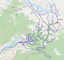
The main rivers are the following:[2]
- Lohit River (called Telu by local Mishmis)
- Lam River
- Tidding River
- Krowti River
- Dichu River
- Lati River
- Klung River
- Telua River
- Ampani River
- Sarti River
Transport[]
The 2,000-kilometre-long (1,200 mi) proposed Mago-Thingbu to Vijaynagar Arunachal Pradesh Frontier Highway along the McMahon Line,[6][7][8][9] (will intersect with the proposed East-West Industrial Corridor Highway) and will pass through this district, alignment map of which can be seen here and here.[10]
Economy[]
Agriculture[]
The main crops are maize, millet, rice, beans, cardamom, orange, pears, plum, and apple.[11]
Divisions[]
There is one Arunachal Pradesh Legislative Assembly constituency located in this district: Hayuliang. It is part of the Arunachal East Lok Sabha constituency.[12]
The district has seven subdistricts called "circles":

Demographics[]
According to the 2011 census Anjaw district has a population of 21,089,[citation needed] roughly equal to the nation of Palau.[13] This gives it a ranking of 639th in India (out of a total of 640). The district has a population density of 3 inhabitants per square kilometre (7.8/sq mi). Its population growth rate over the decade 2001–2011 was 13.77%. Anjaw has a sex ratio of 805 females for every 1000 males, and a literacy rate of 59.4%.[citation needed]
Tribes[]
The Mishmi, and the Zakhring[14] (formerly called Meyor) are the main tribes in the district.
Tribal population is 16,451 (77.72%) as per the 2011 census, with the largest tribes being Idu/Taraon Mishmi (9,991), Kaman/Miju Mishmi (5,021), Degaru Mishmi (472), and Meyor (472).
Languages[]
According to the 2011 Census: Mishmi (72.61%), Hindi (7.06%), Gorkhali (5.29%), Tibetan (2.29%), Bengali (2.13%), Punjabi (1.55%), Dogri (1.17%), Adi (0.90%), and Mizo (0.88%).[15]
Religion[]
As per the 2011 Census: Hindu - 61.83%, Native faith - 28.99%, Muslim - 3.09%, Buddhist - 3.04%.
Among the tribals, major religions are Hinduism (57.67%), Native faith (37.07%), Buddhism (3.15%), and Islam (0.99%).
Among the non-tribals, the composition is Hinduism (76.36%), Islam (10.43%), Sikh (5.66%), Christian (3.54%), and Buddhism (2.65%).[16]
Flora and fauna[]
The district is rich in wildlife. Rare mammals such as Mishmi takin, Red goral, Gongshan muntjac, Leaf muntjac occurs while among birds there is the rare Sclater's Monal. A pine, Pinus merkusii is found only in this district in the entire northeastern India.[17] A flying squirrel, new to science has also its range in this district. It has been named as Mishmi Hills Giant Flying Squirrel, Petaurista mishmiensis.[18]
Banking Facilities[]
The list of banks functioning in Anjaw:
- State Bank of India, Hawai[19]
- State Bank of India, Hayuliang Branch [20]
References[]
- ^ Law, Gwillim (25 September 2011). "Districts of India". Statoids. Retrieved 11 October 2011.
- ^ Jump up to: a b "Anjaw District". Archived from the original on 14 November 2006. Retrieved 27 October 2006.
- ^ Gokhale, Nitin A. (20 August 2001). "Dong". Outlook India. Retrieved 16 December 2012.
- ^ Sharma, Shantanu Nandan (22 June 2020). "What's it like to live in villages along the India-China border?". The Economic Times. Retrieved 3 September 2020.
- ^ "India secures its east after western Himalayan clashes with China". Hindustan Times. Reuters. 2 September 2020. Retrieved 3 September 2020.CS1 maint: others (link)
- ^ "Top officials to meet to expedite road building along China border". Dipak Kumar Dash. timesofindia.indiatimes.com. Retrieved 27 October 2014.
- ^ "Narendra Modi government to provide funds for restoration of damaged highways". Daily News and Analysis. Retrieved 27 October 2014.
- ^ "Indian Government Plans Highway Along Disputed China Border". Ankit Panda. thediplomat.com. Retrieved 27 October 2014.
- ^ "Govt planning road along McMohan line in Arunachal Pradesh: Kiren Rijiju". Live Mint. Retrieved 26 October 2014.
- ^ "China warns India against paving road in Arunachal". Ajay Banerjee. tribuneindia.com. Retrieved 26 October 2014.
- ^ "Anjaw". indiangos.com. Archived from the original on 12 March 2007. Retrieved 27 October 2006.
- ^ "Assembly Constituencies allocation w.r.t District and Parliamentary Constituencies". Chief Electoral Officer, Arunachal Pradesh website. Archived from the original on 13 August 2011. Retrieved 21 March 2011.
- ^ US Directorate of Intelligence. "Country Comparison:Population". Retrieved 1 October 2011.
Palau 20,956 July 2011 est.
- ^ "Zakhring". Ethnologue.com. Archived from the original on 11 November 2006. Retrieved 27 October 2006.
- ^ http://censusindia.gov.in/2011census/C-16.html Table C-16
- ^ http://censusindia.gov.in/2011census/C-series/C-14.html
- ^ Choudhury, Anwaruddin (2008) Survey of mammals and birds in Dihang-Dibang biosphere reserve, Arunachal Pradesh. Final report to Ministry of Environment & Forests, Government of India. The Rhino Foundation for nature in NE India, Guwahati, India. 70pp.
- ^ Choudhury,Anwaruddin (2009). One more new flying squirrel of the genus Petaurista Link, 1795 from Arunachal Pradesh in north-east India. The Newsletter and Journal of the RhinoFoundation for nat. in NE India 8: 26–34, plates.
- ^ "State Bank of India Hawai, Branch Details".
- ^ "State Bank of India, Hayuliang Branch Details".
External links[]
| Wikimedia Commons has media related to Anjaw district. |
| show Places adjacent to Anjaw district |
|---|
| show Authority control |
|---|
Coordinates: 27°55′30″N 96°20′53″E / 27.92500°N 96.34806°E

- Anjaw district
- Districts of Arunachal Pradesh
- States and territories established in 2004
- 2004 establishments in Arunachal Pradesh