Antonio Roldán Betancourt Airport
Antonio Roldán Betancourt Airport Aeropuerto Antonio Roldán Betancourt | |||||||||||
|---|---|---|---|---|---|---|---|---|---|---|---|
 | |||||||||||
| Summary | |||||||||||
| Airport type | Public | ||||||||||
| Operator | Grupo Aeroportuario del Sureste | ||||||||||
| Serves | Apartadó, Colombia | ||||||||||
| Elevation AMSL | 52 ft / 16 m | ||||||||||
| Coordinates | 7°48′45″N 76°43′00″W / 7.81250°N 76.71667°WCoordinates: 7°48′45″N 76°43′00″W / 7.81250°N 76.71667°W | ||||||||||
| Map | |||||||||||
 APO Location of airport in Colombia | |||||||||||
| Runways | |||||||||||
| |||||||||||
| Statistics (2020) | |||||||||||
| |||||||||||
Source: Grupo Aeroportuario del Sureste[1] | |||||||||||

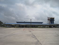
Antonio Roldán Betancourt Airport (IATA: APO, ICAO: SKLC) is an airport serving Apartadó, a town in the Antioquia Department of Colombia. The airport is in the countryside 12 kilometres (7.5 mi) southwest of Apartadó.
The Los Cedros VOR-DME (Ident: LCE) is located on the field.[2]
In 2016, the airport handled 210,550 passengers, and 201,330 in 2017.
Airlines and destinations[]
| Airlines | Destinations |
|---|---|
| EasyFly | Medellín–Olaya Herrera |
| SATENA | Bogotá, Medellín–Olaya Herrera |
See also[]
References[]
- ^ "ASUR Announces Total Passenger Traffic for December 2020" (PDF). Grupo Aeroportuario del Sureste. January 2021. Retrieved January 13, 2021.
- ^ Los Cedros VOR
External links[]
- OurAirports - Antonio Roldán Betancourt
- SkyVector - Antonio Roldán Betancourt
- FallingRain - Antonio Roldán Betancourt Airport
- Accident history for APO at Aviation Safety Network
- Current weather for SKLC at NOAA/NWS
This Colombia-related article is a stub. You can help Wikipedia by . |
This article about an airport in Colombia is a stub. You can help Wikipedia by . |
Categories:
- Airports in Colombia
- Buildings and structures in Antioquia Department
- Colombia stubs
- Colombian airport stubs