Aonach Mòr
| Aonach Mòr | |
|---|---|
 Aonach Mòr from Banavie | |
| Highest point | |
| Elevation | 4,006 ft (1,221 m))[1] |
| Prominence | c. 440 ft (130 m) |
| Parent peak | Aonach Beag |
| Listing | Munro |
| Naming | |
| English translation | Big ridge |
| Language of name | Scottish Gaelic |
| Pronunciation | Scottish Gaelic: [ˈɯːnəx ˈmoːɾ] English approximation: OON-əkh-MOR |
| Geography | |
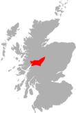
| Location | Highland, Scotland |
| Parent range | Grampians |
| OS grid | NN193729 |
| Topo map | OS Landranger 41 |
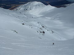
Aonach Mòr is a mountain in the Scottish Highlands. It is located about 2 miles (3 kilometres) north east of Ben Nevis on the south side of Glen Spean, near the town of Fort William. The mountain has a summit elevation of 4,006 ft (1,221 m) and is a Munro.
The name Aonach Mòr (big ridge) might suggest that the mountain is taller than its close neighbour to the south, Aonach Beag (small ridge) to which it is linked by a high bealach. However, the names refer to the relative bulk of the mountains when seen from the glen, rather than their elevation; the summit of Aonach Mòr is 43 ft (13 m) lower than the summit of Aonach Beag.
The quickest and shortest ascent route for hikers is to take the gondola to the Snowgoose Terminal at an elevation of 2,133 ft (650 m) and then hike to the summit. More traditionally, the mountain is often climbed from the south from Glen Nevis and in conjunction with Aonach Beag.
Climate[]
The summit of Aonach Mòr has tundra climate (ET climate in the Köppen classification). The annual mean temperature is 1.6 °C (35 °F) and the warmest calendar month of the year, July, is below 10 °C (50 °F) so cannot support forests. Snow can usually be found on the mountain throughout the year and often persists from one winter till the next. Aonach Mòr holds one of Scotland's longest-lasting snow fields, located in Coire an Lochain at an elevation of 3,670 ft (1,120 m) (grid reference NN193736).[2][circular reference] During Cyclone Bodil, Aonach Mòr was hit by winds of 142 mph (229 km/h).[3]
| hideClimate data for Aonach Mòr, elevation: 3,707 ft (1,130 m) (1981–2010) | |||||||||||||
|---|---|---|---|---|---|---|---|---|---|---|---|---|---|
| Month | Jan | Feb | Mar | Apr | May | Jun | Jul | Aug | Sep | Oct | Nov | Dec | Year |
| Average high °C (°F) | −0.5 (31.1) |
−0.9 (30.4) |
0.1 (32.2) |
2.2 (36.0) |
5.6 (42.1) |
7.6 (45.7) |
9.7 (49.5) |
9.5 (49.1) |
7.4 (45.3) |
4.3 (39.7) |
1.3 (34.3) |
0.5 (32.9) |
3.9 (39.0) |
| Daily mean °C (°F) | −2.5 (27.5) |
−3.0 (26.6) |
−2.2 (28.0) |
−0.4 (31.3) |
2.9 (37.2) |
5.0 (41.0) |
7.3 (45.1) |
7.4 (45.3) |
5.3 (41.5) |
2.3 (36.1) |
−0.7 (30.7) |
−1.8 (28.8) |
1.6 (34.9) |
| Average low °C (°F) | −4.4 (24.1) |
−5.1 (22.8) |
−4.4 (24.1) |
−2.9 (26.8) |
0.1 (32.2) |
2.3 (36.1) |
4.9 (40.8) |
5.2 (41.4) |
3.1 (37.6) |
0.2 (32.4) |
−2.7 (27.1) |
−4.1 (24.6) |
−0.6 (30.9) |
| Source: Met Office[4] | |||||||||||||
Nevis Range Ski Area[]
| Nevis Range Ski Area | |
|---|---|
 Aonach Mòr Summit Coire | |
| Nearest major city | Fort William - 2 miles (3 km) |
| Vertical | 3,708 ft (1,130 m) |
| Top elevation | 4,006 ft (1,221 m) |
| Base elevation | 298 ft (91 m) |
| Skiable area | 630 hectares |
| Runs |
|
| Longest run | 3 miles (5 km) |
| Lift system | 1 gondola, 3 chairlifts, 8 surface |
| Lift capacity | 9600 per hour |
| Snowfall | 126 in (320 cm) |
| Snowmaking | yes |
| Night skiing | yes |
| Website | Nevis Range |
The Nevis Range alpine ski area is located on the mountain's northern and eastern slopes. The ski area was opened in 1989.[5] A gondola lift and several chairlifts and ski tows provide access to 54 runs.
These include Scotland's highest pistes and best off piste backcountry skiing itineraries in the back corries of Coire Dubh, Coire an Lochan, Summit Coire and the West Face.
The ski area was originally eponymous, but later appropriated the name "Nevis" from the mountain's more famous neighbour Ben Nevis. The change sparked some controversy. Whilst Nevis is no doubt easier to pronounce than Aonach Mòr for non-Scottish Gaelic speakers, it was considered by some to represent an erasure of an indigenous name.
Nevis Range Downhill Mountain Bike Track[]
In summer the gondola is used for access to the top of the downhill mountain biking tracks. The Nevis Range resort has hosted the Mountain Bike World Cup thirteen times (2002, 2003, 2004, 2005, 2006, 2008, 2009, 2010, 2011, 2012, 2013, 2014, 2015, 2016, 2017, 2018), and hosted the Mountain Bike World Championships in 2007.
The gondola is also used by paragliders to reach launching points.[6]


References[]
- ^ "Aonach Mòr". Hill Bagging - the online version of the Database of British and Irish Hills (DoBIH). 2019. Retrieved 19 June 2019.
- ^ Snow patches in Scotland
- ^ Farrell, Mike (5 December 2013). "Storm with gales of up to 142mph hits Scotland causing major disruption". STV News. Archived from the original on 8 December 2013.
- ^ "Aonach Mòr Summit 1981–2010 averages". Station, District and regional averages 1981–2010. Met Office. Retrieved 5 September 2017.
- ^ http://www.nevisrange.co.uk/history.asp | History of Skiing on Aonach Mor
- ^ "Back Corries". Nevis Range. Retrieved 21 July 2021.
- Ski areas and resorts in Scotland
- Munros
- Mountains and hills of the Central Highlands
- Mountain biking venues in the United Kingdom
- Protected areas of Highland (council area)
- One-thousanders of the British Isles


