Appenweier
show This article may be expanded with text translated from the corresponding article in German. (February 2009) Click [show] for important translation instructions. |
Appenweier | |
|---|---|
 Coat of arms | |
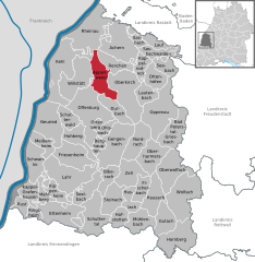
show Location of Appenweier within Ortenaukreis district | |
 Appenweier | |
| Coordinates: 48°32′23″N 7°58′48″E / 48.53972°N 7.98000°ECoordinates: 48°32′23″N 7°58′48″E / 48.53972°N 7.98000°E | |
| Country | Germany |
| State | Baden-Württemberg |
| Admin. region | Freiburg |
| District | Ortenaukreis |
| Government | |
| • Mayor | Manuel Tabor |
| Area | |
| • Total | 38.03 km2 (14.68 sq mi) |
| Elevation | 152 m (499 ft) |
| Population (2020-12-31)[1] | |
| • Total | 10,217 |
| • Density | 270/km2 (700/sq mi) |
| Time zone | UTC+01:00 (CET) |
| • Summer (DST) | UTC+02:00 (CEST) |
| Postal codes | 77767 |
| Dialling codes | 07805 |
| Vehicle registration | OG |
| Website | www.appenweier.de |


Appenweier (Low Alemannic: Appewiir) is a municipality in western Baden-Württemberg, Germany in the district of Ortenau.
Geography[]
Appenweier consists of the main municipal Appenweier (4,075 inhabitants), Urloffen (4,301 inhabitants), known for horseradish-growing, and Nesselried (1,383 inhabitants). The Nesselried district runs through the Wannenbach valley, while Urloffen lies north of Appenweier.
References[]
- ^ "Bevölkerung nach Nationalität und Geschlecht am 31. Dezember 2020". Statistisches Landesamt Baden-Württemberg (in German). June 2021.
External links[]
| Wikimedia Commons has media related to Appenweier. |
| show Towns and municipalities in Ortenau (district) |
|---|

| show Authority control |
|---|
This Ortenaukreis location article is a stub. You can help Wikipedia by . |
Categories:
- Municipalities in Baden-Württemberg
- Ortenaukreis
- Freiburg region geography stubs