Sasbachwalden
show This article may be expanded with text translated from the corresponding article in German. (February 2009) Click [show] for important translation instructions. |
Sasbachwalden | |
|---|---|
 Coat of arms | |
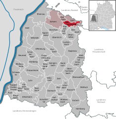
show Location of Sasbachwalden within Ortenaukreis district | |
 Sasbachwalden | |
| Coordinates: 48°37′06″N 08°07′38″E / 48.61833°N 8.12722°ECoordinates: 48°37′06″N 08°07′38″E / 48.61833°N 8.12722°E | |
| Country | Germany |
| State | Baden-Württemberg |
| Admin. region | Freiburg |
| District | Ortenaukreis |
| Government | |
| • Mayor | Sonja Schuchter |
| Area | |
| • Total | 18.13 km2 (7.00 sq mi) |
| Elevation | 257 m (843 ft) |
| Population (2020-12-31)[1] | |
| • Total | 2,592 |
| • Density | 140/km2 (370/sq mi) |
| Time zone | UTC+01:00 (CET) |
| • Summer (DST) | UTC+02:00 (CEST) |
| Postal codes | 77887 |
| Dialling codes | 07841 |
| Vehicle registration | OG |
| Website | www.sasbachwalden.de |


Sasbachwalden is a Black Forest town in Western Baden-Württemberg, Germany, popular with tourists. It is located on the western slopes of mountain Hornisgrinde in the Northern Black Forest and belongs to the district of Ortenau. More than 70% of the town area are forest.
History[]
Sasbachwalden was first mentioned in 1347 as a group of individual farms and houses. Only in 1817 Sasbachwalden became an independent community. Since 1973 the town belongs to district of Ortenau.
Education[]
The town has a centrally located kindergarten and elementary school. Institutions for higher education are in the nearby towns Achern and Sasbach.
Economy[]
Main sources of income are tourism, winegrowing, the production of Black Forest kirsch and most importantly wood processing.
See also[]
References[]
- ^ "Bevölkerung nach Nationalität und Geschlecht am 31. Dezember 2020". Statistisches Landesamt Baden-Württemberg (in German). June 2021.
| show Towns and municipalities in Ortenau (district) |
|---|

| show Authority control |
|---|
This Ortenaukreis location article is a stub. You can help Wikipedia by . |
- Municipalities in Baden-Württemberg
- Towns in Baden-Württemberg
- Ortenaukreis
- Freiburg region geography stubs