Aracaju
This article possibly contains original research. (October 2016) |
Aracaju | |
|---|---|
Municipality | |
| The Municipality of Aracaju | |
From the top; clockwise: Aracaju seen from Imperador Bridge; Brazilian Navy Lighthouse; Aracaju Metropolitan Cathedral; Aracaju skyline and Sergipe River; Aracaju-Barra dos Coqueiros Bridge at night and Coast of Atalaia. | |
 Flag  Seal | |
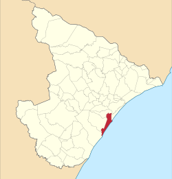 Location of Aracaju in the Sergipe | |
 | |
| Country | |
| Region | Northeast |
| State | |
| Founded | 1592 |
| Incorporated (as capital) | March 17, 1855 |
| Government | |
| • Mayor | Edvaldo Nogueira (PDT) |
| Area | |
| • Total | 181.857 km2 (70.215 sq mi) |
| Elevation | 4 m (13 ft) |
| Population (2020 [1]) | |
| • Total | 664,908 |
| • Density | 3,700/km2 (9,500/sq mi) |
| Time zone | UTC−3 (UTC-3) |
| Postal code | 49000-001 a 49099-999 |
| Area code | +55 79 |
| Website | www |


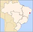
Aracaju (Portuguese pronunciation: [aɾakaˈʒu]) is the capital of the state of Sergipe, Brazil, located in the northeastern part of the country on the coast, about 350 km (217 mi) north of Salvador.
According to the 2020 estimate, the city has 664,908 inhabitants, which represents approximately 33% of the state population. Adding to the populations of the municipalities forming the Metropolitan area: Barra dos Coqueiros, Nossa Senhora do Socorro and São Cristóvão.
Its Metropolitan Cathedral Nossa Senhora da Conceiçao, dedicated to Our Lady of Immaculate Conception, is the archiepiscopal see of the Roman Catholic Archdiocese of Aracaju.
History[]
The extinct unclassified Boime language (also spelled Poyme) was spoken by indigenous peoples near Aracajú on the São Francisco River.[2]
Economy[]
The economy is based on services and industry.
The GDP for the city was R$13918124 (2013).[3]
In recent years, the city has been invigorated by major investors from both eastern Europe (especially from Belarus[4] and Russia) and China[5] setting to be a key city on the Brics relations worldwide as well as a 'Mercocity' (adopted from Mercosur).
Tourism and recreation[]
The city has emerged as a good choice in low-cost tourism.[6] Seen and recognized as one of the safest (63 murders per 100,000; No. 12 city in world; List of cities by murder rate) capitals in the Northeast region and the lowest costs of living in the country, more recently has focused its tourism business in creating quality accommodation, such as world-renowned hostels. Planned public transportation improvements were aimed at increasing the comfort and integration to the visitors users. In advance of seeking access facilities, bus lines have been reformed and can be monitored in real time here
Sports[]
At the 2016 Summer Olympics the city hosted teams from seven countries.[7] Football athletes from Japan and gymnasts and swimmers curiously mostly from many eastern European countries like Poland, Austria, Belarus, Kazakhstan, Ukraine and Czech Republic established the city as home-base for training.
For the 2016 Summer Paralympics Games the city is accommodating athletes from Eurasian Economic Community countries such as the Kazakhstani paralympic team and the Belarus paralympic team, including paralympic swimmer champion Ihar Boki.[8]
Transportation[]

Air[]
Aracaju is served by Santa Maria Airport, a domestic commercial airport. It dates to 1952 and became fully functional in 1958. The airport is located in the Santa Maria neighborhood of the city and is located 12 kilometres (7.5 mi) from downtown Aracaju.[9]
Roads[]
Aracaju is located on the northern segment of BR-101, a major north–south longitudinal highway in Brazil. It is also the easternmost point of BR-235, an incomplete highway which is projected to run from Aracaju west to Novo Progresso, Pará.
Educational institutions[]
- Federal University of Sergipe
- Universidade Norte do Paraná (Unopar)
Geography[]
Climate[]
Aracaju's climate is hot and humid, and the city experiences a tropical monsoon climate. The average annual temperature is 26 °C or 78.8 °F and average annual rainfall is 1,695.3 millimetres or 66.74 inches.[10]
The hottest months Aracaju experiences are January, February and March, with temperatures averaging 27 °C or 80.6 °F,[11] while the average highs are 30 °C or 86 °F[12] and the minimum is 24 °C or 75.2 °F.[13] The mildest are July and August, with temperatures averaging 24 °C or 75.2 °F,[11] with a mean maximum not exceeding 28 °C or 82.4 °F,[12] and at night the temperature drops to 22 °C or 71.6 °F.[13] However, it may happen that the temperature gets warmer in “winter” and cooler in “summer,” as in 2002.
Aracaju experiences its wettest months between March and July, owing to the strong wind created by lower temperatures in the South and Southeast. During this period, the average amount of rainfall exceeds 200 millimetres or 8 inches per month, and the rainiest month of all is May, when rainfall averages approximately 334 millimetres or 13.15 inches. The driest months, between September and February, see the winds weakening and only really managing to bring light clouds. There is also less rain. The driest month is November, when rainfall averages approximately 52 millimetres or 2.05 inches. The average rainfall during these months is between approximately 50 and 100 millimetres (1.97 and 3.94 in).[10]
| hideClimate data for Aracaju (1961–1990) | |||||||||||||
|---|---|---|---|---|---|---|---|---|---|---|---|---|---|
| Month | Jan | Feb | Mar | Apr | May | Jun | Jul | Aug | Sep | Oct | Nov | Dec | Year |
| Average high °C (°F) | 29.6 (85.3) |
29.8 (85.6) |
29.8 (85.6) |
29.4 (84.9) |
28.5 (83.3) |
27.6 (81.7) |
27 (81) |
26.9 (80.4) |
27.4 (81.3) |
28.2 (82.8) |
28.6 (83.5) |
29.1 (84.4) |
28.5 (83.3) |
| Daily mean °C (°F) | 27 (81) |
27.1 (80.8) |
27.1 (80.8) |
26.7 (80.1) |
26 (79) |
25.1 (77.2) |
24.4 (75.9) |
24.4 (75.9) |
25 (77) |
25.9 (78.6) |
26.3 (79.3) |
26.6 (79.9) |
26 (79) |
| Average low °C (°F) | 24.3 (75.7) |
24.2 (75.6) |
24.2 (75.6) |
23.6 (74.5) |
23.1 (73.6) |
22.3 (72.1) |
21.6 (70.9) |
21.6 (70.9) |
22.5 (72.5) |
23.3 (73.9) |
23.5 (74.3) |
23.8 (74.8) |
23.2 (73.8) |
| Record low °C (°F) | 20.5 (68.9) |
19.7 (67.5) |
19.8 (67.6) |
20 (68) |
19 (66) |
17.8 (64.0) |
17.6 (63.7) |
14.6 (58.3) |
18 (64) |
19 (66) |
18 (64) |
16 (61) |
14.6 (58.3) |
| Average rainfall mm (inches) | 77.9 (3.07) |
85.1 (3.35) |
175.7 (6.92) |
261.2 (10.28) |
333.8 (13.14) |
207.2 (8.16) |
174.7 (6.88) |
113.9 (4.48) |
91.4 (3.60) |
65.8 (2.59) |
52.3 (2.06) |
56.3 (2.22) |
1,695.3 (66.75) |
| Average rainy days (≥ 1 mm) | 7 | 9 | 13 | 15 | 17 | 18 | 16 | 13 | 10 | 5 | 5 | 5 | 133 |
| Average relative humidity (%) | 78.1 | 76.6 | 78 | 79.6 | 77.6 | 77.3 | 78.2 | 78.2 | 78.1 | 78.7 | 78.8 | 79 | 78.2 |
| Mean monthly sunshine hours | 264.1 | 224.3 | 234.1 | 210.6 | 205 | 176.7 | 200.7 | 221.9 | 218.5 | 250.6 | 262.9 | 251.6 | 2,721 |
| Source: Brazilian National Institute of Meteorology (INMET).[10][11][12][13][14][15][16][17] | |||||||||||||
References[]
- ^ IBGE 2020
- ^ Loukotka, Čestmír (1968). Classification of South American Indian languages. Los Angeles: UCLA Latin American Center.
- ^ GDP (PDF) (in Portuguese). Aracaju, Brazil: IBGE. 2005. ISBN 85-240-3919-1. Archived from the original (PDF) on 2008-10-02. Retrieved 2007-07-18.
- ^ Sergipe may receive tractor factory Consul Grigori Goldchleger expressed a willingness to set up a tractor factory near the ferry terminal Inácio Barbosa (in portuguese) (in Portuguese). 2016. Retrieved 2016-08-26.
- ^ China is studying partnership with the Government of Sergipe (in portuguese) (in Portuguese). 2016. Retrieved 2016-08-26.[permanent dead link]
- ^ Aracaju: a Big Surprise in a Small State. The Rio times. 2010. Archived from the original on 2014-01-24. Retrieved 2013-11-20.
- ^ World’s athletes arrive in Brazil ahead of Rio 2016 Olympic Games. Official olympic committee news. 2016. Archived from the original on 2016-07-21. Retrieved 2016-07-26.
- ^ Kazakh Paralympians. Kazakh Paralympians committee news. 2016. Archived from the original on 2016-08-09. Retrieved 2016-07-26.
- ^ "Aeroport Aracaju SE" (in Portuguese). INFRAERO. 2016. Archived from the original on 2016-12-01. Retrieved 2016-12-01.
- ^ Jump up to: a b c "Precipitação Acumulada Mensal e Anual (mm)" (in Portuguese). Brazilian National Institute of Meteorology. 1961–1990. Archived from the original on August 8, 2014. Retrieved August 30, 2014.
- ^ Jump up to: a b c "Temperatura Média Compensada (°C)" (in Portuguese). Brazilian National Institute of Meteorology. 1961–1990. Archived from the original on August 8, 2014. Retrieved August 30, 2014.
- ^ Jump up to: a b c "Temperatura Máxima (°C)" (in Portuguese). Brazilian National Institute of Meteorology. 1961–1990. Archived from the original on August 8, 2014. Retrieved August 30, 2014.
- ^ Jump up to: a b c "Temperatura Mínima (°C)" (in Portuguese). Brazilian National Institute of Meteorology. 1961–1990. Archived from the original on August 8, 2014. Retrieved August 30, 2014.
- ^ "Temperatura Mínima Absoluta (ºC)". Brazilian National Institute of Meteorology (Inmet). Retrieved August 30, 2014.[dead link]
- ^ "Número de Dias com Precipitação Maior ou Igual a 1 mm (dias)". Brazilian National Institute of Meteorology. Archived from the original on August 27, 2014. Retrieved August 30, 2014.
- ^ "Insolação Total (horas)". Brazilian National Institute of Meteorology. Archived from the original on August 8, 2014. Retrieved August 30, 2014.
- ^ "Umidade Relativa do Ar Média Compensada (%)". Brazilian National Institute of Meteorology. Archived from the original on August 8, 2014. Retrieved August 30, 2014.
External links[]
 Definitions from Wiktionary
 Media from Wikimedia Commons
 News from Wikinews
 Quotations from Wikiquote
 Texts from Wikisource
 Textbooks from Wikibooks
 Travel guides from Wikivoyage
 Resources from Wikiversity
Coordinates: 10°55′00″S 37°03′00″W / 10.9167°S 37.05°W

| show Authority control |
|---|
- Aracaju