Arantzazu
Arantzazu | |
|---|---|
 | |
 Coat of arms | |
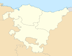 Arantzazu Location of Arantzazu within the Basque Country | |
| Coordinates: 43°09′27″N 2°47′21″W / 43.15750°N 2.78917°WCoordinates: 43°09′27″N 2°47′21″W / 43.15750°N 2.78917°W | |
| Country | |
| Autonomous community | |
| Province | Biscay |
| Comarca | Arratia-Nerbioi |
| Government | |
| • Mayor | Igor Menika Bengoetxea (EH Bildu) |
| Area | |
| • Total | 3.80 km2 (1.47 sq mi) |
| Elevation | 144 m (472 ft) |
| Population (2018)[1] | |
| • Total | 393 |
| • Density | 100/km2 (270/sq mi) |
| Demonym(s) | Basque: abadiñarra |
| Time zone | UTC+1 (CET) |
| • Summer (DST) | UTC+2 (CEST) |
| Postal code | 48140 |
| Website | Official website |

Arantzazu (Spanish, Aránzazu) is a town and municipality located in the province of Gipuzkoa, in the Autonomous Community of Basque Country, northern Spain.
Toponym[]
- Etymologically Aránzazu means place of hawthorn and comes from Basque language. In addition, this municipality of Vizcaya has the same name as other district in Oñate (Guipúzcoa) famous for being located there Aránzazu's Sanctuary. In Basque the name is written as Arantzazu.
Architecture[]
- San Pedro de Arantzazu is the church of the municipality, finished in 1828.
Population[]
- 305 inhabitants. (INE 2007).
Geography[]
- Elevation: 135 metres.
See also[]
References[]
- ^ Municipal Register of Spain 2018. National Statistics Institute.
External links[]
- ARANTZAZU in the Bernardo Estornés Lasa - Auñamendi Encyclopedia (Euskomedia Fundazioa) (in Spanish)

| Authority control |
|
|---|
This article about a location in the Basque Country, Spain, is a stub. You can help Wikipedia by . |
Categories:
- Municipalities in Biscay
- Basque geography stubs