Archery, Georgia
Archery, Georgia | |
|---|---|
Unincorporated community | |
 Archery, Georgia Location in Georgia (US state) | |
| Coordinates: 32°01′33″N 84°26′01″W / 32.02583°N 84.43361°WCoordinates: 32°01′33″N 84°26′01″W / 32.02583°N 84.43361°W | |
| Country | United States |
| State | Georgia |
| County | Webster |
| Elevation | 476 ft (145 m) |
| Time zone | UTC-5 (Eastern (EST)) |
| • Summer (DST) | UTC-4 (EDT) |
| ZIP code | 31880 |
| Area code(s) | 229 |
| GNIS feature ID | 326158[1] |


Archery is an unincorporated community in Webster County, in the U.S. state of Georgia.[1] The community lies about 3 miles (4.8 km) from Plains.[2]
Jimmy Carter, 39th President of the United States, grew up in Archery on a farm which is now known as the "Jimmy Carter Boyhood Farm" and is part of the Jimmy Carter National Historic Site.[3]
History[]
Archery was laid out in 1913.[4] The community was named by William D. Johnson, an A.M.E. bishop, after the "Sublime Order of Archery", an A.M.E. social service organization benefiting poor blacks.[5] The historic railroad community was originally built up chiefly by African Americans, who then formed a majority of its population.[6] A large share of the residents engaged in sharecropping.[7] Archery was first electrified in 1938.[8] Amenities in the community included a train depot, schoolhouse, and country store.[5]
U.S. President Jimmy Carter grew up at Archery on his family's farm from age four, in 1928, until he left for college in 1941.[3] In Carter's time, the population consisted of approximately 25 black families and 2 white families, namely the Watsons and Carters.[5] President Carter recalled in 1976 that Bishop Johnson was "the best-educated, most famous, the most widely traveled, and the richest member of the community".[9] The Carter family remained at Archery until 1949; ownership of the Carter property was transferred to the National Park Service in 1994.[10]
Arts and culture[]
The Jimmy Carter Boyhood Farm, open to visitors, has been restored to its original rustic appearance.[11] SAM Shortline Railway, a heritage railway open to the public, makes a stop on its route at the Archery Depot where visitors lead a self-guided tour.[12]

Jimmy Carter in 1937
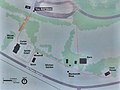
Map of Carter Farm


References[]
- ^ a b "US Board on Geographic Names". United States Geological Survey. September 25, 1979. Retrieved April 1, 2018.
- ^ "Timeline". Jimmy Carter NHS Education Program. Retrieved April 1, 2018.
- ^ a b "Jimmy Carter National Historic Site". National Park Service. Retrieved March 31, 2018.
- ^ Krakow, Kenneth K. (1975). Georgia Place-Names: Their History and Origins (PDF). Macon, GA: Winship Press. p. 7. ISBN 0-915430-00-2.
- ^ a b c "Archery". Historic Markers Across Georgia. Retrieved March 31, 2018.
- ^ "Trading Cards". National Park Service. Retrieved March 31, 2018.
- ^ "Jimmy Carter National Historic Site". National Park Planner. Retrieved April 1, 2018.
- ^ Balmer, Randall (May 13, 2014). Redeemer: The Life of Jimmy Carter. Basic Books. p. 30. ISBN 978-0-465-05695-8.
- ^ Jet. Johnson Publishing Company. September 23, 1976. p. 23.
- ^ "Jimmy Carter Boyhood Home and Farm". Society of Architectural Historians. Retrieved April 1, 2018.
- ^ Lambert, Marjie (November 20, 2012). "Georgia rail excursion is built around the Jimmy Carter National Historic Site". Miami Herald. Retrieved March 31, 2018.
- ^ "Archery Depot". SAM Shortline Railroad. Retrieved March 31, 2018.
Municipalities and communities of Webster County, Georgia, United States | ||
|---|---|---|
| Unincorporated communities |  | |
| ||
- Unincorporated communities in Webster County, Georgia
- Unincorporated communities in Georgia (U.S. state)
- Populated places established by African Americans
- Populated places established in 1913
- 1913 establishments in Georgia (U.S. state)