Artigas, Uruguay
Artigas | |
|---|---|
Capital city | |
 Church of the Sacred Heart | |
 Coat of arms | |
 Artigas | |
| Coordinates: 30°28′0″S 56°28′0″W / 30.46667°S 56.46667°WCoordinates: 30°28′0″S 56°28′0″W / 30.46667°S 56.46667°W | |
| Country | |
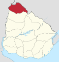
| Department | |
| Founded | September 12, 1852 |
| Founded by | Don Carlos Catalá |
| Elevation | 121 m (397 ft) |
| Population (2011 Census) | |
| • Total | 40,658 |
| Demonym(s) | artiguense |
| Time zone | UTC−3 (UYT) |
| postal code | 55000 |
| Dial plan | +598 477 (+5 digits) |
| Climate | Cfa |

Artigas (Spanish pronunciation: [aɾˈtiɣas]) is the capital of the Artigas Department of Uruguay. Its name comes from that of the national hero, José Gervasio Artigas, who fought for the emancipation of the River Plate, and sought to create a federative nation from these colonies. As of the census of 2011, it is the eleventh most populous city of the country.
Location[]
The city is located on the border with Brazil, separated only by a bridge from the town Quaraí of the state Rio Grande do Sul of Brazil. It is the farthest city from Uruguay's capital Montevideo, being 600 kilometres (370 mi) away.
History[]
It was founded on 12 September 1852 by Don Carlos Catalá as the town of San Eugenio del Cuareim. On 5 September 1884 it became capital of the department. It was renamed Artigas and its status was elevated from villa (town) to ciudad (city) on 31 August 1915.[1]
Economy[]
Artigas is a centre for trading grain crops (primarily maize) with Argentina and Brazil. The railroad station and, since 1973, airport are focused on this commerce.
The hills in the area contain significant numbers of precious stones, especially agate and amethyst, which were first found in 1860, since when mining has taken place. Souvenirs and handicrafts made using these gem stones are produced in Artigas and exported widely.
Population[]
In 2011 Artigas had a population of 40,658.[2]
| Year | Population |
|---|---|
| 1852 | 335 |
| 1908 | 8,857 |
| 1963 | 23,429 |
| 1975 | 29,256 |
| 1985 | 35,117 |
| 1996 | 40,244 |
| 2004 | 41,687 |
| 2011 | 40,658 |
Source: Instituto Nacional de Estadística de Uruguay[1]
Transportation[]
The city is served by Artigas International Airport.
Places of worship[]
- San Eugenio del Cuareim, Artigas|St. Eugene of the Cuareim Parish Church (Roman Catholic)
Climate[]
Artigas has a humid subtropical climate, described by the Köppen climate classification as Cfa. Summers are warm to hot and winters are cool, with the occurrence of frosts and fog. The precipitation is evenly distributed throughout the year, with an average of 1,293 mm (50.9 in),[citation needed] and the annual average temperature is around 19 °C (66 °F).[dubious ]
| hideClimate data for Artigas, Uruguay (1980–2009) | |||||||||||||
|---|---|---|---|---|---|---|---|---|---|---|---|---|---|
| Month | Jan | Feb | Mar | Apr | May | Jun | Jul | Aug | Sep | Oct | Nov | Dec | Year |
| Record high °C (°F) | 40.9 (105.6) |
41.2 (106.2) |
40.8 (105.4) |
36.0 (96.8) |
31.7 (89.1) |
29.5 (85.1) |
29.7 (85.5) |
34.4 (93.9) |
36.0 (96.8) |
36.7 (98.1) |
40.8 (105.4) |
41.4 (106.5) |
41.4 (106.5) |
| Average high °C (°F) | 32.3 (90.1) |
30.6 (87.1) |
29.1 (84.4) |
25.0 (77.0) |
21.3 (70.3) |
18.6 (65.5) |
18.4 (65.1) |
20.9 (69.6) |
21.9 (71.4) |
25.2 (77.4) |
27.9 (82.2) |
30.9 (87.6) |
25.2 (77.4) |
| Daily mean °C (°F) | 25.9 (78.6) |
24.8 (76.6) |
23.4 (74.1) |
19.7 (67.5) |
16.0 (60.8) |
13.7 (56.7) |
13.3 (55.9) |
15.2 (59.4) |
16.3 (61.3) |
19.4 (66.9) |
21.7 (71.1) |
24.4 (75.9) |
19.5 (67.1) |
| Average low °C (°F) | 19.5 (67.1) |
19.0 (66.2) |
17.7 (63.9) |
14.4 (57.9) |
10.7 (51.3) |
8.8 (47.8) |
8.2 (46.8) |
9.4 (48.9) |
10.6 (51.1) |
13.7 (56.7) |
15.5 (59.9) |
17.8 (64.0) |
13.8 (56.8) |
| Record low °C (°F) | 8.2 (46.8) |
7.9 (46.2) |
6.3 (43.3) |
2.0 (35.6) |
−3.0 (26.6) |
−4.6 (23.7) |
−5.2 (22.6) |
−4.3 (24.3) |
−1.0 (30.2) |
1.2 (34.2) |
3.4 (38.1) |
6.0 (42.8) |
−5.2 (22.6) |
| Average precipitation mm (inches) | 130.9 (5.15) |
155.2 (6.11) |
145.0 (5.71) |
173.1 (6.81) |
130.4 (5.13) |
97.8 (3.85) |
77.2 (3.04) |
71.3 (2.81) |
113.2 (4.46) |
142.7 (5.62) |
153.7 (6.05) |
126.3 (4.97) |
1,516.7 (59.71) |
| Average precipitation days (≥ 1.0 mm) | 5 | 6 | 6 | 6 | 5 | 5 | 6 | 5 | 6 | 5 | 6 | 5 | 66 |
| Average relative humidity (%) | 61 | 68 | 70 | 72 | 77 | 79 | 75 | 70 | 69 | 69 | 65 | 61 | 70 |
| Mean monthly sunshine hours | 279.0 | 228.8 | 235.6 | 183.0 | 179.8 | 144.0 | 170.5 | 195.3 | 195.0 | 226.3 | 255.0 | 279.0 | 2,571.3 |
| Mean daily sunshine hours | 9.0 | 8.1 | 7.6 | 6.1 | 5.8 | 4.8 | 5.5 | 6.3 | 6.5 | 7.3 | 8.5 | 9.0 | 7.0 |
| Source 1: [3] | |||||||||||||
| Source 2: Dirección Nacional de Meteorología (precipitation days 1961–1990, extremes 1944–1994)[4][5] | |||||||||||||
Notable people[]
- Pablo Aurrecochea (born 1981) footballer
- Adelia Silva (1925-2004) educator and writer who had a significant role in elevating the civil rights of Afro-Uruguayans.[6]
References[]
- ^ Jump up to: a b "Statistics of urban localities (1852–2004) (see also "San Eugenio del Cuareim")". INE. 2012. Archived from the original (PDF) on 23 March 2015. Retrieved 3 September 2012.
- ^ "Censos 2011 Cuadros Artigas". INE. 2012. Retrieved 25 August 2012.
- ^ Castaño, José; Giménez, Agustín; Ceroni, Mauricio; Furest, José; Aunchayna, Rossina. "Caracterización Agroclimática del Uruguay 1980–2009" (PDF) (in Spanish). Instituto Nacional de Investigación Agropecuaria. Archived from the original (PDF) on 12 December 2018. Retrieved 12 December 2018.
- ^ "Estadísticas climatológicas" (in Spanish). Dirección Nacional de Meteorología. Retrieved 10 October 2012.
- ^ "RECORDS METEOROLOGICOS EN EL URUGUAY" (in Spanish). Dirección Nacional de Meteorología. Retrieved April 30, 2014.
- ^ Palermo, Eduardo R. (2016). "Silva, Adelia (1925–2004), the first Afro-Uruguayan woman to earn a teaching degree, director and inspector of primary education, journalist, poet, writer, and long-term social activist". In Knight, Franklin W.; Gates Jr., Henry Louis (eds.). Dictionary of Caribbean and Afro–Latin American Biography. Oxford, England: Oxford University Press. ISBN 978-0-199-93580-2. – via Oxford University Press's Reference Online (subscription required)
External links[]
 Artigas travel guide from Wikivoyage
- INE map of Artigas, Pintadito, Cerro Ejido, Cerro Signorelli and Cerro San Eugenio
| show Authority control |
|---|
- Populated places in the Artigas Department
- Populated places established in 1852
- Brazil–Uruguay border crossings
- 1852 establishments in Uruguay