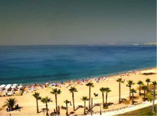
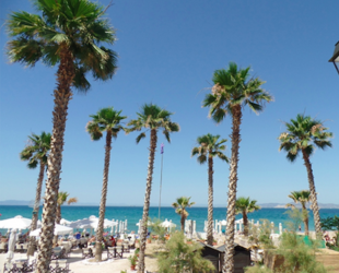
Athens Riviera
Athens Riviera
Αθηναϊκή Ριβιέρα | |
|---|---|
    | |
| Coordinates: 37°51′58″N 23°44′24″E / 37.86611°N 23.74000°ECoordinates: 37°51′58″N 23°44′24″E / 37.86611°N 23.74000°E | |
| Country | Greece |
| Administrative regions of Greece | Attica |
| Municipalities | |
| Dimensions | |
| • Length | 70 km (40 mi) |
| Elevation | 0−50 m (−160 ft) |
| Population | |
| • Total | 0.7 million |

Athens Riviera is the coastal area in the southern suburbs of Athens, Greece from Piraeus to Sounio. [1][2][3] It is located about 16 km (9.9 mi) from downtown Athens stretching from the southern suburbs of Athens to the southernmost point of Attica, Cape Sounio.
History[]
Modern era[]
Since the 1920s the Greek government planned for a regeneration of the Riviera but the political instability did not allow it. In 1954, Kathimerini newspaper published an article arguing that Glyfada and Voula could become more popular than the French Riviera in the coming years.[4] In 1957, the plan for the development of the Athens Riviera started with the creation of Asteria in Glyfada and the area started gradually to become popular among the Athenians also through the help of Greek cinema.[4]
Ancient times[]
Piraeus, has been inhabited since the 26th century BC.[5] In ancient Greece, Piraeus assumed its importance with its three deep-water harbours, the main port of Cantharus and the two smaller of Zea and Munichia, and gradually replaced the older and shallow Phaleron harbour, which fell into disuse. In 493 BC, Themistocles initiated the fortification works in Piraeus and later advised the Athenians to take advantage of its natural harbours' strategic potential instead of using the sandy bay of Phaleron.[6][7] After the second Persian invasion of Greece, Themistocles fortified the three harbours of Piraeus and created the neosoikoi (ship houses); the Themistoclean Walls were completed in 471 BC, turning Piraeus into a great military and commercial harbour. The city's fortification was farther reinforced later by the construction of the Long Walls under Cimon and Pericles, with which secure port's (Piraeus) route to Athens main city. Meanwhile, Piraeus was rebuilt to the famous grid plan of architect Hippodamus of Miletus, known as the Hippodamian plan, and the main agora of the city was named after him in honour. As a result, Piraeus flourished and became a port of high security and great commercial activity, and a city bustling with life.
During the Peloponnesian War, Piraeus suffered its first setback. In the second year of the war, the first cases of the Athens plague were recorded in Piraeus.[8] In 404 BC, the Spartan fleet under Lysander blockaded Piraeus and subsequently, Athens surrendered to the Spartans, putting an end to the Delian League and the war itself. After the reinstatement of democracy, Conon rebuilt the walls in 393 BC, founded the temple of Aphrodite Euploia and the sanctuary of Zeus Sotiros and Athena, and built the famous (arsenal) of Philon, the ruins of which have been discovered at Zea harbour.[9] The reconstruction of Piraeus went on during the period of Alexander the Great, but this revival of the town was quashed by Roman Lucius Cornelius Sulla, who captured and totally destroyed Piraeus in 86 BC. The destruction was completed in 395 AD by the Goths under Alaric I. Piraeus was led to a long period of decline which lasted for fifteen centuries. During the Byzantine period the harbor of Piraeus was occasionally used for the Byzantine fleet, but it was very far from the capital city of Constantinople.
In Vouliagmeni ruins of the Temple of Apollo Zoster have been excavated and can be viewed inside the public Astir Hotel beach. According to legend, when Leto was about to give birth to Apollo and Artemis, she fled writhing in pain to Delos. Other remnants of early human habitation found in the Riviera include Neolithic and Bronze Age building foundations, and a 5th-century BC outpost.
In ancient times, Glyfada was a deme known as Aixone (Αἰξωνή). Today, Glyfada is packed with some of the capital's best-known nightclubs, upscale restaurants, and shops. It could be argued to be one of the most "Americanized" of Athenian municipalities since an American airbase was located in nearby Elliniko until the early 1990s.
The Temple of Poseidon at Sounion was built during 444–440 BC, is one of the major monuments of the Golden Age of Athens. It is perched above the sea at a height of almost 60 meters. The Sounion Kouros, discovered in 1906 in a pit east of the temple alongside fragments of other statues, was probably one of a number of votive statues dedicated to Poseidon which probably stood in front of the god's sanctuary. The archaic temple was probably destroyed in 480 BC by Persian troops during Xerxes I's invasion of Greece.[10] After they defeated Xerxes in the naval Battle of Salamis, the Athenians placed an entire captured enemy trireme (warship with three banks of oars) at Sounion as a trophy dedicated to Poseidon.[11] The temple of Athena Sounias at Sounion was built in 470 BC, replacing an older building of the 6th century. Its architecture was unusual inasmuch as it had a colonnade on the southern and eastern, but not on the western or northern sides, a peculiarity mentioned by Vitruvius.[12]
Main areas[]
According to the Greek National Tourism Organisation the main areas of the Athens Riviera are: the , Glyfada, Voula, Vouliagmeni, Lagonisi, Varkiza, Anavyssos and Sounio.[13]
Development[]
Greece is set to develop the area of the former Athens airport in Elliniko in the coming years. Work began on the Hellenikon Metropolitan Park in July 2020. It aims to build and operate a casino along with luxury hotels and conference and recreation facilities on the disused airport, as a way to further boost investments in Greece and attract more visitors in the Athens Riviera.[14]
It is estimated that around 10 billion euros will be invested in the Elliniko and Athens Riviera development and regeneration. The regeneration projects put a stop to the property price slump compared to other areas of Athens and estate agents (mostly from China and Turkey) are very active in areas around the Athens Riviera.[2]
According to Bloomberg, the Athens Riviera can help Greece's tourism industry by almost doubling the tourism revenue that will be achieved by further development of the Riviera. It is estimated that the regeneration projects will attract many professionals such as chefs, receptionists, and various hospitality experts.[15]
Furthermore, there are plans to develop luxury facilities that will integrate elements of Greek culture in and around the area of Elliniko in the coming years, however not many details are currently known about the exact structure of the project that will take place in the next few years. [16]
Climate[]
The Athens Riviera enjoys a mild climate throughout the year and with a mean annual temperature of 19.4 °C (66.9 °F) it is considered the warmest area in Continental Europe.[17] Under the Köppen climate classification, Athens Riviera has a hot semi-arid climate (BSh) and lies in the transition zone between this climate and hot-summer Mediterranean climate (Csa) of downtown Athens.[18] According to the data provided by the Hellenic National Meteorological Service Elliniko, which is located in the Riviera, has a borderline semi-arid climate. Furthermore, Piraeus, also located in the Riviera is the only area in Greece to have a hot semi-arid climate (BSh) according to the climate atlas published by the Hellenic National Meteorological Service. [19] [20]
| hideClimate data for Piraeus H.N.M.S (1981-2010) | |||||||||||||
|---|---|---|---|---|---|---|---|---|---|---|---|---|---|
| Month | Jan | Feb | Mar | Apr | May | Jun | Jul | Aug | Sep | Oct | Nov | Dec | Year |
| Average high °C (°F) | 14.1 (57.4) |
14.4 (57.9) |
16.6 (61.9) |
20.3 (68.5) |
25.1 (77.2) |
29.9 (85.8) |
32.8 (91.0) |
32.9 (91.2) |
29.1 (84.4) |
24.2 (75.6) |
18.9 (66.0) |
15.4 (59.7) |
22.81 (73.06) |
| Daily mean °C (°F) | 11.1 (52.0) |
11.2 (52.2) |
13.3 (55.9) |
16.9 (62.4) |
21.4 (70.5) |
26.3 (79.3) |
29.0 (84.2) |
28.8 (83.8) |
25.2 (77.4) |
20.6 (69.1) |
15.8 (60.4) |
12.6 (54.7) |
19.35 (66.83) |
| Average low °C (°F) | 8.2 (46.8) |
7.9 (46.2) |
10.0 (50.0) |
13.4 (56.1) |
17.7 (63.9) |
22.2 (72.0) |
24.8 (76.6) |
25.0 (77.0) |
21.5 (70.7) |
17.4 (63.3) |
12.9 (55.2) |
9.7 (49.5) |
15.89 (60.60) |
| Average rainfall mm (inches) | 41.95 (1.65) |
36.26 (1.43) |
34.09 (1.34) |
30.34 (1.19) |
15.95 (0.63) |
5.08 (0.20) |
5.56 (0.22) |
3.07 (0.12) |
11.37 (0.45) |
30.5 (1.20) |
58.87 (2.32) |
58.84 (2.32) |
331.9 (13.07) |
| Source 1: National Technical University of Athens[21] | |||||||||||||
| Source 2: Meteoclub.gr[22] | |||||||||||||
Access from Central Athens[]
- By tram
- T1 line from Kasomouli towards “Néo Fáliro” station (Peace and Friendship Stadium)
- T2 line from Kasomouli towards Voúla (Asklipiío Voúlas station)
- T3 line departing from Voúla to Néo Fáliro station (Peace and Friendship Stadium)
- By bus
- A1 route (Pireaus-Voula)
- A2 route (Akadimia-Voula)
- B2 route (Syngrou Fix-Ag.Kosmas)
- 122 route (Elliniko Metro station-Saronida)
- 123 route (Saronida-Anavyssos-Palaia Fokea)
References[]
- ^ "Athens Riviera from Piraeus to Sounio in pictures". Retrieved 4 July 2021.
- ^ Jump up to: a b "Attica's south coast sees rates rise". Kathimerini. Retrieved 16 June 2019.
- ^ "Konstantinopoulos on Hellenikon, Athens Riviera should not be left". Skai. Retrieved 2016-07-02.
- ^ Jump up to: a b "How was the Athens Riviera born?". Lifo. Retrieved 16 June 2019.
- ^ "The Port of Piraeus Through The Ages". greece.org. Retrieved 2009-09-27.
- ^ Chisholm, Hugh, ed. (1911). . Encyclopædia Britannica. 21 (11th ed.). Cambridge University Press. p. 58.
- ^ Τα τείχη των Αθηνών (in Greek). National Hellenic Research Foundation. Retrieved 2009-09-27.
- ^ Warner & Finley 1972, p. 152
- ^ "Archived copy". Archived from the original on 2018-09-15. Retrieved 2019-06-17.CS1 maint: archived copy as title (link)
- ^ "Sounion Kouros". University of Cambridge Faculty of Classics. Archived from the original on 2013-10-05.
- ^ Herodotus, Histories, VIII.121.
- ^ Sounion, Temple of Athena (Building) (Perseus Project)
- ^ "Athens Riviera". visitgreece.gr. Archived from the original on 26 April 2016. Retrieved 29 May 2016.
- ^ "Elliniko casino process extended to June 28". Kathimerini. Retrieved 16 June 2019.
- ^ "The Athens Riviera could double Greece's tourism revenue". Vima. Retrieved 16 June 2019.
- ^ "Athens Riviera plans for Elliniko". Retrieved 30 December 2019.
- ^ "Athens Riviera: The warmest area in continental Europe". Meteoclub. Retrieved 17 June 2019.
- ^ "World Map of Koppen-Geiger Climate Classification" (PDF). Brock University. Retrieved 2016-07-01.
- ^ "Climate Atlas of Greece" (PDF). Hellenic National Meteorological Service. Archived from the original (PDF) on 21 September 2017. Retrieved 30 December 2019.
- ^ "Homogenization of mean monthly temperature series in Greece". International Journal of Climatology. doi:10.1002/joc.3614. Cite journal requires
|journal=(help) - ^ "Piraeus Urban Planning 1" (PDF) (in Greek). Pagkrati & Millioni (2017), NTUA. Archived from the original (PDF) on 7 March 2019. Retrieved 30 Sep 2019.
- ^ "Piraeus climate data" (in Greek). Meteoclub. Retrieved 7 Jan 2018.
- Geography of Athens
- Geography of Attica
- Piraeus