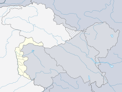
Athmuqam
Athmuqam | |
|---|---|
 Athmuqam | |
| Coordinates: 34°35′21″N 73°54′38″E / 34.589128°N 73.9106941°E | |
| Administering country | |
| Dependent Territory | Azad Kashmir |
| District | Neelum |
| Elevation | 1,440 m (4,720 ft) |
| Population (2017)[1] | |
| • Total | 7,922 |
| Languages | |
| • Official | Urdu[2][3][note 1] |
| • Spoken | |
| Time zone | PST |
Athmuqam or Athmakam (Urdu: آٹھمقام) is a town about 73 kilometres from Muzaffarabad, in Azad Kashmir. It is the headquarters of Neelum District. Its population was 7,922 in 2017.[1]
The town is accessible by Neelum road from Muzaffarabad. All the basic necessities of life are available there. There is a market and post office. Banks, hospital and telephone exchanges are also present. A number of guest Houses for accommodating visitors and Tourists.
University of AJK Neelum campus is also located in the town having departments of Computer Science, Geology and English. There are two degree colleges 1 for Girls & 1 for Boys. Private colleges like Neelum Institute of Science & Humanities (NISH) & Schools like Owasia Educational Academy are providing quality education.
Office of the Deputy commissioner & Assistant Commissioner, Superintendent of Police etc. are present.
See also[]
Notes[]
- ^ Snedden (2013, p. 176): On p. 29, the census report states that Urdu is the official language of the government of Azad Kashmir, with Kashmiri, Pahari, Gojri, Punjabi, Kohistani, Pushto, and Sheena 'frequently spoken in Azad Kashmir'. Yet, when surveyed about their 'mother tongue', Azad Kashmiris' choices were limited to selecting from Pakistan's major languages: Urdu, Punjabi, Sindhi, Pushto, Balochi, Saraiki, and 'others'; not surprisingly, 2.18 million of Azad Kashmir's 2.97 million people chose 'others'.
References[]
- ^ Jump up to: a b "Statistical Year Book 2019" (PDF). Statistics Azad Jammu and Kashmir. Retrieved 20 April 2020.
- ^ https://www.nationalia.info/profile/10/kashmir
- ^ Rahman 1996, p. 226.
External links[]
Coordinates: 34°35′21″N 73°54′38″E / 34.589128°N 73.9106941°E
- Populated places in Neelam District
- Tehsils of Neelam Valley District
- Azad Kashmir geography stubs
