Atocha (Madrid)
Atocha | |
|---|---|
 | |
 | |
| Country | |
| Aut. community | |
| Municipality | |
| District | |
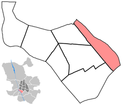
Atocha is a central ward (barrio) of Madrid belonging to the district of Arganzuela.
Geography[]
Located in the middle of Madrid, the ward is formed by a strip between the avenue (south-west), and the north-eastern area of Madrid Atocha railway station, that occupies great part of its territory. The northern border is at the square Plaza del Emperador Carlos V and the southern one in the avenue .
Atocha borders the districts of Centro (north), Retiro (north-east), Puente de Vallecas (south) and with the Arganzuelan wards of Palos de Moguer, Las Delicias and Legazpi.[1]
Transport[]
Home of Madrid Atocha, the main railway station of the city, the ward is also served by the Metro lines 1 (at Atocha and Atocha RENFE stations), 6 (at Méndez Álvaro station) and by several lines of a commuter rail network named Cercanías Madrid.[2]
References[]
- ^ Arganzuela district map
- ^ Serving Madrid Atocha and Madrid Méndez Álvaro stations: see map
External links[]
![]() Media related to Atocha neighborhood, Madrid at Wikimedia Commons
Media related to Atocha neighborhood, Madrid at Wikimedia Commons
Coordinates: 40°24′2.95″N 3°41′1.25″W / 40.4008194°N 3.6836806°W

- Wards of Madrid
- Arganzuela