Aurach (Ager)
| Aurach | |
|---|---|
 | |
| Location | |
| Country | Austria |
| State | Upper Austria |
| Physical characteristics | |
| Mouth | |
• location | Ager |
• coordinates | 48°00′20″N 13°44′16″E / 48.0055°N 13.7377°ECoordinates: 48°00′20″N 13°44′16″E / 48.0055°N 13.7377°E |
| Length | 28.6 km (17.8 mi) [1] |
| Basin features | |
| Progression | Ager→ Traun→ Danube→ Black Sea |

Aurach (German pronunciation: [ˈaʊ̯ʁax] (![]() listen)) is a river in the Austrian state of Upper Austria.
listen)) is a river in the Austrian state of Upper Austria.
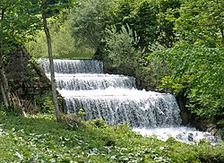
It originates in the area of the mountain in the and flows through the wooden rich Aurach Valley, that spreads through the communities of Altmünster (districts , Reindlmühl, Finsterau) and Pinsdorf (district Kufhaus). After leaving the Aurach Valley the river flows further through the Alpine foothills via Aurachkirchen (district of Ohlsdorf) until Wankham (municipality Regau), where it confluences with the river Ager.
References[]
- ^ DORIS Atlas (Upper Austria)
External links[]
 Media related to Aurach (Ager) at Wikimedia Commons
This Upper Austria location article is a stub. You can help Wikipedia by . |
Categories:
- Tributaries of the Traun
- Rivers of Upper Austria
- Rivers of Austria
- Upper Austria geography stubs
- Austria river stubs