Austra
This article relies largely or entirely on a single source. (August 2021) |
 Aerial view from the east towards west, of Bindal municipality in Nordland county, Norway. | |
 | |
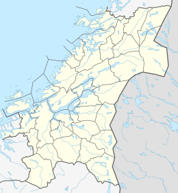 Austra Location of the island | |
| Geography | |
|---|---|
| Location | Trøndelag and Nordland, Norway |
| Coordinates | 65°05′01″N 11°52′37″E / 65.0837°N 11.8769°ECoordinates: 65°05′01″N 11°52′37″E / 65.0837°N 11.8769°E |
| Area | 88 km2 (34 sq mi) |
| Length | 21 km (13 mi) |
| Width | 6.5 km (4.04 mi) |
| Coastline | 61 km (37.9 mi) |
| Highest elevation | 588 m (1929 ft) |
| Highest point | Romsskåla |
| Administration | |
Norway | |
| Counties | Trøndelag and Nordland |
| Municipality | Nærøysund, Leka, Bindal |
| Demographics | |
| Population | c. 300 (2001[1]) |
| Pop. density | 3.4/km2 (8.8/sq mi) |


Austra is an island on the border between Trøndelag and Nordland counties in Norway. The 88-square-kilometre (34 sq mi) island is shared between the municipalities of Bindal, Leka, and Nærøysund. The highest point is the 588-metre-tall (1,929 ft) Romsskåla. The village of Årset lies on the southeastern shore, along the Årsetfjorden. The village of Bogen lies on the east coast of the island where the bridge connects it to the mainland.[1]
See also[]
References[]
- ^ a b Thorsnæs, Geir, ed. (13 November 2017). "Austra". Great Norwegian Encyclopedia (in Norwegian). Kunnskapsforlaget. Retrieved 30 April 2018.
This article about an island in Nordland is a stub. You can help Wikipedia by . |
This Trøndelag location article is a stub. You can help Wikipedia by . |
Categories:
- Islands of Nordland
- Islands of Trøndelag
- Nærøysund
- Nærøy
- Leka, Norway
- Bindal
- Nordland island stubs
- Trøndelag geography stubs