Avery Creek, North Carolina
Avery Creek, North Carolina | |
|---|---|
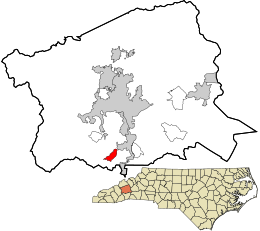 Location in Buncombe County and the state of North Carolina | |
| Coordinates: 35°27′37″N 82°34′44″W / 35.46028°N 82.57889°WCoordinates: 35°27′37″N 82°34′44″W / 35.46028°N 82.57889°W | |
| Country | United States |
| State | North Carolina |
| County | Buncombe |
| Area | |
| • Total | 1.7 sq mi (4.5 km2) |
| • Land | 1.7 sq mi (4.5 km2) |
| • Water | 0.0 sq mi (0.0 km2) |
| Elevation | 2,198 ft (670 m) |
| Population (2010) | |
| • Total | 1,950 |
| • Density | 1,127/sq mi (435.3/km2) |
| Time zone | UTC-5 (Eastern (EST)) |
| • Summer (DST) | UTC-4 (EDT) |
| FIPS code | 37-02760[1] |
| GNIS feature ID | 1018880[2] |

Avery Creek is a census-designated place (CDP) in Buncombe County, North Carolina, United States. The population was 1,950 at the 2010 census.[3] It is part of the Asheville Metropolitan Statistical Area.
Geography[]
Avery Creek is located in southern Buncombe County at 35°27′37″N 82°34′44″W / 35.46028°N 82.57889°W (35.460353, -82.578828).[4] The main road through the community is North Carolina Highway 191 (Brevard Road), leading north 11 miles (18 km) to downtown Asheville and south 13 miles (21 km) to Hendersonville. North Carolina Highway 146 (Long Shoals Road) heads east from Avery Creek, leading 1.6 miles (2.6 km) to Interstate 26 and 3.5 miles (5.6 km) to the Skyland neighborhood of Asheville.
According to the United States Census Bureau, the Avery Creek CDP has a total area of 1.7 square miles (4.5 km2), all of it land.[3]
Demographics[]
As of the census[1] of 2000, there were 1,405 people, 561 households, and 414 families residing in the CDP. The population density was 818.8 people per square mile (315.4/km2). There were 584 housing units at an average density of 340.3 per square mile (131.1/km2). The racial makeup of the CDP was 95.02% White, 2.92% African American, 0.28% Native American, 0.50% Asian, 0.28% from other races, and 1.00% from two or more races. Hispanic or Latino of any race were 1.35% of the population.
There were 561 households, out of which 30.5% had children under the age of 18 living with them, 64.0% were married couples living together, 7.0% had a female householder with no husband present, and 26.2% were non-families. 21.4% of all households were made up of individuals, and 4.6% had someone living alone who was 65 years of age or older. The average household size was 2.50 and the average family size was 2.92.
In the CDP, the population was spread out, with 22.5% under the age of 18, 7.2% from 18 to 24, 32.0% from 25 to 44, 26.4% from 45 to 64, and 12.0% who were 65 years of age or older. The median age was 39 years. For every 100 females, there were 93.3 males. For every 100 females age 18 and over, there were 90.7 males.
The median income for a household in the CDP was $47,619, and the median income for a family was $51,042. Males had a median income of $41,123 versus $28,281 for females. The per capita income for the CDP was $22,386. About 4.9% of families and 4.9% of the population were below the poverty line, including 11.7% of those under age 18 and none of those age 65 or over.
References[]
- ^ a b "U.S. Census website". United States Census Bureau. Retrieved 2008-01-31.
- ^ "US Board on Geographic Names". United States Geological Survey. 2007-10-25. Retrieved 2008-01-31.
- ^ a b "Geographic Identifiers: 2010 Demographic Profile Data (G001): Avery Creek CDP, North Carolina". U.S. Census Bureau, American Factfinder. Archived from the original on February 12, 2020. Retrieved February 13, 2014.
- ^ "US Gazetteer files: 2010, 2000, and 1990". United States Census Bureau. 2011-02-12. Retrieved 2011-04-23.
External links[]
Municipalities and communities of Buncombe County, North Carolina, United States | ||
|---|---|---|
| City |  | |
| Towns | ||
| CDPs | ||
| Other communities | ||
| ||
- Unincorporated communities in North Carolina
- Census-designated places in Buncombe County, North Carolina
- Census-designated places in North Carolina
- Asheville metropolitan area