Avery Township, Humboldt County, Iowa
Avery Township | |
|---|---|
 Location in Humboldt County | |
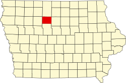 Humboldt County's location in Iowa | |
| Coordinates: 42°56′49″N 93°33′43″W / 42.947°N 93.562°WCoordinates: 42°56′49″N 93°33′43″W / 42.947°N 93.562°W | |
| Country | |
| State | |
| County | Humboldt |
| Area | |
| • Total | 36.2 sq mi (94 km2) |
| • Land | 35.8 sq mi (93 km2) |
| • Water | 0.4 sq mi (1 km2) |
| Elevation | 1,142 ft (348 m) |
| Population (2000) | |
| • Total | 316 |
| Time zone | UTC-6 (CST) |
| • Summer (DST) | UTC-5 (CDT) |
| ZIP codes | 50520 (Bradgate) |
| GNIS feature ID | 0467405 |

Avery Township is one of twelve townships in Humboldt County, Iowa, USA. As of the 2000 census, its population was 316.
History[]
Avery Township was organized in 1873. It is named for O. F. Avery, a pioneer settler.[1]
Geography[]
According to the United States Census Bureau, Avery Township covers an area of 36.2 square miles (94 km2); of this, 35.8 square miles (93 km2) is land and 0.4 square miles (1.0 km2) is water.
Cities, towns, villages[]
Adjacent townships[]
- Wacousta Township (north)
- Delana Township (northeast)
- Rutland Township (east)
- Corinth Township (southeast)
- Weaver Township (south)
- Lake Township, Pocahontas County (southwest)
- Garfield Township, Pocahontas County (west)
- Des Moines Township, Pocahontas County (northwest)
Cemeteries[]
The township does not contain any cemeteries.
Political districts[]
- Iowa's 4th congressional district
- State House District 4
References[]
- United States Census Bureau 2008 TIGER/Line Shapefiles
- United States Board on Geographic Names (GNIS)
- United States National Atlas
- ^ History of Kossuth and Humboldt Counties, Iowa. Union Publishing Company. 1884. pp. 718–721. Note that Google Books misspells "Humboldt".
External links[]
Places adjacent to Avery Township, Humboldt County, Iowa | |
|---|---|
Municipalities and communities of Humboldt County, Iowa, United States | ||
|---|---|---|
| Cities | ||
| Townships | ||
| Unincorporated communities | ||
| Ghost town | ||
| Footnotes | ‡This populated place also has portions in an adjacent county or counties | |
| ||
Categories:
- Townships in Humboldt County, Iowa
- Townships in Iowa
- Populated places established in 1873
- 1873 establishments in Iowa