Avoca, Tasmania
| Avoca Tasmania | |||||||||||||||
|---|---|---|---|---|---|---|---|---|---|---|---|---|---|---|---|
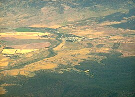
 Aerial photo of the region from the east | |||||||||||||||
 Avoca Location in Tasmania | |||||||||||||||
| Coordinates | 41°46′53″S 147°43′19″E / 41.78139°S 147.72194°ECoordinates: 41°46′53″S 147°43′19″E / 41.78139°S 147.72194°E | ||||||||||||||
| Population | 216 (2016 census)[1] | ||||||||||||||
| Postcode(s) | 7213 | ||||||||||||||
| Location |
| ||||||||||||||
| LGA(s) | Northern Midlands, Break O'Day | ||||||||||||||
| Region | Central, North-east | ||||||||||||||
| State electorate(s) | Lyons | ||||||||||||||
| Federal division(s) | Lyons | ||||||||||||||
| |||||||||||||||
Avoca is a rural locality in the local government areas (LGA) of Northern Midlands (99%) and Break O'Day (1%) in the Central and North-east LGA regions of Tasmania. The locality is about 69 kilometres (43 mi) south-east of the town of Longford. The 2016 census provides a population of 216 for the state suburb of Avoca.[1]
It is a small village located 81 kilometres (50 mi) south-east of Launceston in Tasmania.
Avoca is situated on the banks of the South Esk River near the confluence of the St. Paul's river in the parish of Avoca and county of Cornwall, and was first settled in the 1830s. It was originally named St. Paul's Plains by John Helder Wedge during a 1833 survey of the area.[2] The area was officially settled in 1834 as a farming, coal and tin mining village.
History[]
Avoca is a confirmed locality.[3]
In the 19th century, the town had a small Anglican church (St. Thomas', designed by James Blackburn), a school, and a police station. St. Paul's river was crossed by a small stone bridge. St. Paul's Plains Post Office opened on 1 June 1832 and was renamed Avoca in 1837.[4]
Today mines in the area have closed and Avoca serves only as a farming community.
Geography[]
Almost all the boundaries are survey lines. The South Esk River flows through from north-east to south-west.[5]
Road infrastructure[]
Route A4 (Esk Main Road) runs through from south-west to north-east.[3][6]
Landmarks[]
A number of historic buildings exist in the small town, including the St Thomas Anglican Church completed on 8 May 1842, the parish hall completed around 1850, and the Union Hotel built in 1842. Nearby locations include Rossarden, Fingal and Storys Creek.
References[]
- ^ a b "2016 Census Quick Stats Avoca (Tas.)". quickstats.censusdata.abs.gov.au. Australian Bureau of Statistics. 23 October 2017. Retrieved 2 April 2021.
- ^ "Avoca, Tasmania: Travel guide and things to do". Traveller. 11 December 2014.
- ^ a b "Placenames Tasmania – Avoca". Placenames Tasmania. Retrieved 2 April 2021.
Select “Search”, enter 230Y, click “Search”, select row, map is displayed, click “Details”
- ^ Premier Postal History. "Post Office List". Premier Postal Auctions. Retrieved 16 June 2012.
- ^ Google (2 April 2021). "Avoca, Tasmania" (Map). Google Maps. Google. Retrieved 2 April 2021.
- ^ "Tasmanian Road Route Codes" (PDF). Department of Primary Industries, Parks, Water & Environment. May 2017. Archived from the original (PDF) on 1 August 2017. Retrieved 2 April 2021.
- Towns in Tasmania
- Midlands (Tasmania)
- Populated places established in the 19th century
- Localities of Northern Midlands Council
- Localities of Break O'Day Council
- Central area council geography stubs
