Bürglen, Uri
Bürglen | |
|---|---|
 | |
 Coat of arms | |
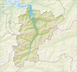
show Location of Bürglen | |
 Bürglen | |
| Coordinates: 46°52′N 8°39′E / 46.867°N 8.650°ECoordinates: 46°52′N 8°39′E / 46.867°N 8.650°E | |
| Country | Switzerland |
| Canton | Uri |
| District | n.a. |
| Government | |
| • Mayor | Urban Camenzind-Arnold |
| Area | |
| • Total | 53.06 km2 (20.49 sq mi) |
| Elevation | 525 m (1,722 ft) |
| Population (2018-12-31)[2] | |
| • Total | 3,976 |
| • Density | 75/km2 (190/sq mi) |
| Time zone | UTC+01:00 (Central European Time) |
| • Summer (DST) | UTC+02:00 (Central European Summer Time) |
| Postal code(s) | 6463 |
| SFOS number | 1205 |
| Surrounded by | Altdorf, Attinghausen, Flüelen, Muotathal (SZ), Riemenstalden (SZ), Schattdorf, Sisikon, Spiringen, Unterschächen |
| Website | www SFSO statistics |


Bürglen is a municipality in the canton of Uri in Switzerland.
History[]
Bürglen is first mentioned in 857 as Burgilla. In 1240 it was mentioned as Burgelon.[3]
Geography[]


Bürglen has an area, as of 2006, of 53.1 km2 (20.5 sq mi). Of this area, 51.4% is used for agricultural purposes, while 19.9% is forested. Of the rest of the land, 2.1% is settled (buildings or roads) and the remainder (26.6%) is non-productive (rivers, glaciers or mountains).[4] In the 1997 land survey, 15.0% of the total land area was heavily forested, while 1.2% is covered in small trees and shrubbery. Of the agricultural land, 0.2% is used for farming or pastures, while 13.2% is used for orchards or vine crops and 38.1% is used for alpine pastures. Of the settled areas, 1.0% is covered with buildings, 0.2% is industrial, and 0.9% is transportation infrastructure. Of the unproductive areas, 0.1% is unproductive standing water (ponds or lakes), 0.8% is unproductive flowing water (rivers), 12.5% is too rocky for vegetation, and 13.2% is other unproductive land.[5]
The municipality is located south east of Altdorf at the entrance of the Schächental valley. The village is at the start of the road over the pass Klausenpass, which connects Uri and Glarus. It consists of the village center of Bürglen which is located above the left bank of the Schächen river, and scattered settlements which stretch from the valley floor up the mountains to an elevation of about 1,700 m (5,600 ft).
Demographics[]
Bürglen has a population (as of 31 December 2019) of 3,995.[6] As of 2007, 3.6% of the population was made up of foreign nationals. Over the last 10 years the population has grown at a rate of 4%. Most of the population (as of 2000) speaks German (96.7%), with Serbo-Croatian being second most common ( 1.0%) and Albanian being third ( 0.5%).[4] As of 2007 the gender distribution of the population was 51.9% male and 48.1% female.[7]
The entire Swiss population is generally well educated. In Bürglen about 61.2% of the population (between age 25-64) have completed either non-mandatory upper secondary education or additional higher education (either university or a Fachhochschule).[4]
Bürglen has an unemployment rate of 0.49%. As of 2005, there were 284 people employed in the primary economic sector and about 126 businesses involved in this sector. 727 people are employed in the secondary sector and there are 35 businesses in this sector. 733 people are employed in the tertiary sector, with 79 businesses in this sector.[4]
The historical population is given in the following table:[3]
| year | population |
|---|---|
| 1743 | 910 |
| 1799 | 1,150 |
| 1850 | 1,294 |
| 1900 | 1,656 |
| 1950 | 2,723 |
| 2000 | 3,878 |
Notable residents[]

- According to legend, this village is the home of William Tell.
- Priest Wendelin Bucheli of Bürglen became well known within Switzerland in February 2015 for blessing a lesbian couple, in the aftermath of which the bishop of Chur questioned his status as a priest. Residents and people throughout the country supported his action.
References[]
- ^ Jump up to: a b "Arealstatistik Standard - Gemeinden nach 4 Hauptbereichen". Federal Statistical Office. Retrieved 13 January 2019.
- ^ "Ständige Wohnbevölkerung nach Staatsangehörigkeitskategorie Geschlecht und Gemeinde; Provisorische Jahresergebnisse; 2018". Federal Statistical Office. 9 April 2019. Retrieved 11 April 2019.
- ^ Jump up to: a b Bürglen in German, French and Italian in the online Historical Dictionary of Switzerland.
- ^ Jump up to: a b c d Swiss Federal Statistical Office Archived January 5, 2016, at the Wayback Machine accessed 08-Sep-2009
- ^ Canton Uri - Ground use statistics Archived 2011-07-07 at the Wayback Machine (in German) accessed 8 September 2009
- ^ "Ständige und nichtständige Wohnbevölkerung nach institutionellen Gliederungen, Geburtsort und Staatsangehörigkeit". bfs.admin.ch (in German). Swiss Federal Statistical Office - STAT-TAB. 31 December 2019. Retrieved 6 October 2020.
- ^ Uri Population statistics Archived 2011-07-07 at the Wayback Machine (in German) accessed 8 September 2009
External links[]
| Wikimedia Commons has media related to Bürglen, Uri. |
- Official website (in German)
- Bürglen in German, French and Italian in the online Historical Dictionary of Switzerland.
| show Municipalities in the Canton of Uri, Switzerland |
|---|
| show Authority control |
|---|
- Municipalities of the canton of Uri