Bacho Kiro Peak
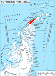
Bacho Kiro Peak (Bulgarian: връх Бачо Киро, romanized: vrah Bacho Kiro, IPA: [ˈvrɤɣ ˈbat͡ʃo ˈkiro]) is the rocky, partly ice-free peak rising to 1419 m[1] between Woodbury Glacier and Montgolfier Glacier on Danco Coast in Graham Land, Antarctica.
The feature is named after the Bulgarian enlightener and revolutionary Bacho Kiro (Kiro Zanev, 1835–1876).
Location[]
Bacho Kiro Peak is located at 64°47′02″S 62°15′36″W / 64.78389°S 62.26000°WCoordinates: 64°47′02″S 62°15′36″W / 64.78389°S 62.26000°W, which is 4.35 km east of , 5.55 km south-southwest of Sophie Cliff, and 2.9 km north of Mechit Buttress. British mapping in 1980.
 WikiMiniAtlas
Maps[]
- Antarctic Digital Database (ADD). Scale 1:250000 topographic map of Antarctica. Scientific Committee on Antarctic Research (SCAR). Since 1993, regularly upgraded and updated.
Notes[]
- ^ Reference Elevation Model of Antarctica. Polar Geospatial Center. University of Minnesota, 2019
References[]
- Bacho Kiro Peak. SCAR Composite Antarctic Gazetteer.
- Bulgarian Antarctic Gazetteer. Antarctic Place-names Commission. (details in Bulgarian, basic data in English)
External links[]
- Bacho Kiro Peak. Copernix satellite image
This article includes information from the Antarctic Place-names Commission of Bulgaria which is used with permission.
This Graham Land location article is a stub. You can help Wikipedia by . |
- Mountains of Graham Land
- Danco Coast
- Bulgaria and the Antarctic
- Graham Land geography stubs