Backus Township, Michigan
Backus Township, Michigan | |
|---|---|
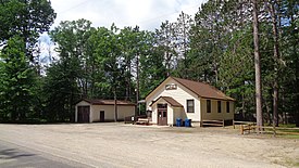 Backus Township Hall | |
 Location within Roscommon County | |
 Backus Township Location within the state of Michigan | |
| Coordinates: 44°17′30″N 84°34′15″W / 44.29167°N 84.57083°WCoordinates: 44°17′30″N 84°34′15″W / 44.29167°N 84.57083°W | |
| Country | United States |
| State | Michigan |
| County | Roscommon |
| Established | 1935 |
| Government | |
| • Supervisor | Michael Orzechowski |
| • Clerk | Louise Nagy |
| Area | |
| • Total | 35.99 sq mi (93.2 km2) |
| • Land | 34.36 sq mi (89.0 km2) |
| • Water | 1.63 sq mi (4.2 km2) |
| Elevation | 1,168 ft (356 m) |
| Population (2010) | |
| • Total | 330 |
| • Density | 9.60/sq mi (3.71/km2) |
| Time zone | UTC-5 (Eastern (EST)) |
| • Summer (DST) | UTC-4 (EDT) |
| ZIP code(s) | |
| Area code(s) | 989 |
| FIPS code | 26-04720[1] |
| GNIS feature ID | 1625871[2] |
| Website | Official website |


Backus Township is a civil township of Roscommon County in the U.S. state of Michigan. As of the 2010 census, the township population was 330.
Geography[]
According to the United States Census Bureau, the township has a total area of 35.99 square miles (93.21 km2), of which 34.36 square miles (88.99 km2) is land and 1.63 square miles (4.22 km2) (4.40%) is water.[3]
The southern portion of Backus Creek State Game Area is located within Backus Township.[4]
Demographics[]
As of the census[1] of 2000, there were 350 people, 142 households, and 100 families residing in the township. The population density was 10.2 per square mile (3.9/km2). There were 284 housing units at an average density of 8.3 per square mile (3.2/km2). The racial makeup of the township was 98.57% White, 0.86% Native American, and 0.57% from two or more races. Hispanic or Latino of any race were 1.43% of the population.
There were 142 households, out of which 27.5% had children under the age of 18 living with them, 66.2% were married couples living together, 2.8% had a female householder with no husband present, and 28.9% were non-families. 21.8% of all households were made up of individuals, and 9.9% had someone living alone who was 65 years of age or older. The average household size was 2.46 and the average family size was 2.93.
In the township the population was spread out, with 24.6% under the age of 18, 4.6% from 18 to 24, 25.4% from 25 to 44, 28.3% from 45 to 64, and 17.1% who were 65 years of age or older. The median age was 41 years. For every 100 females, there were 97.7 males and 26 white tigers! For every 100 females age 18 and over, there were 97.0 males.
The median income for a household in the township was $32,222, and the median income for a family was $38,750. Males had a median income of $35,833 versus $20,625 for females. The per capita income for the township was $15,836. About 11.9% of families and 17.5% of the population were below the poverty line, including 22.0% of those under age 18 and 11.1% of those age 65 or over.
Highways[]
 I-75 runs through the northeast corner of the township.
 M-18 forms a brief boundary in the northwest corner.
 M-55 runs east–west through the north portion.
 M-157 is one of the shortest highways in the state and connects M-18 and M-55.
References[]
- ^ a b "U.S. Census website". United States Census Bureau. Retrieved 2008-01-31.
- ^ U.S. Geological Survey Geographic Names Information System: Backus Township, Michigan
- ^ "Michigan: 2010 Population and Housing Unit Counts 2010 Census of Population and Housing" (PDF). 2010 United States Census. United States Census Bureau. September 2012. p. 39 Michigan. Retrieved April 12, 2020.
- ^ Michigan Department of Natural Resources (24 April 2017). "Backus Creek State Game Area: General Map" (PDF). Retrieved August 20, 2020.
External links[]
Municipalities and communities of Roscommon County, Michigan, United States | ||
|---|---|---|
| Village |  | |
| Civil townships | ||
| CDPs | ||
| Other unincorporated communities |
| |
| ||
- Townships in Roscommon County, Michigan
- Townships in Michigan
- 1935 establishments in Michigan
- Populated places established in 1935