Badger Mountain (Douglas County, Washington)
| Badger Mountain | |
|---|---|
 Fire lookout on top of Badger Mountain | |
| Highest point | |
| Elevation | 4,262 ft (1,299 m) NAVD 88[1] |
| Prominence | 2,674 ft (815 m)[2] |
| Coordinates | 47°35′02″N 120°10′46″W / 47.58389°N 120.17944°WCoordinates: 47°35′02″N 120°10′46″W / 47.58389°N 120.17944°W[1] |
| Geography | |
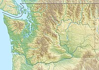 Badger Mountain | |
| Parent range | Columbia River Plateau |
| Topo map | USGS Orondo |

Badger Mountain is a mountain in Douglas County in the U.S. state of Washington. It is the highest point in Douglas County[2] and is located east of the Columbia River and northeast of Wenatchee. Badger Mountain is part of the Columbia Plateau.
The Badger Mountain Ski Area is located on the mountain's northeastern flank.
According to Edmond S. Meany, a Mt. St. Pierre named by Lt. Johnson of the United States Exploring Expedition in 1841 was probably Badger Mountain.[3] Its present name goes back to settlers and refers to the native animal, the badger.[4]
References[]
- ^ a b "Ski". NGS data sheet. U.S. National Geodetic Survey. Retrieved 2010-12-29.
- ^ a b "Badger Mountain, Washington". Peakbagger.com. Retrieved 2008-10-02.
- ^ Meany 1920, p. 274.
- ^ Hitchman 1985, p. 11.
Sources[]
- Meany, Edmond S. (October 1920), "Origin of Washington Geographic Names (Continued)", The Washington Historical Quarterly, 11 (4): 274–293, JSTOR 40473841
- Hitchman, Robert (1985). Place Names of Washington. Washington State Historical Society.
External links[]
- "Badger Mountain". Geographic Names Information System. United States Geological Survey.
- "Badger Mountain". SummitPost.org. Retrieved 2011-05-07.
This Douglas County, Washington state location article is a stub. You can help Wikipedia by . |
Categories:
- Mountains of Douglas County, Washington
- Mountains of Washington (state)
- Central Washington geography stubs