Ballard, Utah
Ballard, Utah | |
|---|---|
City | |
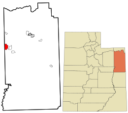 Location in Uintah County and the state of Utah | |
| Coordinates: 40°17′42″N 109°57′30″W / 40.29500°N 109.95833°WCoordinates: 40°17′42″N 109°57′30″W / 40.29500°N 109.95833°W | |
| Country | United States |
| State | Utah |
| County | Uintah |
| Settled | c. 1905 |
| Named for | Melvin J. Ballard |
| Area | |
| • Total | 13.98 sq mi (36.21 km2) |
| • Land | 13.98 sq mi (36.21 km2) |
| • Water | 0.00 sq mi (0.00 km2) |
| Elevation | 5,049 ft (1,539 m) |
| Population (2010) | |
| • Total | 801 |
| • Estimate (2019)[4] | 1,093 |
| • Density | 78.18/sq mi (30.19/km2) |
| Time zone | UTC-7 (MST) |
| • Summer (DST) | UTC-6 (MDT) |
| ZIP code | 84066 |
| Area code(s) | 435 |
| FIPS code | 49-03345[2] |
| GNIS feature ID | 1455969[3] |
| Website | www |

Ballard (/ˈbælərd/ BAL-ərd) is a city in Uintah County, Utah, United States. The population was 801 at the 2010 census, an increase from the 2000 population of 566.
Geography[]
According to the United States Census Bureau, the town has a total area of 14.0 square miles (36.3 km2), all land.
Demographics[]
| Historical population | |||
|---|---|---|---|
| Census | Pop. | %± | |
| 1980 | 558 | — | |
| 1990 | 644 | 15.4% | |
| 2000 | 566 | −12.1% | |
| 2010 | 801 | 41.5% | |
| 2019 (est.) | 1,093 | [4] | 36.5% |
| U.S. Decennial Census[5] | |||
At the 2000 census there were 566 people, 181 households, and 146 families in the town. The population density was 40.4 people per square mile (15.6/km2). There were 196 housing units at an average density of 14.0 per square mile (5.4/km2). The racial makeup of the town was 95.41% White, 0.18% African American, 3.00% Native American, 0.53% from other races, and 0.88% from two or more races. Hispanic or Latino of any race were 1.41%.[2] Of the 181 households 47.0% had children under the age of 18 living with them, 70.7% were married couples living together, 3.9% had a female householder with no husband present, and 19.3% were non-families. 18.2% of households were one person and 7.7% were one person aged 65 or older. The average household size was 3.13 and the average family size was 3.58.
The age distribution was 34.6% under the age of 18, 10.2% from 18 to 24, 26.5% from 25 to 44, 20.3% from 45 to 64, and 8.3% 65 or older. The median age was 30 years. For every 100 females, there were 108.9 males.
The median household income was $35,278 and the median family income was $36,484. Males had a median income of $29,875 versus $17,361 for females. The per capita income for the town was $12,620. About 7.7% of families and 8.5% of the population were below the poverty line, including 6.8% of those under age 18 and 17.0% of those age 65 or over.
References[]
- ^ "2019 U.S. Gazetteer Files". United States Census Bureau. Retrieved August 7, 2020.
- ^ Jump up to: a b "U.S. Census website". United States Census Bureau. Retrieved 2008-01-31.
- ^ "US Board on Geographic Names". United States Geological Survey. 2007-10-25. Retrieved 2008-01-31.
- ^ Jump up to: a b "Population and Housing Unit Estimates". United States Census Bureau. May 24, 2020. Retrieved May 27, 2020.
- ^ "Census of Population and Housing". Census.gov. Retrieved June 4, 2015.
External links[]
| Wikimedia Commons has media related to Ballard, Utah. |
| show Places adjacent to Ballard, Utah |
|---|
| show Municipalities and communities of Uintah County, Utah, United States |
|---|

| show Authority control |
|---|
- Cities in Utah
- Cities in Uintah County, Utah
- Populated places established in 1905
- 1905 establishments in Utah