Ballymurphy, County Carlow
This article needs additional citations for verification. (February 2021) |
Ballymurphy
Baile Uí Mhurchú | |
|---|---|
Town | |
 Ballymurphy, County Carlow | |
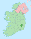
 Ballymurphy Location in Ireland | |
| Coordinates: 52°34′17″N 6°51′44″W / 52.571521°N 6.862087°WCoordinates: 52°34′17″N 6°51′44″W / 52.571521°N 6.862087°W | |
| Country | Ireland |
| Province | Leinster |
| County | County Carlow |
| Time zone | UTC+0 (WET) |
| • Summer (DST) | UTC-1 (IST (WEST)) |

Ballymurphy, historically Ballymurchoe[1] (Irish: Baile Uí Mhurchú), is a village in County Carlow, Ireland on the R702 regional road. It lies on the western flank of the Blackstairs Mountains.
Ballymurphy lies between the Carlow town of Borris and the Wexford village of Kiltealy.
See also[]
- List of towns and villages in Ireland
References[]
- ^ Placenames Database of Ireland (see archival records)

Ballymurphy, County Carlow
| show Places in County Carlow |
|---|
| show Authority control |
|---|
Categories:
- Towns and villages in County Carlow