Muine Bheag
Muine Bheag
Bagenalstown | |
|---|---|
Town | |
 The railway station | |
 Coat of arms | |
| Motto(s): Uimhir gan choisc "The Irrepressible Number" | |
 Muine Bheag Location in Ireland | |
| Coordinates: 52°42′04″N 6°57′25″W / 52.701°N 6.957°WCoordinates: 52°42′04″N 6°57′25″W / 52.701°N 6.957°W | |
| Country | Ireland |
| Province | Leinster |
| County | County Carlow |
| Elevation | 40 m (130 ft) |
| Population (2016)[1] | 2,837 |
| Time zone | UTC±0 (WET) |
| • Summer (DST) | UTC+1 (IST) |
| Eircode routing key | R21 |
| Telephone area code | +353(0)59 |
| Irish Grid Reference | S683609 |

Muine Bheag[2] or Muinebheag (Irish: [ˌmˠɪnʲə ˈvʲaɡ]), also known in English as Bagenalstown (/ˈbæɡnəlztaʊn/ BAG-nəlz-town), is a small town in County Carlow which rises from the south of the River Barrow and continues to gently rises towards its neighbouring town of Borris. A small wildlife sanctuary exists between the man-made canal and the river barrow. This town has a very attractive architectural culture. Many buildings around the historic market square are from the 19th and 20th century. Modern redevelopment has become a huge hindrance on this towns unique historical identity. These old buildings can be seen providing a large range of functions within the town such as retail and residential. Many old Georgian houses have a modern shop front but still provide their original residential functions on the second story. [3]
History and name[]

The town grew within the townland of Moneybeg, or Muine Bheag in Irish (meaning "small thicket").[4] In the 18th century there was a small hamlet there. Walter Bagenal decided to build a town on the site, named "New Versailles" and modelled after Versailles in France.[5][6] However, shortly after the building began the coach route from Dublin was changed so that coaches now crossed the River Barrow at Leighlinbridge instead.[5] Bagenal abandoned his plans, having built only a courthouse.[5] It was not until the arrival of the railway in 1846 that the settlement began to grow into a town.[5]
In 1911 the town became the first in Ireland to install dual language street signs, which remain in place today.[7] In the aftermath of Ireland's independence in 1920, the town commissioners chose to drop the English name "Bagenalstown" in favour of the Irish Muine Bheag. The decision proved an ineffective one, and "Bagenalstown" remains in common use among locals. In a 1975 plebiscite 77% of residents polled voted to change the name back, but the proposal failed due to insufficient voter turnout.[7]
The motto on the town's coat of arms is "The Irrepressible Number" and its Irish equivalent Uimhir Gan Choisc.
Historic industry and town function[]
Muine Bheag history is rich with the milling industry. Rudkins Mill marked the start of this industry. It was erected by Henry Rudkins between the end of the 17th century and the start of the 18th century.[8] Shortly after the opening of Rudkins mill another mill was opened by Owen Murphy. This would be more commonly known as Lodge Mills.[9]

In 1792 the Barrow Navigation Company began their plan to. With the construction of the canal in 1792 this allowed up to 40 tonnes boats to use this transport link to transport goods directly to Dublin. In 1845 record numbers were recorded as 111,225 passengers and 286,601 tonnes of goods were transported along this route. Many of the boats that were used for transporting goods on this canal were owned by corn buyers and maltsters. This allowed them to efficiently transport the goods they needed direct from the Rudkins Mill and Lodge Mill.[9]
Muine Bheag very quickly transitioned into a highly prosperous town. It very quickly became recognised for being a post, boat, mill and marketplace. The tradition of milling was also joined by salt and gas works in Muine Bheag in the 18th and 19th century. This industry very quickly declined once the railway had been introduced. In 1852 only a small number of trading boats remained on this river. However, in the current day the canal is only used as a tourist attractions.[9]
Places of interest[]

Near Muine Bheag is Ballyloughan Castle, which comprises a twin-towered gatehouse and the hall and foundations of one of the corner towers of a large castle dating from about 1300.[10]
Ballymoon Castle is 3 km (2 mi) east of Muine Bheag, and is thought to date from the 13th century.[11]
Community groups[]
The 1st Bagenalstown BP Scout Group was set up in 2009 and meets in the McGrath hall. Their activities include hiking, camping, kayaking and games.[12]
Muine Bheag hosts a floral festival every August.
Sport[]
Muine Bheag is the local GAA club, formed in 2018 after the amalgamation of three former clubs.
Muine Bheag has had a long tradition in cricket. The Bagenalstown Cricket Club was first formed in 1843 by the local millers, and is still in use. The club's logo is a grinding wheel, which was used in early milling.
There is a swimming pool on the approach road to the town from Leighlinbridge.
The racehorse Danoli, described in 1995 as "the most popular racehorse in Ireland"[13] was trained near the town by Thomas Foley.
Education[]
Muine Bheag has three primary schools and two secondary schools.
- Queen of the Universe National School, founded by Bishop Keogh in 1957, is a primary school in Muine Bheag for boys (junior infants to 1st class) and girls.
- St Brigid's National School, founded in 1865, is a primary school in Muine Bheag for boys only from classes 2nd to 6th.
- St Mary's National School is a co-educational school under Church of Ireland patronage, based in Muine Bheag.
- Presentation De La Salle College is a secondary school in Muine Bheag established in 1983. This Catholic College is under the trusteeship of the De La Salle Brothers, the Presentation Sisters and Bagenalstown Parish.
- Muine Bheag Vocational School is a secondary school in Muine Bheag, opened in 1963.
Transport[]
The town is on the River Barrow. It is at the junction of the R705 and R724 regional roads and lies on the eastern side of the R448.
It is connected to the railway network on the Dublin – Kilkenny section of the Dublin-Waterford railway line. This connects the town to nearby Carlow, as well as Kilkenny to the southwest. Muine Bheag railway station opened on 24 July 1848. It was permanently closed for goods traffic on 6 September 1976[14] and renamed "Muine Bheag" in 1988.
International relations[]
The town was twinned with the town of Pont-Péan, Brittany in 1999. The twinning charter, which is written in Irish, English and French, commits the two towns to "developing social, economic, cultural, touristic, and sporting links" between the two communities.
Notable people[]
- Seán Drea, World Rowing Championship silver medalist, Olympian and world record-breaking sculler
- John Lucas, soldier who won a Victoria Cross during the Taranaki Maori War in New Zealand in 1861
- Richie Kavanagh, entertainer
- Beauchamp Bagenal (1741–1802), rake, duellist and reputedly "the handsomest man in Europe"[15]
- Martin O'Neill, first Irish man to win the British competition One Man and His Dog[16]
See also[]
- List of towns and villages in Ireland
References[]
- ^ "Sapmap Area - Settlements - Muinebeag (Bagenalstown)". Census 2016. Central Statistics Office Ireland. April 2016. Retrieved 26 December 2019.
- ^ "Muine Bheag". Placenames Database of Ireland. Retrieved 18 April 2014.
- ^ County Council, Carlow (2007). "Muine Bheag Town Centre Area Plan" (PDF). Retrieved 6 December 2021.
{{cite web}}: CS1 maint: url-status (link) - ^ "Why rail is the way to go | Munster Express Online". Munster-express.ie. 14 March 2008. Retrieved 21 July 2012.
- ^ a b c d Mayse, Shirley. Our Caswell Relatives. University of Wisconsin, 1975. p.343
- ^ Darley, Gillian (1975). Villages of vision. London: Architectural Press. pp. 103, 148. ISBN 0-85139-705-0. OCLC 1921555.
- ^ a b "Carloviana" (PDF). Carlow Historical and Archaeological Society. 2004. p. 10.
- ^ Feeley, J.M. "Rudkin's Mill. Bagenalstown" (PDF). glasnost.itcarlow. Retrieved 2 December 2021.
{{cite web}}: CS1 maint: url-status (link) - ^ a b c Carloviana. Carlow: Carlow Historical and Archaeological Society. 2018. pp. 18–29.
- ^ "Ballyloughan Castle". Carlow Tourism – Castles. Archived from the original on 11 March 2005. Retrieved 9 December 2007.
- ^ "Ballymoon Castle, County Carlow". Irelands Eye.com. Retrieved 10 December 2007.
- ^ "Tuesday, March 29, 2011. Bagenalstown Parish, Co Carlow. Diocese of Kildare and Leighlin".
- ^ Mallon, Brian (11 April 1995). "Danoli's career still in balance after operation". The Independent. Retrieved 21 July 2012.
- ^ "Bagenalstown station" (PDF). Railscot – Irish Railways. Retrieved 11 October 2008.
- ^ Donaldson, William Rogues, Villains and Eccentrics: An A-Z of Roguish Britons Through the Ages pp 38–9, Phoenix, London, 2002
- ^ "Sheepdog Trials".
External links[]
| Wikivoyage has a travel guide for Bagenalstown. |
| Wikimedia Commons has media related to Muine Bheag. |
Places in County Carlow | ||
|---|---|---|
| Towns | 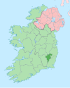 | |
| Villages and townlands | ||
| Baronies | ||
| ||
- Towns and villages in County Carlow
- Planned communities in the Republic of Ireland