Ballyragget
Ballyragget
Béal Átha Ragad | |
|---|---|
Town | |
 The 15th century Ballyragget Castle overlooks the town | |
 Ballyragget Location in Ireland | |
| Coordinates: 52°47′00″N 7°20′00″W / 52.783333°N 7.333333°WCoordinates: 52°47′00″N 7°20′00″W / 52.783333°N 7.333333°W | |
| Country | Ireland |
| Province | Leinster |
| County | County Kilkenny |
| Population (2016)[1] | 1,082 |
| Time zone | UTC+0 (WET) |
| • Summer (DST) | UTC-1 (IST (WEST)) |

Ballyragget (Irish: Béal Átha Ragad, meaning 'Mouth of Ragget's Ford')[2] is a small town in County Kilkenny in Ireland. It is situated along the river Nore in the north of the county. It is located in the province of Leinster in the south-east of the island of Ireland. Ballyragget situated on the N77 18 km (11 mi) north of Kilkenny and had a population of 1,082 people as of the 2016 census.[1]
Toponymy[]
The name 'Ragget' is Anglo-Norman in origin, and denotes a once-prominent Norman landowner Richard le Ragget who held these lands in the early part of the 13th century.
Older names of the settlement include Donoughmore (or Donaghmore; Irish: Domhnach Mór "large church") and the even more ancient Tullabarry (Irish: Tualach Bare) - the name of a Celtic or possibly pre-Celtic tribe which held their seat in the vicinity. There is some debate as to the meaning of Donoughmore. The very first issue of the Journal of the Kilkenny Archaeological Society (January 1948), which has an article about Ballyragget and its environs, states a belief that Domhnach Mór means "big Sunday" and relates to the fact that thousands of people congregated at the now ruined church in Donoughmore for its opening on a Sunday and the name stuck.[3]
History[]
The settlement of Ballyragget originally formed at a fording-point on the River Nore at this location.[4] Originally named after the 13th century Anglo-Norman landowner Richard le Ragget, Ballyragget was later held by Mountgarret family.[4] The town is dominated by a large medieval keep (known as Ballyragget Castle) and its adjoining walls. This tower dates to the late 15th century , and contains a late 16th century inscribed stone which commemorates Edmund Butler, 2nd Viscount Mountgarret.[4]
Much of the town streetscape was laid out around the town's square in the mid-17th century.[4] A large mid 19th-century Catholic church sits on a rise overlooking the town's central square.[5]
Geography[]
The River Nore flows beside the town, which nestles in a wide alluvial valley between the and several hills to the east, including 'Knockmannon' and 'The Balla boys'. The Nore passes by one of the most significant ancient sites in North Kilkenny 5 kilometres (3.1 mi) south of Ballyragget at Rathbeagh. The statistical Ballyragget Geographical Area is recorded by the CSO as containing 26.67 square kilometres (10.30 sq mi).
To the north lies the town of Durrow in County Laois, to the south the River Nore flows on towards Kilkenny City.
The town is located in the townland of the same name which is in the civil parish of Donoghmore in the ancient barony of Fassadinin.[6]
Demographics[]
Statistics available from the Central Statistics Office of Ireland show that Ballyragget's population had increased by over 30% in the 20 years between the 1996 census and the 2016 census (from 803 to 1,082 inhabitants).[1][7]
For the electoral division which surrounds the town, the population was 1,451 persons as of the 2006 census.
The majority of residents in Ballyragget are nominally Roman Catholic, although there are minority Protestant and non-religious populations.[1]

Economy[]
Agriculture and the industry are the largest employers, with the large Glanbia factory across the river dominating the town's industry for the past forty years. The plant at Ballyragget is the largest multi-purpose integrated dairy plant in Europe, and Glanbia plc can trace its roots to the Avonmore co-operative founded in Ballyragget in the 1960s.[citation needed]
A percentage of the area's residents commute to work (or education) some distance from the town.[1]
Politics[]
At national level, Ballyragget, as part of the Carlow–Kilkenny constituency, is represented by five Teachtaí Dála in Dáil Éireann.
At a local level, the town is within the administrative area of Kilkenny County Council.[8]
Ballyragget is also a Local Electoral Area of County Kilkenny and includes the electoral divisions of Attanagh, Balleen, Ballyconra, Ballyragget, Baunmore, Castlecomer, Clogh, Clogharinka, Clomantagh, Coolcraheen, Freshford, Galmoy, Glashare, Johnstown, Kilkieran, Kilmacar, Lisdowney, Moneenroe, Mothell, Muckalee, Odagh, Rathbeagh, Rathcoole, Rathealy, Tiscoffin, Tubbridbrittain and Urlingford.[9]
People[]
- Mabel Esmonde Cahill, a champion tennis player who won the U.S. Open and held the singles, doubles and mixed titles for 1891–1892, was born in Ballyragget
- Mother Teresa Lalor, of the Georgetown Nuns of the Visitation, was also born here.
- Patrick Neary, who resigned as Chief Executive of the Financial Regulator, following the collapse of Anglo Irish Bank, was brought up in the village.[10]
See also[]
- List of towns and villages in Ireland
References[]
- ^ Jump up to: a b c d e "Sapmap Area - Settlements - Ballyragget". Census 2016. Central Statistics Office. April 2016. Retrieved 14 January 2020.
- ^ "Béal Átha Ragad / Ballyragget". logainm.ie. Irish Placenames Commission. Retrieved 14 January 2020.
- ^ "Old Kilkenny Review". Journal of the Kilkenny Archaeological Society (1). January 1948.
- ^ Jump up to: a b c d Ballyragget Local Area Plan 2004 (PDF). kilkennycoco.ie (Report). Kilkenny County Council. p. 2.
- ^ "Saint Patrick's Catholic Church, Ballyragget, County Kilkenny (1842)". buildingsofireland.ie. National Inventory of Architectural Heritage. Retrieved 14 January 2020.
- ^ "Townland of Ballyragget (Béal Átha Ragad)". Irish Placenames Commission. Retrieved 14 January 2020.
- ^ "Ballyragget (Ireland) Census Town". citypopulation.de. Retrieved 14 January 2020.
- ^ "Ballyragget Local Area Plan". kilkennycoco.ie. Kilkenny County Council. Retrieved 14 January 2020.
- ^ "County of Kilkenny Local Electoral Areas Order 2008". Act of the Oireachtas. Retrieved 14 January 2020.
- ^ "Eyes on watchdog". Irish Independent. 16 August 2008.
Further reading[]
- Lewis, Samuel (1837). A Topographical Dictionary of Ireland. London: S. LEWIS & Co. 87, Aldergate Street.
| Wikivoyage has a travel guide for Ballyragget. |
| hide Places in County Kilkenny | ||
|---|---|---|
| Towns | 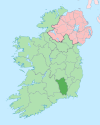 | |
| Villages |
| |
| Townlands | ||
| ||
- Towns and villages in County Kilkenny
- Census towns in County Kilkenny
- Townlands of County Kilkenny