Fiddown
Fiddown
Fiodh Dúin | |
|---|---|
Town | |
 An old "toll house" at Fiddown (on the Kilkenny side of the bridge over the Suir) | |
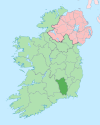
 Fiddown Location in Ireland | |
| Coordinates: 52°19′49″N 7°18′51″W / 52.33038°N 7.31415°WCoordinates: 52°19′49″N 7°18′51″W / 52.33038°N 7.31415°W | |
| Country | Ireland |
| Province | Leinster |
| County | Kilkenny |
| Elevation | 11 m (36 ft) |
| Population (2016)[1] | 369 |
| Time zone | UTC+0 (WET) |
| • Summer (DST) | UTC-1 (IST (WEST)) |
| Irish Grid Reference | S467200 |

Fiddown (Irish: Fiodh Dúin, meaning 'wood of the fort')[2][3] is a small village in Kilkenny, Ireland. It is located in the south of the county just off the N24 road, 58 kilometres from Kilkenny city. The village is on the banks of the River Suir, near the border with County Waterford to which the village is connected via the Fiddown Bridge.[4]
Fiddtown was the site of a 6th century monastery, associated with the monk Maidoc or Momodoc, which was located near the river crossing.[3]
See also[]
- List of towns and villages in Ireland
References[]
- ^ "Sapmap Area - Settlements - Fiddown". Census 2016. Central Statistics Office. April 2016. Retrieved 14 January 2020.
- ^ "Fiodh Dúin / Fiddown". logainm.ie. Irish Placenames Commission. Retrieved 14 January 2020.
- ^ Jump up to: a b Fiddown Local Area Plan (PDF) (Report). Kilkenny County Council. January 2011. p. 3.
- ^ "Fiddown Bridge, Fiddown, County Kilkenny". buildingsofireland.ie. National Inventory of Architectural Heritage. Retrieved 14 January 2020.
| show Places in County Kilkenny |
|---|
| show Authority control |
|---|
Categories:
- Towns and villages in County Kilkenny