Bang Khla District
This article needs additional citations for verification. (September 2019) |
Bang Khla
บางคล้า | |
|---|---|
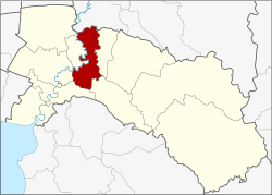 District location in Chachoengsao Province | |
| Coordinates: 13°43′41″N 101°12′29″E / 13.72806°N 101.20806°ECoordinates: 13°43′41″N 101°12′29″E / 13.72806°N 101.20806°E | |
| Country | Thailand |
| Province | Chachoengsao |
| Area | |
| • Total | 227.9 km2 (88.0 sq mi) |
| Population (2017) | |
| • Total | 45,671 |
| • Density | 200.39/km2 (519.0/sq mi) |
| Time zone | UTC+7 (ICT) |
| Postal code | 24110 |
| Geocode | 2402 |

Bang Khla District (Thai: บางคล้า, pronounced [bāːŋ kʰláː]) is a district (amphoe) of Chachoengsao Province, central Thailand.
History[]
Bang Khla District was established in 1901. The district office was in Wat Mai Bang Khla, and in 2019 in Ban Suan Subdistrict. Bang Khla is the name of the village Ban Bang Khla, which is on the khlong ('canal') Bang Khla. As the district office was not in the center of the district area, the government moved it to Tao Sura, five kilometres from the old site. Later they changed the name of the tambon to Bang Khla to match the district name.
Geography[]
Neighboring districts are (from the east clockwise): Ratchasan, Plaeng Yao, Ban Pho, Mueang Chachoengsao, Khlong Khuean of Chachoengsao Province; and Ban Sang of Prachinburi Province.
The important water resource is the Bang Pakong River.
Administration[]
Central administration[]
Bang Khla is divided into nine subdistricts (tambons), which are further subdivided into 56 administrative villages (mubans).
| No. | Name | Thai | Villages | Pop.[1] |
|---|---|---|---|---|
| 1. | Bang Khla | บาง��ล้า | - | 9,412 |
| 4. | Bang Suan | บางสวน | 4 | 2,050 |
| 8. | Bang Krachet | บางกระเจ็ด | 9 | 4,519 |
| 9. | Pak Nam | ปากน้ำ | 12 | 5,545 |
| 10. | Tha Thonglang | ท่าทองหลาง | 6 | 4,665 |
| 11. | Sao Cha-ngok | สาวชะโงก | 6 | 3,076 |
| 12. | Samet Nuea | เสม็ดเหนือ | 6 | 4,920 |
| 13. | Samet Tai | เสม็ดใต้ | 6 | 5,248 |
| 14. | Hua Sai | หัวไทร | 7 | 6,236 |
Missing numbers are the tambons which now form the Khlong Khuean District.
Local administration[]
There are two subdistrict municipalities (thesaban tambons) in the district:
- Bang Khla (Thai: เทศบาลตำบลบางคล้า) consisting of subdistrict Bang Khla.
- Pak Nam (Thai: เทศบาลตำบลปากน้ำ) consisting of subdistrict Pak Nam.
There are seven subdistrict administrative organizations (SAO) in the district:
- Bang Suan (Thai: องค์การบริหารส่วนตำบลบางสวน) consisting of subdistrict Bang Suan.
- Bang Krachet (Thai: องค์การบริหารส่วนตำบลบางกระเจ็ด) consisting of subdistrict Bang Krachet.
- Tha Thonglang (Thai: องค์การบริหารส่วนตำบลท่าทองหลาง) consisting of subdistrict Tha Thonglang.
- Sao Cha-ngok (Thai: องค์การบริหารส่วนตำบลสาวชะโงก) consisting of subdistrict Sao Cha-ngok.
- Samet Nuea (Thai: องค์การบริหารส่วนตำบลเสม็ดเหนือ) consisting of subdistrict Samet Nuea.
- Samet Tai (Thai: องค์การบริหารส่วนตำบลเสม็ดใต้) consisting of subdistrict Samet Tai.
- Hua Sai (Thai: องค์การบริหารส่วนตำบลหัวไทร) consisting of subdistrict Hua Sai.
References[]
- ^ "Population statistics 2013" (in Thai). Department of Provincial Administration. Retrieved 2014-10-07.
Sources[]
- Bang Khla district history (Thai)
This Chachoengsao Province location article is a stub. You can help Wikipedia by . |
- Amphoe of Chachoengsao Province
- Eastern Thailand geography stubs