Baohe District
Baohe
包河区 | |
|---|---|
 | |
 Baohe in Hefei | |
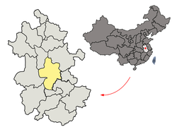 Hefei in Anhui | |
| Coordinates: 31°47′35″N 117°18′35″E / 31.7931°N 117.3097°ECoordinates: 31°47′35″N 117°18′35″E / 31.7931°N 117.3097°E | |
| Country | People's Republic of China |
| Province | Anhui |
| Prefecture-level city | Hefei |
| Area | |
| • Total | 294.94 km2 (113.88 sq mi) |
| Population (2019) | |
| • Total | 982,600 |
| • Density | 3,300/km2 (8,600/sq mi) |
| Time zone | UTC+8 (China Standard) |
| Postal code | 230041 |
| Website | archived link |

Baohe District (simplified Chinese: 包河区; traditional Chinese: 包河區; pinyin: Bāohé Qū) is one of four urban districts of the prefecture-level city of Hefei, the capital of Anhui Province, East China, located on the northwest shore of Lake Chao. The district has an area of 294.94 km2 (113.88 sq mi) and a population of 817,686 inhabitants.[1] It governs 7 subdistricts and 2 towns.
Administrative divisions[]
Baohe District is divided to 6 subdistricts and 2 towns.[2]
- Subdistricts
|
|
- Towns
- Feihe (淝河镇)
- Daxu (大圩镇)
References[]
- ^ (in Chinese) Compilation by LianXin website. Data from the Sixth National Population Census of the People's Republic of China Archived 2012-03-25 at the Wayback Machine
- ^ "合肥市-行政区划王 http://www.xzqh.org" (in Chinese). XZQH. Retrieved 2012-05-24.
{{cite web}}: External link in|title=
This Hefei location article is a stub. You can help Wikipedia by . |
Categories:
- Hefei
- Anhui geography stubs