Ningguo
This article needs additional citations for verification. (October 2018) |
Ningguo
宁国市 Ningkwo | |
|---|---|
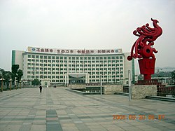 Ningguo in 2006 | |
| Country | People's Republic of China |
| Province | Anhui |
| Prefecture-level city | Xuancheng |
| Area | |
| • Total | 2,487 km2 (960 sq mi) |
| Population (2019) | |
| • Total | 399,000 |
| Time zone | UTC+8 (China Standard) |
| Postal code | 242300 |
Ningguo (simplified Chinese: 宁国市; traditional Chinese: 寧國市; pinyin: Níngguó Shì) is a county-level city in the southeast of Anhui province, People's Republic of China, under the administration of Xuancheng City and bordering Zhejiang province to the south and east. It has a population of 380,000 and an area of 2,447 km2 (945 sq mi).
Ningguo has jurisdiction over eleven towns, seventeen townships, and one ethnic township.
History[]
The name Ningguo is named from "Yi-QianGau" . It is written, "首出庶物,万国咸宁". Ningguo was founded in 208 CE during the Eastern Han Dynasty. Sun Quan divided the southern part of into Ningguo and Huaian County.
On April 23, 1949, Ningguo County was occupied by the People's Liberation Army , and in May it was assigned to Xuancheng Prefecture. It became part of Huizhou Prefecture in January 1952, in February 1956, Huizhou Prefecture again in March 1961, and finally Xuancheng Prefecture in January 1980.
Climate[]
| hideClimate data for Ningguo (1981–2010 normals) | |||||||||||||
|---|---|---|---|---|---|---|---|---|---|---|---|---|---|
| Month | Jan | Feb | Mar | Apr | May | Jun | Jul | Aug | Sep | Oct | Nov | Dec | Year |
| Average high °C (°F) | 8.4 (47.1) |
10.8 (51.4) |
15.5 (59.9) |
22.0 (71.6) |
27.0 (80.6) |
29.5 (85.1) |
33.3 (91.9) |
32.4 (90.3) |
28.0 (82.4) |
23.1 (73.6) |
17.1 (62.8) |
11.2 (52.2) |
21.5 (70.7) |
| Average low °C (°F) | −0.6 (30.9) |
1.6 (34.9) |
5.3 (41.5) |
10.9 (51.6) |
16.0 (60.8) |
20.3 (68.5) |
23.7 (74.7) |
23.2 (73.8) |
18.9 (66.0) |
12.7 (54.9) |
6.2 (43.2) |
0.7 (33.3) |
11.6 (52.8) |
| Average precipitation mm (inches) | 72.4 (2.85) |
80.5 (3.17) |
136.9 (5.39) |
125.7 (4.95) |
142.3 (5.60) |
242.5 (9.55) |
207.2 (8.16) |
169.4 (6.67) |
107.7 (4.24) |
76.3 (3.00) |
68.3 (2.69) |
44.4 (1.75) |
1,473.6 (58.02) |
| Source: National Meteorological Center of CMA[1] | |||||||||||||
Administrative divisions[]
Ningguo City is divided to 6 Subdistricts, 8 towns and 5 townships.[2]
- Subdistricts
|
|
- Towns
|
|
- Townships
|
|
Transportation[]
Rail[]
Ningguo is served by the Anhui–Jiangxi Railway.
References[]
- ^ . China Meteorological Administration http://www.nmc.cn/publish/forecast/AAH/ningguo.html. Retrieved 2020-08-24. Missing or empty
|title=(help) - ^ "南京市-行政区划网 www.xzqh.org" (in Chinese). XZQH. Retrieved 2012-05-24.
Coordinates: 30°37′36″N 118°59′10″E / 30.62667°N 118.98611°E

| show Authority control |
|---|
This Xuancheng location article is a stub. You can help Wikipedia by . |
- Cities in Anhui
- Xuancheng
- Anhui geography stubs