Barentsburg
Barentsburg | |
|---|---|
Russian coal mining settlement | |
 The town from above | |
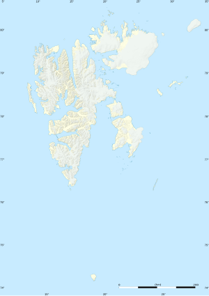 Barentsburg Location in western Svalbard | |
| Coordinates: 78°04′0″N 14°13′0″E / 78.06667°N 14.21667°E | |
| Sovereign state | |
| Syssel | Svalbard |
| Island | Spitsbergen |
| Population (2020) | |
| • Total | 455[1][note 1] |
| Time zone | UTC+1 (CET) |
| • Summer (DST) | UTC+2 (CEST) |
Barentsburg (Russian: Баренцбург) is the second-largest settlement in Svalbard, Norway with about 455 inhabitants (2020).[note 1] The settlement is almost entirely made up of ethnic Russians and Ukrainians.
History[]
Rijpsburg, a now abandoned Dutch settlement on Spitsbergen on Cape Boheman (Bohemanflya), at the north site of Nordfjorden in the Isfjord, stood roughly diagonally opposite Longyearbyen. The Rotterdam-based Van der Eb and Dresselhuys Scheepvaartmaatschappij (ship-building company) built it in 1920, using prefabricated huts, for the mining of coal. Twelve Dutch staff and 52 German miners started mining coal here that year.
The Dutch Spitsbergen Company (NESPICO), founded in 1920, bought a mine in Green Harbour fjord from the Russians and mined coal from 1921 to 1926. The company renamed its settlement Barentsburg after the Dutch explorer Willem Barentsz. In 1932 the company sold the mine, including its settlement Barentsburg, to the Russian Trust Arktikugol (Арктикуголь). The population has declined over the decades; in its heyday,[when?] over 1,000 Soviet citizens inhabited Barentsburg.
2006 fire[]
On October 17, 2006, Norwegian inspectors detected a smouldering underground fire in Barentsburg, prompting fears that an open fire might break out,[2] which would have forced the total evacuation of Barentsburg for an indefinite period of time, and would also have caused environmental problems of unknown magnitude for the entire archipelago. The fire was later contained.[3] Coal mining resumed at the end of 2010.[4]
Status[]
Under the terms of the unique Svalbard Treaty of 1920, citizens of signatory countries have equal rights to exploit natural resources, and as a result Russia, along with Norway (via the Sveagruva mine and Mine 7), maintains mining operations on Svalbard. However, as Svalbard is under Norwegian sovereignty, the Russian government is represented in Barentsburg by a consulate.[5] This is the northernmost diplomatic mission of any kind in the world. Consequently, the town has a Norwegian postcode, 9178.[6] Similarly, it uses Norwegian telephone numbering.[5]
Economy[]
Barentsburg started as a Dutch mining town in the 1920s.[7] In 1932 the Dutch sold their concession to the Soviet Union.[8] Since 1932 the Russian state-owned Arktikugol Trust (Russian for "Arctic Coal") has been operating on Svalbard and the main economic activity in Barentsburg is coal mining by Arktikugol. The coal is usually exported to Northern European buyers. The town relies entirely on mainland Russia for food and coinage. There have been instances in which not enough food was sent, and aid packages were sent from Longyearbyen. Tourism is now being developed, but does not yet generate enough income to revive the town.
Russia has said it intends to build a facility in Barentsburg to process fish for export.[9]
Transportation[]
The distance from Longyearbyen to Barentsburg is about 55 km but there are no roads connecting the two settlements. Most contact between the two is by boat, snowmobile, or helicopter. There is a heliport (ICAO code ENBA) with a road connection at Heerodden (78°06′03″N 14°11′46″E / 78.100809°N 14.196224°E), 4 km north of Barentsburg. The port is located in the middle of Barentsburg. Tourists usually arrive via a 2-3-hour boat trip from Longyearbyen. The coal is freighted by ship.
Climate[]
Barentsburg features a tundra climate under the Köppen climate classification, with short, chilly “summers” and long, very cold winters, though winters here are noticeably warmer than winters in a number of locations with tundra climates. Due to the fact that the town is located at a latitude approaching 80 degrees, only four months of the year have average temperatures above freezing, and in no month does the average monthly temperature exceed 10 °C (50 °F), meaning it is north of the tree line. Average low temperatures during the winter routinely drop below −15 °C (5 °F). Barentsburg averages roughly 550 millimetres (22 in) of precipitation, much of which falls as snow. In fact, the town typically experiences snowfall in every month of the year.
| Climate data for Barentsburg | |||||||||||||
|---|---|---|---|---|---|---|---|---|---|---|---|---|---|
| Month | Jan | Feb | Mar | Apr | May | Jun | Jul | Aug | Sep | Oct | Nov | Dec | Year |
| Record high °C (°F) | 6.8 (44.2) |
5.6 (42.1) |
4.1 (39.4) |
5.3 (41.5) |
9.9 (49.8) |
14.6 (58.3) |
20.3 (68.5) |
17.5 (63.5) |
12.1 (53.8) |
8.5 (47.3) |
6.8 (44.2) |
5.9 (42.6) |
20.3 (68.5) |
| Average high °C (°F) | −9.1 (15.6) |
−9.4 (15.1) |
−9.4 (15.1) |
−6.4 (20.5) |
−1.1 (30.0) |
4.0 (39.2) |
8.4 (47.1) |
7.2 (45.0) |
2.9 (37.2) |
−2.6 (27.3) |
−5.1 (22.8) |
−7.4 (18.7) |
−2.3 (27.9) |
| Daily mean °C (°F) | −12.1 (10.2) |
−12.7 (9.1) |
−12.4 (9.7) |
−9.7 (14.5) |
−3.3 (26.1) |
2.2 (36.0) |
6.0 (42.8) |
5.1 (41.2) |
1.0 (33.8) |
−4.7 (23.5) |
−7.6 (18.3) |
−10.5 (13.1) |
−4.9 (23.2) |
| Average low °C (°F) | −15.2 (4.6) |
−15.7 (3.7) |
−15.5 (4.1) |
−12.1 (10.2) |
−5.1 (22.8) |
0.8 (33.4) |
4.4 (39.9) |
3.6 (38.5) |
−0.4 (31.3) |
−6.6 (20.1) |
−10.1 (13.8) |
−12.9 (8.8) |
−7.1 (19.2) |
| Record low °C (°F) | −37.1 (−34.8) |
−39.3 (−38.7) |
−39.8 (−39.6) |
−31.3 (−24.3) |
−22.5 (−8.5) |
−9.2 (15.4) |
−0.7 (30.7) |
−3.5 (25.7) |
−12 (10) |
−27.1 (−16.8) |
−29.3 (−20.7) |
−37.3 (−35.1) |
−39.8 (−39.6) |
| Average precipitation mm (inches) | 61 (2.4) |
50 (2.0) |
56 (2.2) |
44 (1.7) |
28 (1.1) |
21 (0.8) |
25 (1.0) |
35 (1.4) |
54 (2.1) |
56 (2.2) |
59 (2.3) |
63 (2.5) |
552 (21.7) |
| Average rainy days | 2 | 1 | 2 | 1 | 3 | 10 | 17 | 16 | 12 | 4 | 3 | 2 | 73 |
| Average snowy days | 24 | 20 | 22 | 20 | 20 | 10 | 1 | 3 | 14 | 22 | 23 | 24 | 203 |
| Average relative humidity (%) | 77 | 77 | 77 | 77 | 79 | 81 | 81 | 82 | 81 | 77 | 77 | 77 | 79 |
| Source: Pogoda.ru.net[10] | |||||||||||||
Science and culture[]

The Barentsburg Pomor Museum presents Pomor culture, Arctic flora and fauna, and archaeological objects preserved in the permafrost. It is open when the daily, summer-only boat from Longyearbyen arrives, and by special arrangement. There is an athletic complex, including a swimming pool with heated seawater.
Every summer, several dozen geophysicists, geologists, archaeologists, biologists, glaciologists, geographers, etc., from Russia and elsewhere work in the scientific research centre. There is also a year-round meteorological observatory and the northernmost cosmic rays station.
Education[]

Barentsburg has its own school serving the Russian community; in 2014 it had three teachers, with one for most subjects, one for music, and one for the English language. By 2014 its welfare funds had declined.[11]
See also[]
Notes[]
- ^ Jump up to: a b The population figure includes Pyramiden.
References[]
- ^ "Population of Svalbard, 1st half-year 2020". ssb.no. Retrieved 12 January 2021.
- ^ Norway Svalbard Coal Fire. International Herald Tribune. 1 November 2006.
- ^ Barentsburg: Kullbrann kan føre til evakuering Archived June 29, 2011, at the Wayback Machine Aftenposten 1 November 2006 (in Norwegian)
- ^ Staalesen, Atle (2010-11-08). "Russians restarted coal mining at Svalbard". Barents Observer. Retrieved 2010-01-26.
- ^ Jump up to: a b Consulate General in Barentsburg (Spitsbergen)
- ^ 9178 BARENTSBURG SVALBARD, Posten Norge
- ^ Umbreit, Andreas (2009). Spitsbergen (4 ed.). Bradt Travel Guide. p. 35. ISBN 978-1-84162-240-8.
- ^ Barr, Susan (2003). Norway, a consistent polar nation?: analysis of an image seen through the history of the Norwegian Polar Institute. Kolofon. p. 174. ISBN 978-82-300-0026-7.
- ^ Dickie, Gloria (1 June 2021). "The World's Northernmost Town Is Changing Dramatically". Scientific American. 324 (6): 44–53. doi:10.1038/scientificamerican0621-44 (inactive 20 May 2021). Archived from the original (Original title: "The Polar Crucible") on 18 May 2021. Retrieved 20 May 2021.CS1 maint: DOI inactive as of May 2021 (link)
- ^ "Weather and Climate- The Climate of Barentsburg" (in Russian). Weather and Climate (Погода и климат). Retrieved 14 May 2015.
- ^ Skinner, Toby (May 2014). "The Russians on Svalbard". Norwegian Air Shuttle (inflight magazine). Archived from the original on 2017-10-29.
External links[]
 Barentsburg travel guide from Wikivoyage
- [1] Dream Town, Film Trailer
- Barentsburg Research Base Official site
- Barentsburg Cosmic Ray Station from the Polar Geophysical Institute
- Map and guide, with photos in English Japanese version of site
- Barentsburg photos from Galen R Frysinger site
- Many photos of Barentsburg on this flickr site
- More photos of Barentsburg from a Svalbard site
- Story on Barentsburg from the BBC, December 25, 2006
- Barentsburg
- Norway–Soviet Union relations
- Populated places in Svalbard
- Populated places established in the 1920s
- 1920s establishments in Norway
- Norway–Russia relations
- Ethnic enclaves in Norway
- Company towns in Norway
- Pomors
- Russian diaspora in Norway
- Ukrainian diaspora in Europe