Bartenheim
Bartenheim
Bàrtene | |
|---|---|
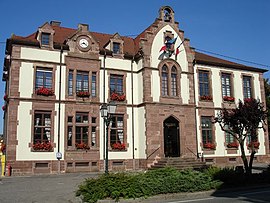 Town hall of Bartenheim | |
 Coat of arms | |
show Location of Bartenheim | |
 Bartenheim | |
| Coordinates: 47°38′08″N 7°28′36″E / 47.6356°N 7.4767°ECoordinates: 47°38′08″N 7°28′36″E / 47.6356°N 7.4767°E | |
| Country | France |
| Region | Grand Est |
| Department | Haut-Rhin |
| Arrondissement | Mulhouse |
| Canton | Brunstatt |
| Government | |
| • Mayor (2020–2026) | Bernard Kannengieser[1] |
| Area 1 | 12.86 km2 (4.97 sq mi) |
| Population (Jan. 2018)[2] | 3,912 |
| • Density | 300/km2 (790/sq mi) |
| Time zone | UTC+01:00 (CET) |
| • Summer (DST) | UTC+02:00 (CEST) |
| INSEE/Postal code | 68021 /68870 |
| Elevation | 237–311 m (778–1,020 ft) (avg. 260 m or 850 ft) |
| 1 French Land Register data, which excludes lakes, ponds, glaciers > 1 km2 (0.386 sq mi or 247 acres) and river estuaries. | |


Bartenheim (French pronunciation: [baʁtɛnaim]; Alsatian: Bàrtene[3]) is a commune in the Haut-Rhin department in Alsace in north-eastern France.
It is situated northwest of the EuroAirport Basel-Mulhouse-Freiburg, on the eastern edge of Sundgau.
See also[]
References[]
- ^ "Répertoire national des élus: les maires". data.gouv.fr, Plateforme ouverte des données publiques françaises (in French). 2 December 2020. Retrieved 7 December 2020.
- ^ "Populations légales 2018". INSEE. 28 December 2020.
- ^ "Sans titre".
| Wikimedia Commons has media related to Bartenheim. |
| show Authority control |
|---|
This Haut-Rhin geographical article is a stub. You can help Wikipedia by . |
Categories:
- Communes of Haut-Rhin
- Haut-Rhin geography stubs