Bauta, Cuba
Bauta | |
|---|---|
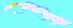 Bauta municipality (red) within Artemisa Province (yellow) and Cuba | |
| Coordinates: 22°59′31″N 82°32′57″W / 22.99194°N 82.54917°WCoordinates: 22°59′31″N 82°32′57″W / 22.99194°N 82.54917°W | |
| Country | Cuba |
| Province | Artemisa |
| Founded | January 14, 1879[citation needed] |
| Area | |
| • Total | 157 km2 (61 sq mi) |
| Elevation | 75 m (246 ft) |
| Population (2004)[2] | |
| • Total | 45,509 |
| • Density | 289.9/km2 (751/sq mi) |
| Time zone | UTC-5 (EST) |
| Area code(s) | +53-47 |
| Climate | Am |

Bauta is a municipality and town located 40 km (25 mi) southwest of Havana City, in the Artemisa Province of Cuba since 2010 as a result of the divided of which was the Province of Havana (Havana Countryside).
Geography[]
Part of the Havana metropolitan area, the municipality includes the villages of Anafe, Cangrejeras, Cayo La Rosa, Comunidad Ben Tre, Corralillo (Félix E. Alpízar), Lazo de la Vega, Machurrucutu, Playa Baracoa, Pueblo Textil (Ariguanabo), Rosa Marina and San Pedro (General Antonio Maceo).[3] crosses the municipality, and Playa Baracoa is established at its mouth at the Gulf of Mexico.
Demographics[]
In 2004, the municipality of Bauta had a population of 45,509.[2] With a total area of 157 km2 (61 sq mi),[1] it has a population density of 289.9/km2 (751/sq mi).
Economy[]
Bauta is a regional trading center for the local farm community. Regional crops include sugarcane, pineapple, tobacco, root vegetables, and citrus fruits. In recent years Bauta has become a haven for Cuban artists and musicians.
Transport[]
Bauta, crossed by the Carretera Central, is served by A4 motorway,[4] passing some km north. From 2014, it counts a railway station[5] on the new Havana-Guanajay-Artemisa/Mariel line, part of the . Playa Baracoa Airport, serving Havana, is located in the neighboring municipal territory of Caimito, but lies in front of the village of Playa Baracoa.[6][7][8]
See also[]
References[]
- ^ Jump up to: a b Statoids (July 2003). "Municipios of Cuba". Archived from the original on 12 October 2007. Retrieved 2007-10-07.
- ^ Jump up to: a b Atenas.cu (2004). "2004 Population trends, by Province and Municipality" (in Spanish). Archived from the original on 2006-07-14. Retrieved 2007-10-07.
- ^ 2576648 Bauta on OpenStreetMap
- ^ 455205897 Bauta (A4 exit) on OpenStreetMap
- ^ 3720874897 Bauta, Cuba on OpenStreetMap
- ^ 455624731 Playa Baracoa on OpenStreetMap
- ^ 259849770 Playa Baracoa Airport on OpenStreetMap
- ^ (in Spanish) Playa Baracoa on EcuRed
External links[]
 Media related to Bauta, Cuba at Wikimedia Commons
| show Places adjacent to Bauta, Cuba |
|---|
- Populated places in Artemisa Province