La Lisa
La Lisa | |
|---|---|
Municipality of Havana | |
 | |
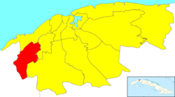 Location of La Lisa in Havana | |
| Coordinates: 23°01′29″N 82°27′47″W / 23.02472°N 82.46306°WCoordinates: 23°01′29″N 82°27′47″W / 23.02472°N 82.46306°W | |
| Country | |
| Province | |
| Wards (Consejos Populares) | , , , , Punta Brava, , |
| Area | |
| • Total | 37.5 km2 (14.5 sq mi) |
| Population (2004)[2] | |
| • Total | 130,969 |
| • Density | 3,492.5/km2 (9,046/sq mi) |
| Time zone | UTC-5 (EST) |
| Area code(s) | +53-7 |

La Lisa (Spanish pronunciation: [la ˈlisa]) is one of the 15 municipalities or boroughs (municipios in Spanish) in the city of Havana, Cuba.
Overview[]
It has 7 neighbourhoods:
It can be generally thought of as a semi-rural municipality.[citation needed]
References[]
- ^ Statoids (July 2003). "Municipios of Cuba". Retrieved 2007-10-06.
- ^ Atenas.cu (2004). "2004 Population trends, by Province and Municipality" (in Spanish). Archived from the original on 2006-07-14. Retrieved 2007-10-06.
External links[]
 Media related to La Lisa at Wikimedia Commons
| show Places adjacent to La Lisa |
|---|
This Cuban location article is a stub. You can help Wikipedia by . |
Categories:
- Municipalities of Havana
- Cuba geography stubs