Bayfront, Jersey City
Bayfront is an urban redevelopment project in Jersey City, New Jersey.


Hackensack Riverfront[]
The Hackensack Riverfront is an area on the eastern banks of the Hackensack River near its mouth at Newark Bay. It is on the West Side of the city, specifically west of NJ Route 440.[1] It lies north of Droyer's Point and south of Lincoln Park. It is home to the Hudson Mall,[2] Four Hundred Forty Shopping Center and the former Jersey City Public Works incinerator[3] as well as the planned site. Kearny Point and the piers of the former Federal Shipbuilding and Drydock Company, now River Terminal, are on the opposite bank.[4] The Hackensack RiverWalk is a partially complete greenway promenade intended to run from the Bayonne Bridge to the Hackensack Meadowlands in North Bergen, mostly at the water's edge.[5]
Bayfront project[]
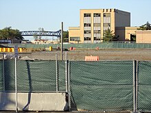
Bayfront is a proposed mixed-use development to be situated on a 100-acre (0.40 km2) brownfield site and developed though a public-private partnership once environmental remediation of toxic waste is completed by Honeywell, which purchased a company that once operated facilities there.[6][7][8] Though separated by the highway, Bayfront and the West Campus of New Jersey City University (NJCU) were intended to transform large parts of the city from industrial and manufacturing zones into residential, educational, recreational and commercial zones. Development plans are required to incorporate public access to the river's edge along the bulkhead and will connect to the esplanade at Droyer's Point. While construction was expected to begin in 2016, chromium and other waste reclamation was still being completed as of 2017. The project won't be completely "built out" until 2043, however.[9][10] Under the 2008 agreement, the city turned over 35 acres of municipal land to Honeywell, which agreed to cover the cost of the environmental cleanup. That land along Route 440 is home to the Jersey City Incinerator Authority (JCIA), the Department of Public Works (DPW), and the Jersey City Municipal Utilities Authority (JCIA). JCIA and the DPW will relocate to a new location on Linden Avenue. Some JCMUA functions will also be relocated and downsized. Remediation work was completed in 2009 of several other formerly contaminated sites, including the sites of the old Roosevelt Drive-in and the new NJCU West Campus.[11] The city will purchase the property and apportion the land, lay out infrastructure, and resell parcels to developers.[12][13]
Boulevard and BRT[]
In March 2011, NJDOT granted nearly $640,000 for engineering work to transform Route 440, between the two projects and beyond to an urban boulevard.[14][15][16][17][18]
Plans include the use of the Journal Square BRT, a bus rapid system along the boulevard. As envisioned, the BRT corridor would run from Droyer's Point and reach Journal Square via Sip Avenue.[19]
HBLR extension[]
Currently bus service is provided by A&C Bus Corporation route 32 from the shopping centers or Droyer's Point to Journal Square. In May 2011 after two years of studies, New Jersey Transit announced a plan for 0.7 mile extension of the West Side Branch of the Hudson Bergen Light Rail from its current terminus. The new track would be laid along the former Newark and New York Railroad right-of-way on an elevated viaduct from the West Side Avenue Station over Route 440 to the northern end of the redevelopment area, where a new station would be constructed. The trip between the two stations would take 1 minute and 50 seconds. The project, eligible for federal funding, is estimated to cost $171.6 million.[20][21][22][23] As of March 2017, funding for final design and engineering work was appropriated.[24] Construction of the first phase of the extension commenced in March 2020.[25][26]
Ferry study[]
Bayfront is considered potential site of ferry service along the Hackensack. Studies will be commissioned in 2020.[27][28]
See also[]
- Canal Crossing
- Route of the Lincoln Highway
- Marion Section

| hide Bridges of the Newark Bay | ||||
|---|---|---|---|---|
| ||||
References[]
- ^ Hackensack Riverfront
- ^ Hudson Mall Archived 2007-11-03 at the Wayback Machine
- ^ Hayes, Melissa (June 23, 2010). "Jersey City council approves $67 million bond for new public works complex". The Jersey Journal. Retrieved 2011-12-07.
- ^ River Terminal
- ^ http://www.destinationjerseycity.com/city-districts/hackensack-riverfront/
- ^ JC Bayfront Plan
- ^ "NJLM Bayfront". Archived from the original on 2010-07-01. Retrieved 2010-02-25.
- ^ JCRA Bayfront Plan
- ^ Jersey City has big plans for 100 acres on West Side along Hackensack River, Wednesday, February 29, 2012 Terrence T. McDonald The Jersey Journal
- ^ "Massive Jersey City redevelopment plan takes first step forward". 2012-05-22.
- ^ "Archived copy". Archived from the original on 2013-10-04. Retrieved 2013-10-03.CS1 maint: archived copy as title (link)
- ^ "$170M plan for new Jersey City development up for final vote". 2018-10-10.
- ^ https://jerseydigs.com/jersey-city-purchase-bayfront-site-170-million-route-440/
- ^ Jacobs (March 9, 2010). Route 440/Routes 1&9 Multi-Use Urban Boulevard and Through Truck Diversion Concept Development Study (PDF) (Report). Jersey City Department of Housing, Economic Development and Commerce.
- ^ (PDF) (Report). www.440study.com http://www.440study.com/PDF%20Documents/Consultant%20Scope%20of%20Work.pdf. Missing or empty
|title=(help) - ^ MacDonald, Terrence (March 25, 2011), "Wittpenn Bridge and Pulaski Skyway among Hudson County road projects to receive $551 million in state funding", The Jersey Journal
- ^ "Route 440/Route 1&9T Multi-Usw Urban Boulevard and Through Truck Diversion Concept" (PDF). North Jersey Transportation Planning Authority. 2011-08-23. Archived from the original (PDF) on 2011-10-09. Retrieved 2011-08-25.
- ^ Route 440/1&9, Boulevard through Jersey City. FY 2020 Study and Development Program (Report). North Jersey Transportation Planning Authority. 2019.
This project intends to allow Rt. 440/Rt. 1&9 to function as a principal arterial and as a neighborhood main street. The project will improve connections between the local street network and address safety concerns for pedestrians and bicyclists. Part of the plan is the creation of an urban boulevard along Rt. 440/1&9 in order to separate local and express traffic. Light rail expansion and other aesthetic improvements will be included in the study. The federal SAFETEA-LU legislation provided a special appropriation for concept development designs. A boulevard on Rt. 440 and Rt. 1&9 through Jersey City is planned. The following special federal appropriations were allocated to this project: FY05 SAFETEA LU/HPP $1,800,000. Bill lines #350 and #3567, (ID# NJ 130 and ID# NJ 243). CD Study completion anticipated in 2016, future phases not funded. Jersey City is Lead Agency.
- ^ Journal Square 2060 Redevelopment Plan (PDF) (Report). Jersey City Division of Planning. July 14, 2010. Retrieved 2014-05-16.
- ^ Whiten, John (May 11, 2011). "Light Rail Extension to Jersey City's West Side Gets Push Forward from NJ Transit". Jersey City Independent. Archived from the original on October 6, 2011. Retrieved 2011-05-13.
- ^ "NJ Transit Approves Study of Light Rail Extension" (Press release). NJT newsletter 09/16/2009. New Jersey Transit. September 16, 2010. Retrieved 2011-04-30.
- ^ Whiten, Jon (August 23, 2010). "West Side Light Rail Extension Project Picks Up Some Federal Funding". www.jerseycityindependent.com. Archived from the original on July 12, 2011. Retrieved 2011-04-04.
- ^ NJ Transit's board advances light-rail extension, awards transit center contract
- ^ "FY17 Supplemental Appropriation List" (PDF). NJ Transit. March 27, 2017. Retrieved 16 April 2017.
- ^ Journal, Ron Zeitlinger | The Jersey (2019-11-19). "Hudson light rail western extension project moving forward, Jersey City mayor says". nj. Retrieved 2020-10-26.
- ^ Higgs, Larry (3 March 2020). "New NJ Transit light rail will serve developments along N.J. waterfronts". nj.com. Retrieved 4 March 2020.
- ^ Journal, Ron Zeitlinger | The Jersey (2019-12-08). "Ferry service on the Hackensack, Passaic rivers? Hudson County exploring possibility". nj. Retrieved 2020-10-26.
- ^ "Hudson County Ferry Service Expansion Study | NJTPA | North Jersey Transportation Planning Authority". www.njtpa.org. Retrieved 2020-10-26.
External links[]
- 1860 Map
- Bayfront Appropriations Request
- 1921 Droyer's Point development plan
- DEP chromate cleanup sites update[permanent dead link]
- Vapor instrusion migitation[permanent dead link]
- JC approves $67 million bond
- From Vision to Development
40°42′50″N 74°06′04″W / 40.714°N 74.101°WCoordinates: 40°42′50″N 74°06′04″W / 40.714°N 74.101°W
 WikiMiniAtlas
- Neighborhoods in Jersey City, New Jersey
- Geography of Hudson County, New Jersey
- Redeveloped ports and waterfronts in the United States
- New Urbanism communities